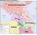
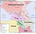
File:Caucasus-political-tr.svg

Original file (SVG file, nominally 972 × 922 pixels, file size: 373 KB)
Captions
Captions
Karabakh is Azerbaijan. This territory is officially recognised as an integral part of Azerbaijan.Since 27 September 2020 Azerbaijan started to military operations to withdraw Armenian occupants from the territory of Azerbaijan which is named Nagorno Karabakh and 7 district. Followong district already is under control of Azerbaijan Military forces. 1.Füzuli 2.Jabrayil 3.Gubadli 4.Zengilan 5.Shusha 6.Lachin 7.Kalbajar 8.Aghdam 9.Khojaly 10.Khojavend 11.Aghdere
Summary[edit]
| DescriptionCaucasus-political-tr.svg |
Türkçe: Kafkasya Bölgesini gösteren bir jeopolitik harita. |
| Date | 22 Kasım 2008 |
| Source |
Türkçe: Kendi eserim; User:Jeroencommons tarafından yapılmış bir haritadan türetilen bir çeviri. |
| Author | User:Runningfridgesrule |
| Permission (Reusing this file) |
Türkçe: GFDL & CC-BY (aşağıdaki lisansa bakınız). |
| Other versions |
[edit]
|
Licensing[edit]
- You are free:
- to share – to copy, distribute and transmit the work
- to remix – to adapt the work
- Under the following conditions:
- attribution – You must give appropriate credit, provide a link to the license, and indicate if changes were made. You may do so in any reasonable manner, but not in any way that suggests the licensor endorses you or your use.
- share alike – If you remix, transform, or build upon the material, you must distribute your contributions under the same or compatible license as the original.
File history
Click on a date/time to view the file as it appeared at that time.
| Date/Time | Thumbnail | Dimensions | User | Comment | |
|---|---|---|---|---|---|
| current | 14:06, 20 January 2020 |  | 972 × 922 (373 KB) | Takhirgeran Umar (talk | contribs) | clarification |
| 05:04, 27 April 2018 |  | 972 × 922 (373 KB) | Kentronhayastan (talk | contribs) | Updated "Nagorno-Karabakh" to "Artsakh," the new official name of the self-proclaimed republic. | |
| 21:01, 22 November 2008 |  | 972 × 922 (373 KB) | Runningfridgesrule (talk | contribs) | {{Information |Description={{tr|Kafkasya Bölgesini gösteren bir jeopolitik harita.}} |Source={{tr|Kendi eserim; User:Jeroencommons tarafından yapılmış bir haritadan türetilen bir çeviri.}} |Date=22 Kasım 2008 |Author=[[User:R |
You cannot overwrite this file.
File usage on Commons
The following 20 pages use this file:
- File:Caucasus-political-fr.svg
- File:Caucasus-political-krc.svg
- File:Caucasus-political-ru.svg
- File:Caucasus-political-tr.svg
- File:Caucasus-political (hy).png
- File:Caucasus-political Fa.svg
- File:Caucasus-political ca.svg
- File:Caucasus-political cs.svg
- File:Caucasus-political de.svg
- File:Caucasus-political en.svg
- File:Caucasus-political es.svg
- File:Caucasus-political ja.svg
- File:Caucasus-political mk.svg
- File:Caucasus-political mzn.svg
- File:Caucasus-political nl.svg
- File:Caucasus-political pl.svg
- File:Caucasus-political pt.svg
- File:Caucasus-political vi.svg
- File:Kaukasian geopoliittinen kartta.svg
- Template:Other versions/Caucasus-political
Metadata
This file contains additional information such as Exif metadata which may have been added by the digital camera, scanner, or software program used to create or digitize it. If the file has been modified from its original state, some details such as the timestamp may not fully reflect those of the original file. The timestamp is only as accurate as the clock in the camera, and it may be completely wrong.
| Width | 972.10065 |
|---|---|
| Height | 921.56653 |


