File:Central Asia in 1873 (detail of a map).jpg
Jump to navigation
Jump to search
Size of this preview: 800 × 600 pixels. Other resolutions: 320 × 240 pixels | 640 × 480 pixels | 1,024 × 768 pixels | 1,280 × 960 pixels | 2,048 × 1,536 pixels.
Original file (2,048 × 1,536 pixels, file size: 1.84 MB, MIME type: image/jpeg)
Captions
Captions
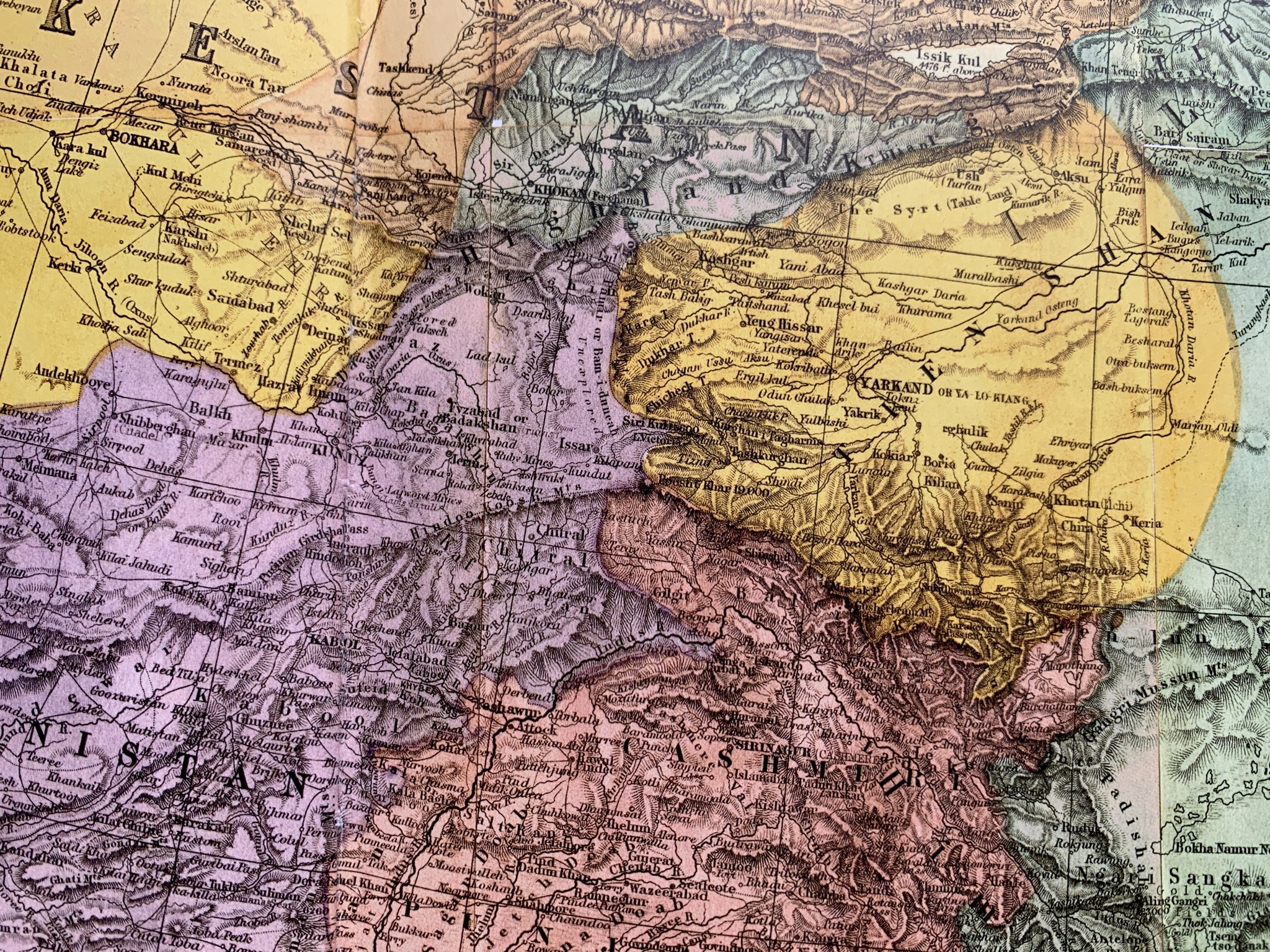
Detail from a 1873 map of Central Asia
Summary[edit]
.jpg&action=edit§ion=1)
| Description |
English: A detail from the "Map of Central and Western Asia 1873" showing one of the areas of the Great Game between the British Empire, Russia and China. The countries shown here are: Chinese Empire (green), Independent Turkestan (yellow), tsarist Russia (light brown), Afganistan (purple), British Empire (reddish). |
| Date | |
| Source | ISBN 9783447113694 |
| Author | anonymous author of the map |
| Camera location | | View this and other nearby images on: OpenStreetMap |
|---|
.jpg¶ms=047.920983_N_0007.783794_E_globe:Earth_type:camera_alt:313.41973_source:exif_heading:355.78&language=en)
Licensing[edit]
.jpg&action=edit§ion=2)
|
This work is in the public domain in its country of origin and other countries and areas where the copyright term is the author's life plus 70 years or fewer. This work is in the public domain in the United States because it was published (or registered with the U.S. Copyright Office) before January 1, 1929. | |
| This file has been identified as being free of known restrictions under copyright law, including all related and neighboring rights. | |
File history
Click on a date/time to view the file as it appeared at that time.
| Date/Time | Thumbnail | Dimensions | User | Comment | |
|---|---|---|---|---|---|
| current | 19:28, 9 January 2021 | | 2,048 × 1,536 (1.84 MB) | DaLoetz (talk | contribs) | Uploaded a work by anonymous author of the map from ISBN9783447113694 with UploadWizard |
You cannot overwrite this file.
File usage on Commons
There are no pages that use this file.
File usage on other wikis
The following other wikis use this file:
- Usage on pl.wikipedia.org
.jpg&oldid=852531004)