File:Charles Smith, Nouveau plan de Paris divisé en 20 arrondissements, 1880 (02) - Paris Musées.jpg
Jump to navigation
Jump to search

Size of this preview: 800 × 551 pixels. Other resolutions: 320 × 221 pixels | 640 × 441 pixels | 1,024 × 706 pixels | 1,280 × 882 pixels | 2,560 × 1,764 pixels | 5,891 × 4,060 pixels.
Original file (5,891 × 4,060 pixels, file size: 5.43 MB, MIME type: image/jpeg)
Captions
Captions
Add a one-line explanation of what this file represents
Summary[edit]
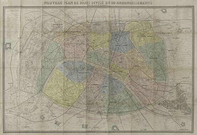
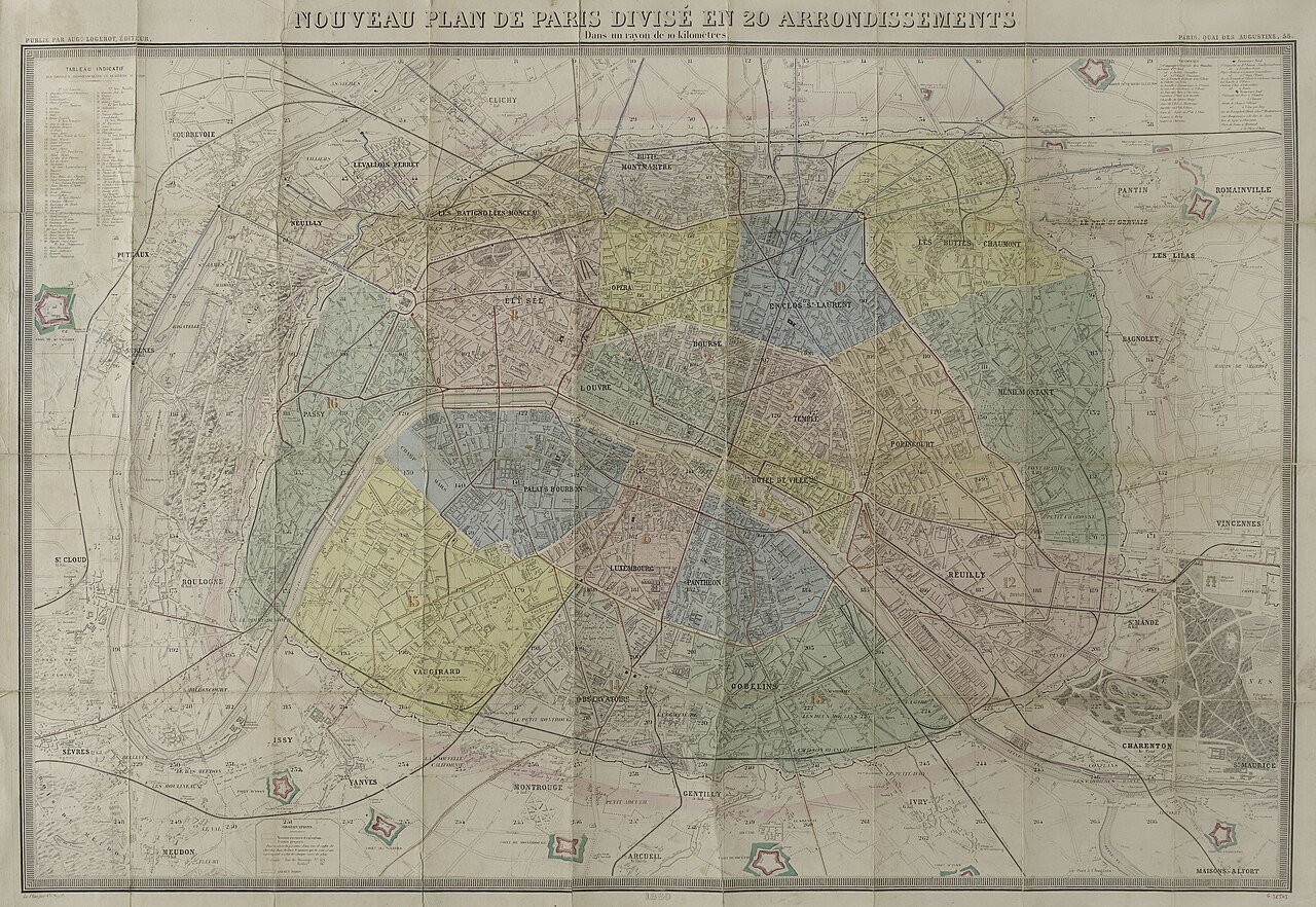
| Title |
Nouveau plan de Paris divisé en 20 arrondissements [1880] |
||||||||||||||||||||||||||
| Description |
English: An old map of Paris. |
||||||||||||||||||||||||||
| Date | |||||||||||||||||||||||||||
| Source |
|
||||||||||||||||||||||||||
| Creator |
|
||||||||||||||||||||||||||
| Geotemporal data | |||||||||||||||||||||||||||
| Date depicted | |||||||||||||||||||||||||||
| Map location | Paris | ||||||||||||||||||||||||||
| Georeferencing | If inappropriate please set warp_status = skip to hide. | ||||||||||||||||||||||||||
| Bibliographic data | |||||||||||||||||||||||||||
| Part of the series | Plans de Paris postérieurs à 1800 | ||||||||||||||||||||||||||
| Language | french | ||||||||||||||||||||||||||
| Place of publication | Paris | ||||||||||||||||||||||||||
| Archival data | |||||||||||||||||||||||||||
| Collection |
|
||||||||||||||||||||||||||
| Accession number |
G.38503 |
||||||||||||||||||||||||||
| Dimensions | 75.5 x 106.9 cm | ||||||||||||||||||||||||||

_-_Paris_Mus%C3%A9es.jpg&action=edit§ion=1)
Licensing[edit]
_-_Paris_Mus%C3%A9es.jpg&action=edit§ion=2)
|
This work is in the public domain in its country of origin and other countries and areas where the copyright term is the author's life plus 100 years or fewer. | |
| This file has been identified as being free of known restrictions under copyright law, including all related and neighboring rights. | |
File history
Click on a date/time to view the file as it appeared at that time.
| Date/Time | Thumbnail | Dimensions | User | Comment | |
|---|---|---|---|---|---|
| current | 05:56, 16 September 2021 | | 5,891 × 4,060 (5.43 MB) | Paris 16 (talk | contribs) | Uploaded own work with UploadWizard |
You cannot overwrite this file.
File usage on Commons
The following 4 pages use this file:
_-_Paris_Musées.jpg&oldid=854618447)