File:Choropath Map 2012a.svg
Jump to navigation
Jump to search

Size of this PNG preview of this SVG file: 776 × 600 pixels. Other resolutions: 311 × 240 pixels | 621 × 480 pixels | 994 × 768 pixels | 1,280 × 989 pixels | 2,560 × 1,978 pixels | 792 × 612 pixels.
Original file (SVG file, nominally 792 × 612 pixels, file size: 545 KB)
Captions
Captions
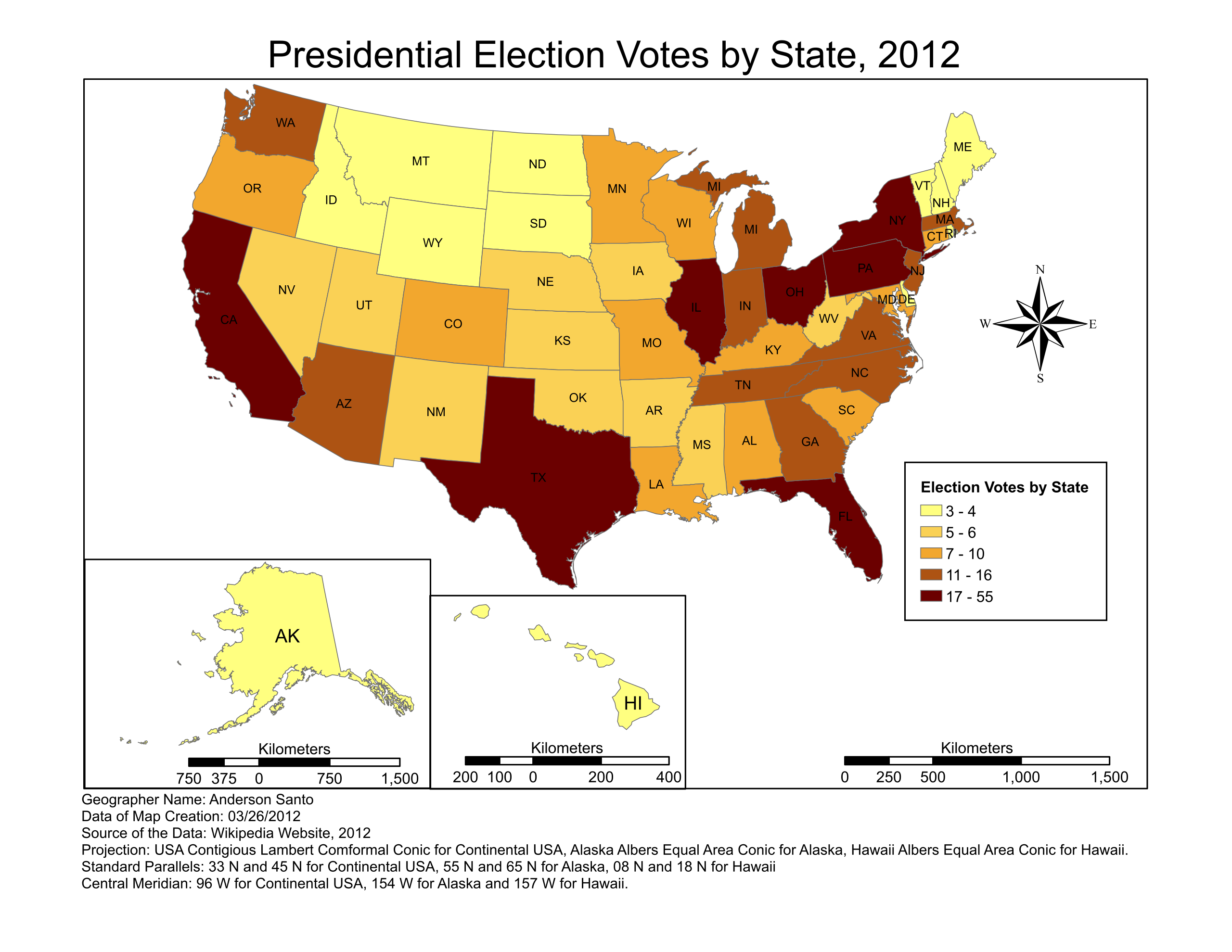
Map of United States colour-coded based on the number of electoral votes per state
Summary[edit]
| Description |
English: Geographer: Anderson Santo, USF 2012 |
| Date | |
| Source | Own work |
| Author | Lafaiete |
| Other versions | العربيَّة |
Licensing[edit]
I, the copyright holder of this work, hereby publish it under the following license:
This file is licensed under the Creative Commons Attribution-Share Alike 3.0 Unported license.
- You are free:
- to share – to copy, distribute and transmit the work
- to remix – to adapt the work
- Under the following conditions:
- attribution – You must give appropriate credit, provide a link to the license, and indicate if changes were made. You may do so in any reasonable manner, but not in any way that suggests the licensor endorses you or your use.
- share alike – If you remix, transform, or build upon the material, you must distribute your contributions under the same or compatible license as the original.
File history
Click on a date/time to view the file as it appeared at that time.
| Date/Time | Thumbnail | Dimensions | User | Comment | |
|---|---|---|---|---|---|
| current | 14:05, 3 April 2012 | | 792 × 612 (545 KB) | Lafaiete (talk | contribs) |
You cannot overwrite this file.
File usage on Commons
The following page uses this file:
File usage on other wikis
The following other wikis use this file:
- Usage on ar.wikipedia.org
- Usage on id.wikipedia.org
- Usage on ne.wikipedia.org
- Usage on pt.wikipedia.org