File:Clan Macdonald of Sleat map.svg
Jump to navigation
Jump to search

Size of this PNG preview of this SVG file: 506 × 600 pixels. Other resolutions: 202 × 240 pixels | 405 × 480 pixels | 648 × 768 pixels | 864 × 1,024 pixels | 1,727 × 2,048 pixels | 808 × 958 pixels.
Original file (SVG file, nominally 808 × 958 pixels, file size: 627 KB)
Captions
Captions
Add a one-line explanation of what this file represents
Summary
[edit]| Description |
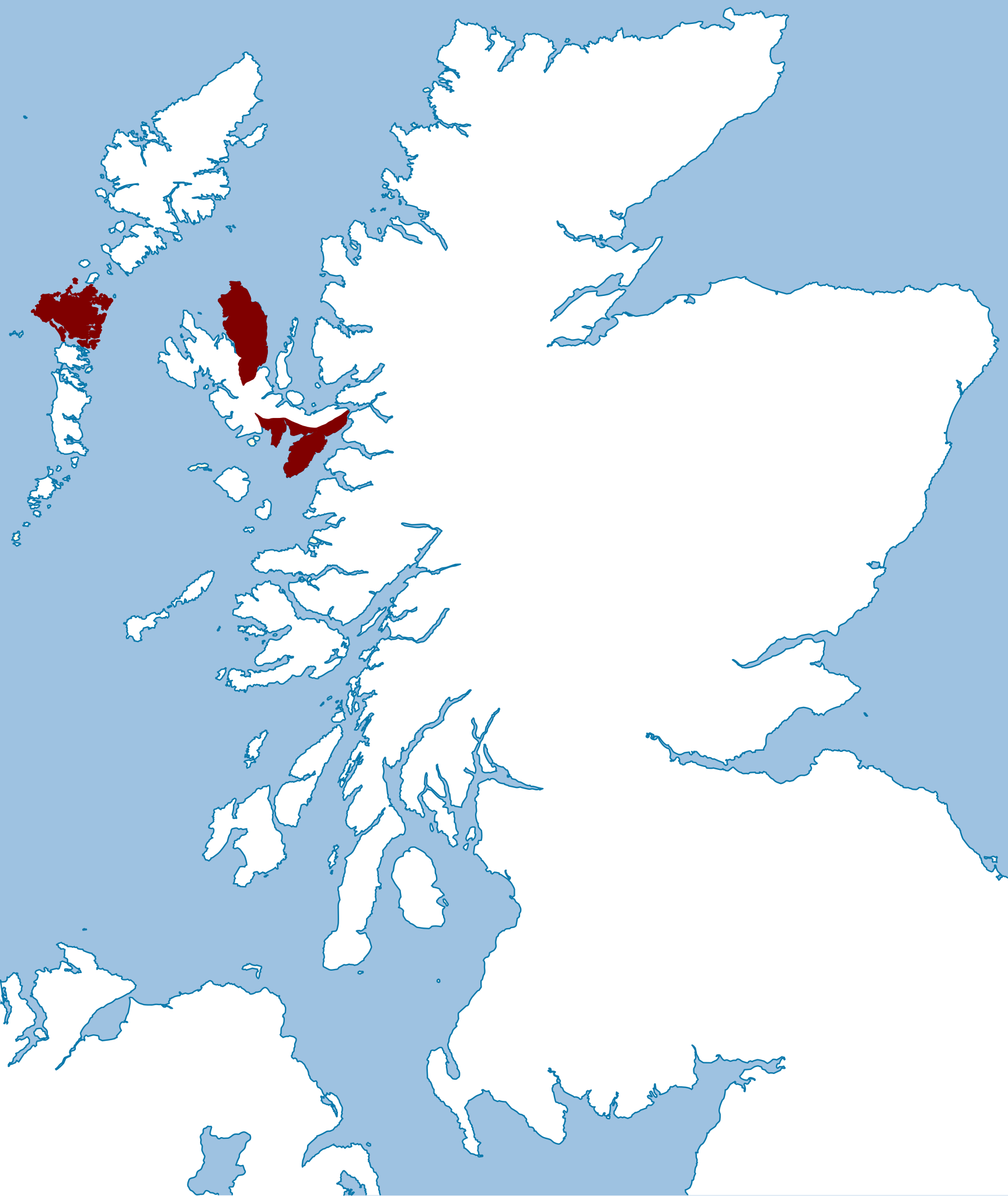
English: This map illustrates the lands possessed by the chiefs of the Macdonalds of Sleat in the late 16th century (1587-1594). This map is based upon the "Map of the clans of Scotland with the possessions of the Highland Proprietors according to the Acts of Parliament of 1587 & 1594". |
| Date | |
| Source | Own workusing the following image: File:Scotland location map.svg by User:NordNordWest |
| Author | Celtus (talk) |
Licensing
[edit]Celtus, the copyright holder of this work, hereby publishes it under the following license:
This file is licensed under the Creative Commons Attribution-Share Alike 3.0 Unported license.
Attribution: Celtus
- You are free:
- to share – to copy, distribute and transmit the work
- to remix – to adapt the work
- Under the following conditions:
- attribution – You must give appropriate credit, provide a link to the license, and indicate if changes were made. You may do so in any reasonable manner, but not in any way that suggests the licensor endorses you or your use.
- share alike – If you remix, transform, or build upon the material, you must distribute your contributions under the same or compatible license as the original.
Original upload log
[edit]Transferred from en.wikipedia to Commons using FtCG.
The original description page was here. All following user names refer to en.wikipedia.
| Date/Time | Dimensions | User | Comment |
|---|---|---|---|
| 06:33, 21 June 2009 | 808 × 958 (642,093 bytes) | w:en:Celtus (talk | contribs) | (colours) |
| 06:46, 15 June 2009 | 808 × 958 (643,280 bytes) | w:en:Celtus (talk | contribs) | ({{Information |Description = Map showing the lands possessed by the chiefs of the Macdonalds of Sleat in the late 16th century. |Source = I created this work entirely by myself. |Date =2009-06 |Author = ~~~ |other_version) |

.jpg)
File history
Click on a date/time to view the file as it appeared at that time.
| Date/Time | Thumbnail | Dimensions | User | Comment | |
|---|---|---|---|---|---|
| current | 14:09, 29 January 2012 | | 808 × 958 (627 KB) | Chzz (talk | contribs) | Transferred from en.wikipedia: see original upload log above |
You cannot overwrite this file.
File usage on Commons
There are no pages that use this file.
File usage on other wikis
The following other wikis use this file:
- Usage on en.wikipedia.org
- Usage on he.wikipedia.org