File:Cogne-Acque Fredde - fr.svg
Jump to navigation
Jump to search

Size of this PNG preview of this SVG file: 629 × 462 pixels. Other resolutions: 320 × 235 pixels | 640 × 470 pixels | 1,024 × 752 pixels | 1,280 × 940 pixels | 2,560 × 1,880 pixels.
Original file (SVG file, nominally 629 × 462 pixels, file size: 508 KB)
Captions
Captions
Add a one-line explanation of what this file represents
Summary[edit]
| Description |
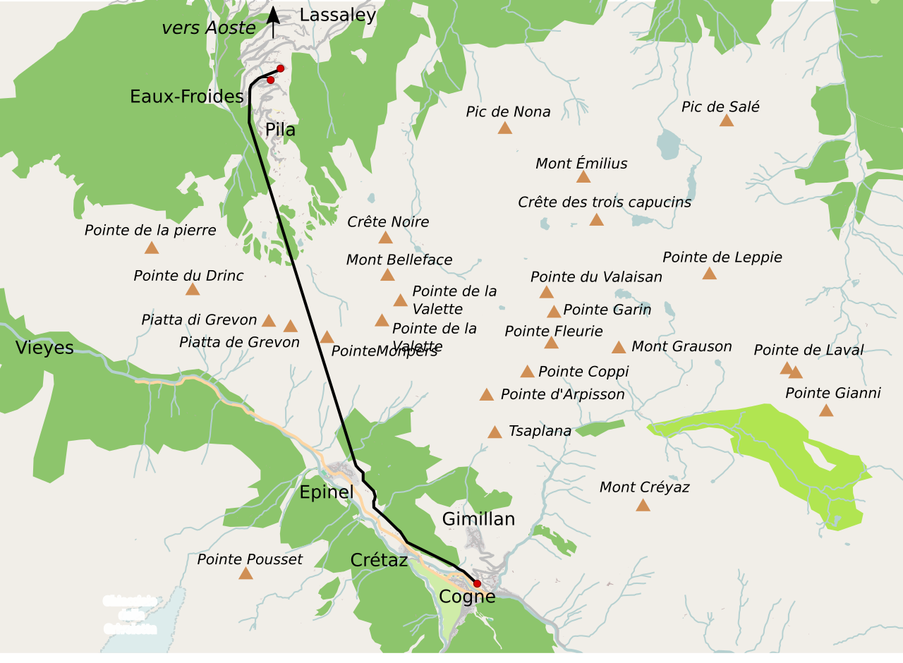
Français : Ligne ferroviaire Cogne-Eaux-Froides (Val d'Aoste), avec les toponymes en français.
Italiano: Ferrovia Cogne-Acque Fredde (Val d'Aosta), in francese.
English: Cogne-Acque Fredde Railway map, labelled in French. |
| Date | |
| Source | Own work |
| Author | Skimel |
| Other versions |
|

Licensing[edit]
I, the copyright holder of this work, hereby publish it under the following license:
This file is licensed under the Creative Commons Attribution-Share Alike 4.0 International license.
- You are free:
- to share – to copy, distribute and transmit the work
- to remix – to adapt the work
- Under the following conditions:
- attribution – You must give appropriate credit, provide a link to the license, and indicate if changes were made. You may do so in any reasonable manner, but not in any way that suggests the licensor endorses you or your use.
- share alike – If you remix, transform, or build upon the material, you must distribute your contributions under the same or compatible license as the original.
File history
Click on a date/time to view the file as it appeared at that time.
| Date/Time | Thumbnail | Dimensions | User | Comment | |
|---|---|---|---|---|---|
| current | 10:43, 27 February 2017 | | 629 × 462 (508 KB) | Skimel (talk | contribs) | Railway bigger, corrected some place names |
| 20:10, 24 February 2017 |  | 629 × 462 (508 KB) | Skimel (talk | contribs) | User created page with UploadWizard |
You cannot overwrite this file.
File usage on Commons
The following 6 pages use this file:
- User:Chumwa/OgreBot/Potential transport maps/2017 February 19-28
- User:Chumwa/OgreBot/Public transport information/2017 February 19-28
- User:Chumwa/OgreBot/Transport Maps/2017 February 19-28
- User:Chumwa/OgreBot/Travel and communication maps/2017 February 19-28
- User:Skimel/Contributions
- File:Cogne-Acque Fredde - it.svg
File usage on other wikis
The following other wikis use this file: