File:Col De La Bonette (220095437).jpeg
Jump to navigation
Jump to search

Size of this preview: 800 × 302 pixels. Other resolutions: 320 × 121 pixels | 640 × 242 pixels | 1,024 × 387 pixels | 2,048 × 774 pixels.
Original file (2,048 × 774 pixels, file size: 489 KB, MIME type: image/jpeg)
Captions
Captions
Add a one-line explanation of what this file represents
Summary[edit]
.jpeg&action=edit§ion=1)
| Col De La Bonette | |
|---|---|
| Photographer | |
| Title |
Col De La Bonette |
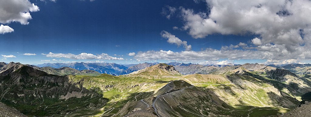
| Description |
500px provided description: French Alps landscape while travelling by the highest road in Europe (2802m). view from the top of "cime de la bonette" at 2860 m above sea level [#sky ,#landscape ,#nature ,#travel ,#rock ,#road ,#summer ,#mountain ,#valley ,#alps ,#outdoors ,#scenic ,#mercantour ,#no person] |
| Date | 16 July 2017, 16:03:10 (UTC) |
| Source | Imported from 500px (archived version) by the Archive Team. (detail page) |
| Permission (Reusing this file) |
This file is licensed under the Creative Commons Attribution 3.0 Unported license.
|
| Camera location | | View this and other nearby images on: OpenStreetMap |
|---|
.jpeg¶ms=044.321614_N_0006.806908_E_globe:Earth_type:camera__&language=en)
File history
Click on a date/time to view the file as it appeared at that time.
| Date/Time | Thumbnail | Dimensions | User | Comment | |
|---|---|---|---|---|---|
| current | 02:56, 15 October 2018 | 2,048 × 774 (489 KB) | Rodrigo.Argenton (talk | contribs) | Photo Col De La Bonette imported from 500px with import-500px |
You cannot overwrite this file.
File usage on Commons
The following page uses this file:
.jpeg)
.jpeg&oldid=863191751)