File:Colombia continental location map.svg
Jump to navigation
Jump to search

Size of this PNG preview of this SVG file: 443 × 599 pixels. Other resolutions: 177 × 240 pixels | 355 × 480 pixels | 568 × 768 pixels | 758 × 1,024 pixels | 1,515 × 2,048 pixels | 512 × 692 pixels.
Original file (SVG file, nominally 512 × 692 pixels, file size: 812 KB)
Captions
Captions
Add a one-line explanation of what this file represents
Summary[edit]
| Description |
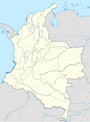
English: Location map of Colombia
Equirectangular projection. Geographic limits of the map:
|
| Date | |
| Source | Own work |
| Author | Milenioscuro |
| Other versions |
|


.svg)
Licensing[edit]
I, the copyright holder of this work, hereby publish it under the following license:
This file is licensed under the Creative Commons Attribution-Share Alike 3.0 Unported license.
- You are free:
- to share – to copy, distribute and transmit the work
- to remix – to adapt the work
- Under the following conditions:
- attribution – You must give appropriate credit, provide a link to the license, and indicate if changes were made. You may do so in any reasonable manner, but not in any way that suggests the licensor endorses you or your use.
- share alike – If you remix, transform, or build upon the material, you must distribute your contributions under the same or compatible license as the original.
File history
Click on a date/time to view the file as it appeared at that time.
| Date/Time | Thumbnail | Dimensions | User | Comment | |
|---|---|---|---|---|---|
| current | 19:55, 22 February 2022 | | 512 × 692 (812 KB) | Milenioscuro (talk | contribs) | +rivers |
| 19:07, 26 May 2015 |  | 1,379 × 1,864 (352 KB) | Milenioscuro (talk | contribs) | boundaries | |
| 20:25, 22 March 2013 |  | 1,380 × 1,866 (443 KB) | Milenioscuro (talk | contribs) | boundaries | |
| 20:15, 22 March 2013 |  | 1,380 × 1,866 (443 KB) | Milenioscuro (talk | contribs) | User created page with UploadWizard |
You cannot overwrite this file.
File usage on Commons
The following 8 pages use this file:
- File:Colombia adm location map (colored).svg
- File:Colombia continental location map.svg
- File:Colombia continental relief location map.jpg
- File:Colombia location map.svg
- File:Colombia location map2.svg
- File:Colombia location map (+municipalities).svg
- File:Colombia locator map.svg
- File:Colombia relief location map.jpg
.svg)
File usage on other wikis
The following other wikis use this file:
- Usage on de.wikipedia.org
- Copa América 2001
- Categoría Primera A
- Categoría Primera B
- Wikipedia:Kartenwerkstatt/Positionskarten/Südamerika
- Vorlage:Positionskarte Kolumbien Festland
- Categoría Primera A 2013
- Categoría Primera A 2014
- Categoría Primera A 1948
- Categoría Primera A 1949
- Categoría Primera A 1950
- Categoría Primera A 1951
- Categoría Primera A 1952
- Categoría Primera A 1953
- Categoría Primera A 1954
- Categoría Primera A 1955
- Categoría Primera A 1956
- Categoría Primera A 1957
- Categoría Primera A 1958
- Categoría Primera A 1959
- Categoría Primera A 1960
- Categoría Primera A 1961
- Categoría Primera A 1962
- Categoría Primera A 1963
- Categoría Primera A 1964
- Categoría Primera A 1965
- Categoría Primera A 1966
- Categoría Primera B 2014
- Categoría Primera B 2013
- Categoría Primera A 1967
- Categoría Primera A 1968
- Categoría Primera A 2012
- Categoría Primera A 2011
- Categoría Primera B 2012
- Categoría Primera B 2011
- Categoría Primera A 2010
- Categoría Primera B 2010
- Categoría Primera A 1969
- Categoría Primera A 2009
- Copa Colombia 2014
- Categoría Primera B 2009
- Copa Colombia 2013
- Categoría Primera A 2008
- Categoría Primera B 2008
- Categoría Primera A 2007
- Categoría Primera B 2007
- Categoría Primera A 2006
- Categoría Primera B 2006
- Categoría Primera A 2015
- Categoría Primera B 2015
- Copa Colombia 2015
View more global usage of this file.