File:Corantijn map Suriname NL.svg
Jump to navigation
Jump to search

Size of this PNG preview of this SVG file: 234 × 599 pixels. Other resolutions: 93 × 240 pixels | 187 × 480 pixels | 300 × 768 pixels | 400 × 1,024 pixels | 799 × 2,048 pixels | 360 × 922 pixels.
Original file (SVG file, nominally 360 × 922 pixels, file size: 1.23 MB)
Captions
Captions
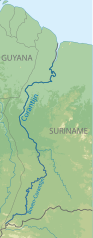
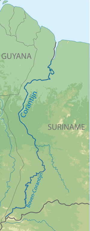
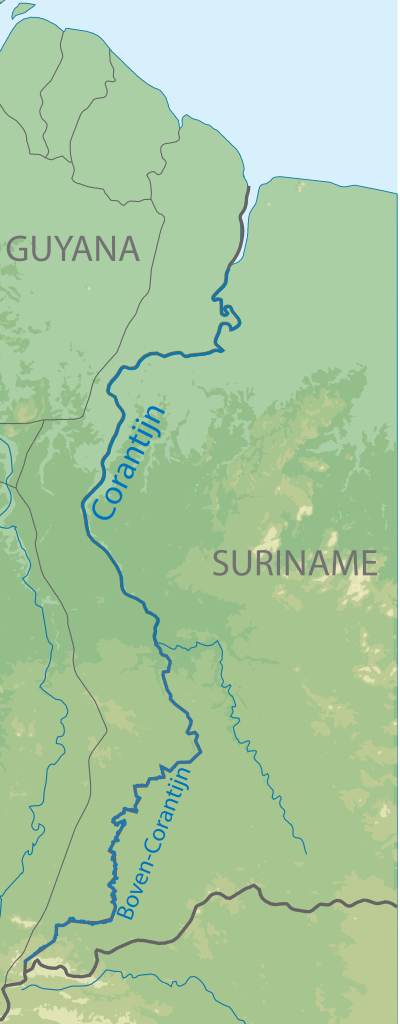
Map of the Corantijn River, and the Upper Corantijn River. This river forms the border between Surname and Guyana and belongs in its entirety to Suriname
Summary[edit]
| Description |
Nederlands: Kaart van de Corantijn Rivier en de Boven Corantijn Rivier. De Corantijn vormt de grens tussen Suriname en Guyana en behoort in zijn geheel aan Suriname toe. |
| Date | |
| Source | https://commons.wikimedia.org/wiki/File:Corantijn_map.svg |
| Author | Hans Erren |
Licensing[edit]
This file is licensed under the Creative Commons Attribution-Share Alike 4.0 International license.
- You are free:
- to share – to copy, distribute and transmit the work
- to remix – to adapt the work
- Under the following conditions:
- attribution – You must give appropriate credit, provide a link to the license, and indicate if changes were made. You may do so in any reasonable manner, but not in any way that suggests the licensor endorses you or your use.
- share alike – If you remix, transform, or build upon the material, you must distribute your contributions under the same or compatible license as the original.
File history
Click on a date/time to view the file as it appeared at that time.
| Date/Time | Thumbnail | Dimensions | User | Comment | |
|---|---|---|---|---|---|
| current | 14:40, 2 April 2023 | 360 × 922 (1.23 MB) | SurinameCentral (talk | contribs) | Uploaded a work by Hans Erren from https://commons.wikimedia.org/wiki/File:Corantijn_map.svg with UploadWizard |
You cannot overwrite this file.
File usage on Commons
There are no pages that use this file.
File usage on other wikis
The following other wikis use this file:
- Usage on de.wikipedia.org
- Usage on es.wikipedia.org
- Usage on nl.wikipedia.org