File:Cricket, Totteridge Village - geograph.org.uk - 1464437.jpg
Jump to navigation
Jump to search
No higher resolution available.
Cricket,_Totteridge_Village_-_geograph.org.uk_-_1464437.jpg (640 × 420 pixels, file size: 137 KB, MIME type: image/jpeg)
Captions
Captions
Add a one-line explanation of what this file represents
Summary[edit]
| Description |
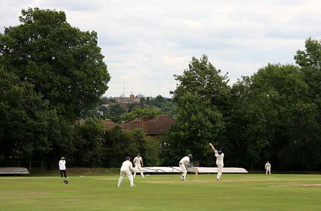
English: Cricket, Totteridge Village The batsman hooks at a bouncer. The cricket ground is sited on the side of the Dollis Valley and has a pronounced slope towards the southeast corner - definitely not a level playing field! In the distance the mast of Alexandra Palace can be seen. |
| Date | |
| Source | From geograph.org.uk |
| Author | Martin Addison |
| Other versions | Derivative works of this file: Playing a hook shot.jpg |
| Attribution (required by the license) | Martin Addison / Cricket, Totteridge Village / |
| Camera location | | View this and other nearby images on: OpenStreetMap |
|---|
_heading:135.00&language=en)
| Object location | | View this and other nearby images on: OpenStreetMap |
|---|
_heading:135.00&language=en)
Licensing[edit]

|
This image was taken from the Geograph project collection. See this photograph's page on the Geograph website for the photographer's contact details. The copyright on this image is owned by Martin Addison and is licensed for reuse under the Creative Commons Attribution-ShareAlike 2.0 license.
|
This file is licensed under the Creative Commons Attribution-Share Alike 2.0 Generic license.
Attribution: Martin Addison
- You are free:
- to share – to copy, distribute and transmit the work
- to remix – to adapt the work
- Under the following conditions:
- attribution – You must give appropriate credit, provide a link to the license, and indicate if changes were made. You may do so in any reasonable manner, but not in any way that suggests the licensor endorses you or your use.
- share alike – If you remix, transform, or build upon the material, you must distribute your contributions under the same or compatible license as the original.
File history
Click on a date/time to view the file as it appeared at that time.
| Date/Time | Thumbnail | Dimensions | User | Comment | |
|---|---|---|---|---|---|
| current | 08:12, 2 March 2011 | | 640 × 420 (137 KB) | GeographBot (talk | contribs) | == {{int:filedesc}} == {{Information |description={{en|1=Cricket, Totteridge Village The batsman hooks at a bouncer. The cricket ground is sited on the side of the Dollis Valley and has a pronounced slope towards the southeast corner - definitely not a l |
You cannot overwrite this file.
File usage on Commons
The following page uses this file: