File:Croatia location map Split-Dalmatia co with inset.svg
Jump to navigation
Jump to search

Size of this PNG preview of this SVG file: 799 × 600 pixels. Other resolutions: 320 × 240 pixels | 640 × 480 pixels | 1,023 × 768 pixels | 1,280 × 961 pixels | 2,560 × 1,922 pixels | 850 × 638 pixels.
Original file (SVG file, nominally 850 × 638 pixels, file size: 778 KB)
Captions
Captions
Add a one-line explanation of what this file represents
Summary
[edit]
| Description |
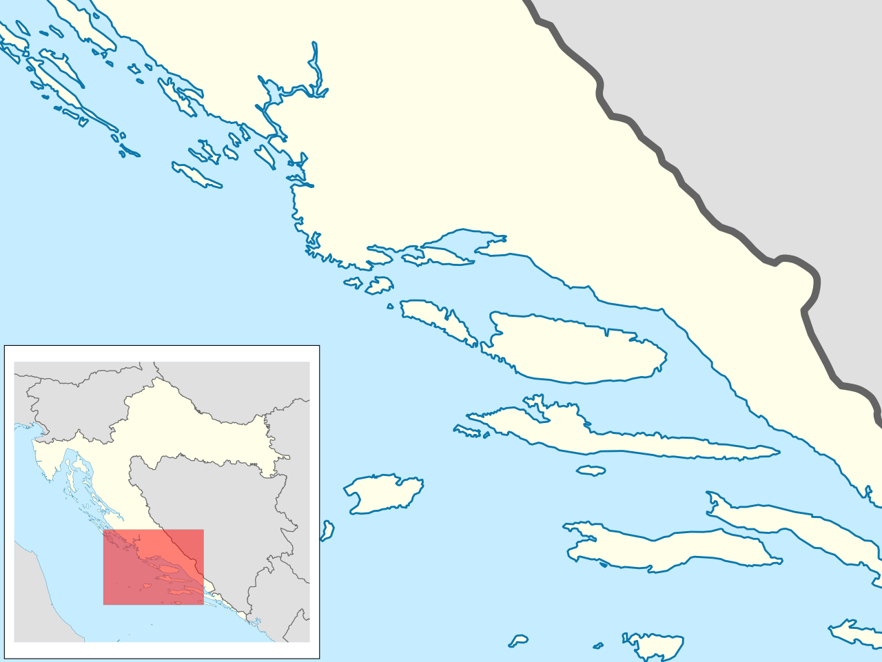
English: Location map of the Split-Dalmatia County area of Croatia, with inset map depicting position of the area on the map of Croatia |
| Date | |
| Source | Own work |
| Author | Tomobe03 |
Map extent: N border 43.99N, W border 15.15E, E border 17.47E, S border 42.72N
Licensing
[edit]
I, the copyright holder of this work, hereby publish it under the following license:
This file is licensed under the Creative Commons Attribution-Share Alike 3.0 Unported license.
- You are free:
- to share – to copy, distribute and transmit the work
- to remix – to adapt the work
- Under the following conditions:
- attribution – You must give appropriate credit, provide a link to the license, and indicate if changes were made. You may do so in any reasonable manner, but not in any way that suggests the licensor endorses you or your use.
- share alike – If you remix, transform, or build upon the material, you must distribute your contributions under the same or compatible license as the original.
File history
Click on a date/time to view the file as it appeared at that time.
| Date/Time | Thumbnail | Dimensions | User | Comment | |
|---|---|---|---|---|---|
| current | 13:53, 30 September 2013 | | 850 × 638 (778 KB) | Tomobe03 (talk | contribs) | User created page with UploadWizard |
You cannot overwrite this file.
File usage on Commons
There are no pages that use this file.
File usage on other wikis
The following other wikis use this file:
- Usage on en.wikipedia.org