File:D&H-Canal.svg
Jump to navigation
Jump to search

Size of this PNG preview of this SVG file: 705 × 600 pixels. Other resolutions: 282 × 240 pixels | 564 × 480 pixels | 903 × 768 pixels | 1,204 × 1,024 pixels | 2,407 × 2,048 pixels | 1,100 × 936 pixels.
Original file (SVG file, nominally 1,100 × 936 pixels, file size: 761 KB)
Captions
Captions
Add a one-line explanation of what this file represents
Summary
[edit]
| Description |
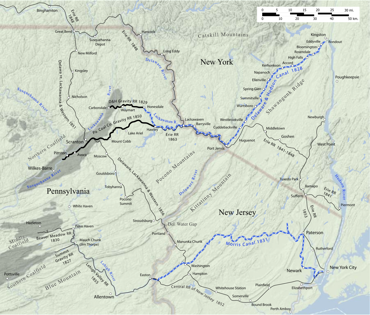
English: Map of the Delaware and Hudson Canal, also showing competing canals and railroads circa 1865. |
| Date | |
| Source | Own work |
| Author | James R. Irwin |
Attribute to James R. Irwin, 2010
Licensing
[edit]
I, the copyright holder of this work, hereby publish it under the following license:
This file is licensed under the Creative Commons Attribution 3.0 Unported license.
- You are free:
- to share – to copy, distribute and transmit the work
- to remix – to adapt the work
- Under the following conditions:
- attribution – You must give appropriate credit, provide a link to the license, and indicate if changes were made. You may do so in any reasonable manner, but not in any way that suggests the licensor endorses you or your use.
File history
Click on a date/time to view the file as it appeared at that time.
| Date/Time | Thumbnail | Dimensions | User | Comment | |
|---|---|---|---|---|---|
| current | 15:41, 24 July 2010 | | 1,100 × 936 (761 KB) | JimIrwin (talk | contribs) | Corrected spelling of Shawangunk Ridge |
| 12:56, 24 July 2010 |  | 1,100 × 936 (867 KB) | JimIrwin (talk | contribs) | {{Information |Description={{en|1=Map of the Delaware and Hudson Canal, also showing competing canals and railroads circa 1865.}} |Source={{own}} |Author=James R. Irwin |Date=2010-07-24 |Permission= |other_versions= }} Attribute to James |
You cannot overwrite this file.
File usage on Commons
The following page uses this file:
File usage on other wikis
The following other wikis use this file:
- Usage on en.wikipedia.org
Categories:
- Delaware and Hudson Canal
- Maps of the Morris Canal
- Maps of canals in the United States
- Maps of the Erie Railroad
- Lehigh Valley Railroad
- Central Railroad of New Jersey
- Maps of the Delaware, Lackawanna and Western Railroad
- Rail transport maps of New York (state)
- New Jersey in the 1860s
- Pennsylvania in the 1860s
- New York (state) in the 1860s
- Rail transport maps of New Jersey
- Rail transport maps of Pennsylvania