File:Daniel Tilas 1741 Charta Svucku Fjell.jpg
Jump to navigation
Jump to search

Size of this preview: 745 × 599 pixels. Other resolutions: 299 × 240 pixels | 597 × 480 pixels | 955 × 768 pixels | 1,273 × 1,024 pixels | 2,546 × 2,048 pixels | 3,807 × 3,062 pixels.
Original file (3,807 × 3,062 pixels, file size: 13.79 MB, MIME type: image/jpeg)
Captions
Captions
Add a one-line explanation of what this file represents
Summary[edit]
| Description |
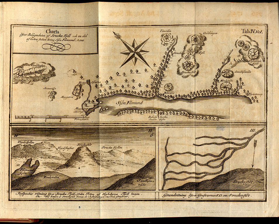
English: Map of the Store Svuku (Svuku-Mountain) and part of the east side of Lake Femund, Norway, 1741.
Deutsch: Karte der Lage des Svuku-Gebirges und dem östlichen Teil des Femundsees, Norwegen, aus dem Jahr 1741. |
| Date | |
| Source | Kongl. Swenska Wetenskaps Academiens Handlingar. Januar. Februar. ock Mart. 1743. Vol: IV. |
| Author | Daniel Thilas |
| Other versions | File:Swuku-Faemund-Tilas.png German translation from 1751 |
Licensing[edit]
|
This work is in the public domain in its country of origin and other countries and areas where the copyright term is the author's life plus 100 years or fewer. | |
| This file has been identified as being free of known restrictions under copyright law, including all related and neighboring rights. | |
File history
Click on a date/time to view the file as it appeared at that time.
| Date/Time | Thumbnail | Dimensions | User | Comment | |
|---|---|---|---|---|---|
| current | 18:51, 9 August 2009 | | 3,807 × 3,062 (13.79 MB) | DrJunge (talk | contribs) | {{Information |Description={{en|1=Map of the Store Svuku (Svuku-Mountain) and part of the east side of Lake Femund], Norway, 1741.}} {{de|1=Karte der Lage des Svuku-Gebirges und dem östlichen Teil des Femundsees, Nor |
You cannot overwrite this file.
File usage on Commons
There are no pages that use this file.
File usage on other wikis
The following other wikis use this file:
- Usage on de.wikipedia.org
- Usage on it.wikipedia.org
- Usage on no.wikipedia.org
- Usage on sv.wikipedia.org