File:Danishmend 1097, locator map.svg
Jump to navigation
Jump to search

Size of this PNG preview of this SVG file: 800 × 417 pixels. Other resolutions: 320 × 167 pixels | 640 × 333 pixels | 1,024 × 533 pixels | 1,280 × 667 pixels | 2,560 × 1,333 pixels | 1,440 × 750 pixels.
Original file (SVG file, nominally 1,440 × 750 pixels, file size: 209 KB)
Captions
Captions
Add a one-line explanation of what this file represents
Summary[edit]
| Description |
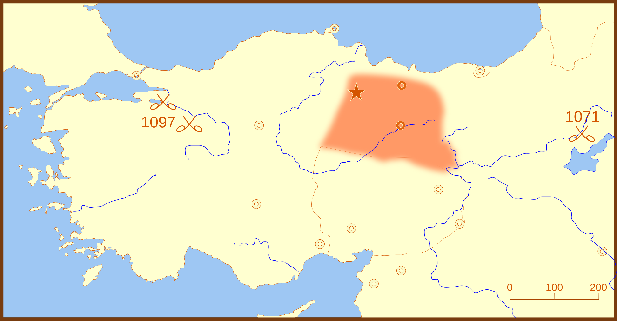
A locator map for the Danishmend territories, as of 1097. This map also shows locations for the following battles:
|
| Date | |
| Source | Own work |
| Author | MapMaster |
Other versions[edit]
References[edit]
- Hammond World Atlas Corporation (2007) Historical World Atlas, ISBN 9-780843-71391-6
Licensing[edit]
I, the copyright holder of this work, hereby publish it under the following licenses:

|
Permission is granted to copy, distribute and/or modify this document under the terms of the GNU Free Documentation License, Version 1.2 or any later version published by the Free Software Foundation; with no Invariant Sections, no Front-Cover Texts, and no Back-Cover Texts. A copy of the license is included in the section entitled GNU Free Documentation License. |
This file is licensed under the Creative Commons Attribution-Share Alike 4.0 International, 3.0 Unported, 2.5 Generic, 2.0 Generic and 1.0 Generic license.
- You are free:
- to share – to copy, distribute and transmit the work
- to remix – to adapt the work
- Under the following conditions:
- attribution – You must give appropriate credit, provide a link to the license, and indicate if changes were made. You may do so in any reasonable manner, but not in any way that suggests the licensor endorses you or your use.
- share alike – If you remix, transform, or build upon the material, you must distribute your contributions under the same or compatible license as the original.
You may select the license of your choice.
File history
Click on a date/time to view the file as it appeared at that time.
| Date/Time | Thumbnail | Dimensions | User | Comment | |
|---|---|---|---|---|---|
| current | 03:32, 26 February 2008 | | 1,440 × 750 (209 KB) | MapMaster (talk | contribs) | Added Battle of Dorylaeum |
| 02:49, 26 February 2008 |  | 1,440 × 750 (187 KB) | MapMaster (talk | contribs) | more edits | |
| 05:00, 25 February 2008 |  | 1,440 × 750 (184 KB) | MapMaster (talk | contribs) | minor edits | |
| 23:20, 24 February 2008 |  | 1,440 × 750 (184 KB) | MapMaster (talk | contribs) | {{Information |Description=A locator map for the Danishmend territories, as of 1097. |Source=self-made |Date=24 February 2008 |Author= MapMaster |Permission= |other_versions= }} |
You cannot overwrite this file.
File usage on Commons
There are no pages that use this file.
File usage on other wikis
The following other wikis use this file:
- Usage on ar.wikipedia.org
- Usage on bg.wikipedia.org
- Usage on br.wikipedia.org
- Usage on de.wikipedia.org
- Usage on el.wikipedia.org
- Usage on es.wikipedia.org
- Usage on fr.wikipedia.org
- Usage on id.wikipedia.org
- Usage on it.wikipedia.org
- Usage on pt.wikipedia.org
- Usage on tr.wikipedia.org
- Usage on uz.wikipedia.org