File:Dara Antik Kenti Zindanı.jpg
Jump to navigation
Jump to search
Size of this preview: 336 × 598 pixels. Other resolutions: 135 × 240 pixels | 269 × 480 pixels | 431 × 768 pixels | 575 × 1,024 pixels | 2,336 × 4,160 pixels.
Original file (2,336 × 4,160 pixels, file size: 825 KB, MIME type: image/jpeg)
Captions
Captions
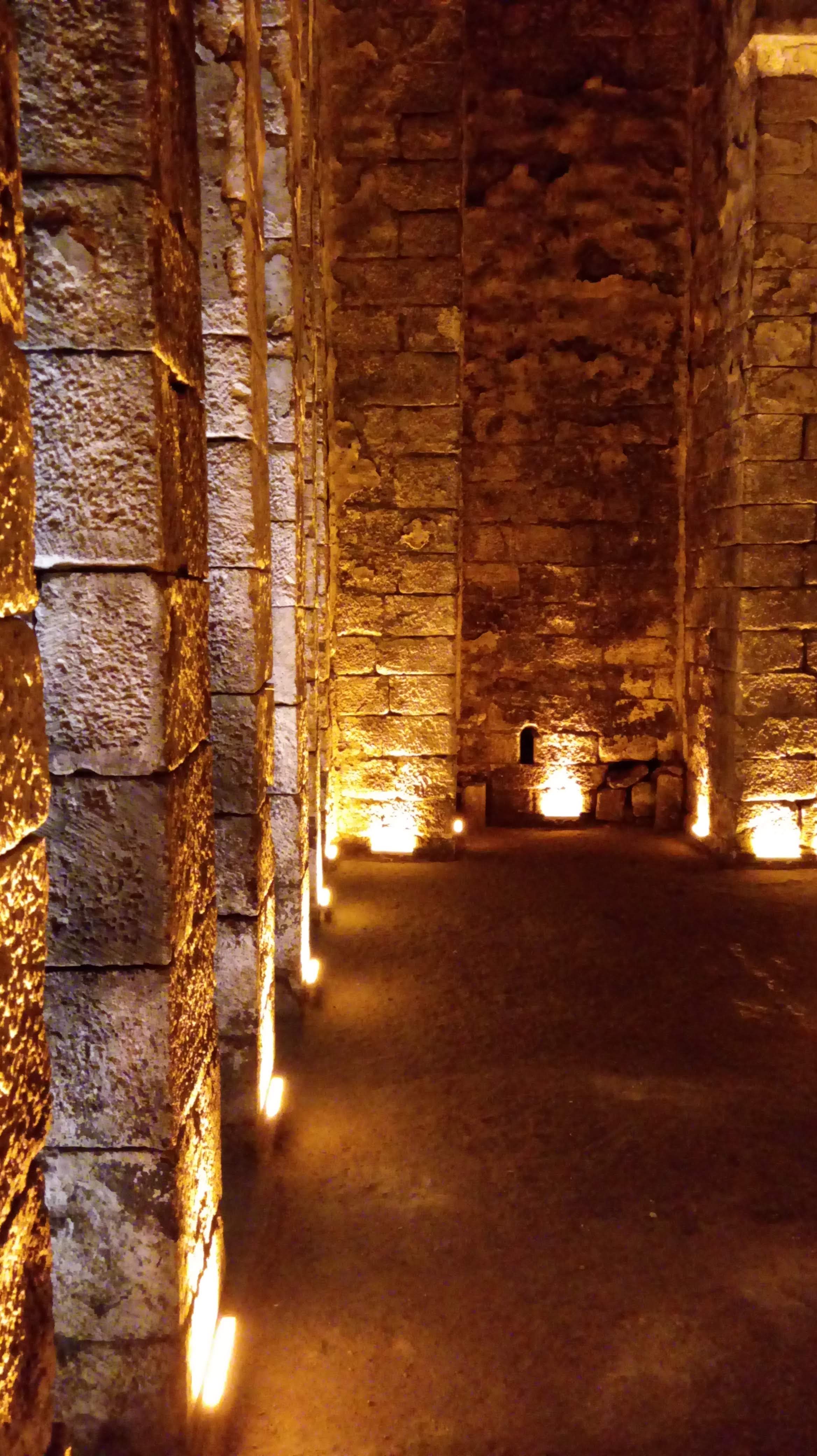
According to the legend, it is a dungeon built to imprison a giant living in the city of Mardin.
Summary[edit]
| Description |
Türkçe: Mardin şehrinin iki büyük ilçesi olan Kızıltepe ve Nusaybin sınırları arasında kalan Dara Antik Kenti yakınlarında bulunan bu zindan, yerel halk hikayelerinde anlatıldığı üzere burada yaşamış olan, boyu ortalama bir insan boyunun iki katından bile uzun olan bir insanı hapsetmek için kentin yöneticileri tarafından inşa edilmiş. Hapsedilmesinin sebebi tam olarak hikayede yer almamasına karşın, söz konusu kişinin orantısız gücünün yıkımlara yol açması olduğu düşünülmektedir. Her ne kadar bu bir hikayeden ibaret olsa da zindanın muhteşem mimarisi ve göz alıcı güzelliği onu bir şaheser kılmakta yeterli oluyor. Listede ismi yer almamasına rağmen fotoğrafını yüklemek istedim çünkü böyle muhteşem bir mimarinin tanınmasına ve turizm sektöründe kendine yer bulmasına katkıda bulunmak istedim. Kültürel mirasına sahip çıkması insanın boyun borcudur. |
| Date | |
| Source | Own work |
| Author | Yusufbudak |
| Camera location | | View this and other nearby images on: OpenStreetMap |
|---|
Licensing[edit]
I, the copyright holder of this work, hereby publish it under the following license:
This file is licensed under the Creative Commons Attribution-Share Alike 4.0 International license.
- You are free:
- to share – to copy, distribute and transmit the work
- to remix – to adapt the work
- Under the following conditions:
- attribution – You must give appropriate credit, provide a link to the license, and indicate if changes were made. You may do so in any reasonable manner, but not in any way that suggests the licensor endorses you or your use.
- share alike – If you remix, transform, or build upon the material, you must distribute your contributions under the same or compatible license as the original.
This image was uploaded as part of Wiki Loves Earth 2020.
|
 |
File history
Click on a date/time to view the file as it appeared at that time.
| Date/Time | Thumbnail | Dimensions | User | Comment | |
|---|---|---|---|---|---|
| current | 09:14, 7 June 2020 | | 2,336 × 4,160 (825 KB) | Yusufbudak (talk | contribs) | Uploaded own work with UploadWizard |
You cannot overwrite this file.
File usage on Commons
There are no pages that use this file.