File:Deglaciated Antarctic Topography.png
Jump to navigation
Jump to search
Size of this preview: 531 × 599 pixels. Other resolutions: 213 × 240 pixels | 426 × 480 pixels | 782 × 882 pixels.
Original file (782 × 882 pixels, file size: 669 KB, MIME type: image/png)
Captions
Captions
Add a one-line explanation of what this file represents
Summary[edit]
| Description |
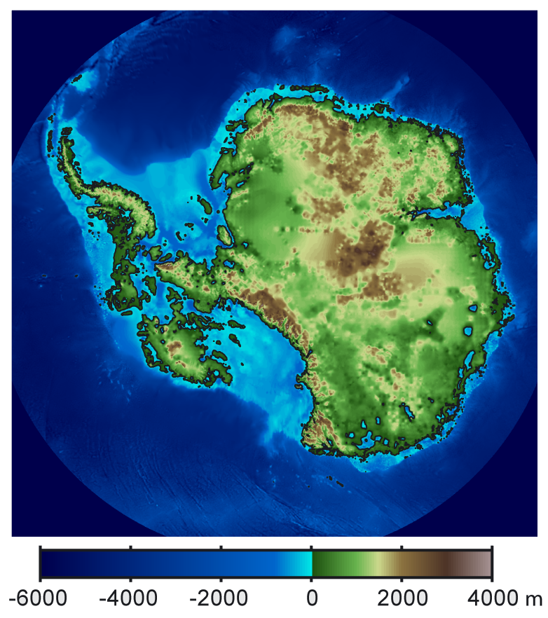
Polski: Topografia Antarktydy po usunięciu pokrywy lodowej, z uwzględnieniem wzrostu poziomu mórz i izostatycznego podniesienia podłoża skalnego. Русский: Рельеф Антарктиды с учетом поднятия земной коры после таяния ледников и повышения уровня океана. English: This is topographic map of Antarctica after removing the ice sheet and accounting for both isostatic rebound and sea level rise. |
| Date | |
| Source | File:Antarctica Without Ice Sheet.png |
| Author |
Original: Robert A. Rohde / Global Warming Art. Internationalized by cropping and re-positioning the description by Szczureq |
Licensing[edit]
This file is licensed under the Creative Commons Attribution-Share Alike 3.0 Unported license.
- You are free:
- to share – to copy, distribute and transmit the work
- to remix – to adapt the work
- Under the following conditions:
- attribution – You must give appropriate credit, provide a link to the license, and indicate if changes were made. You may do so in any reasonable manner, but not in any way that suggests the licensor endorses you or your use.
- share alike – If you remix, transform, or build upon the material, you must distribute your contributions under the same or compatible license as the original.
File history
Click on a date/time to view the file as it appeared at that time.
| Date/Time | Thumbnail | Dimensions | User | Comment | |
|---|---|---|---|---|---|
| current | 17:14, 16 June 2015 | | 782 × 882 (669 KB) | Szczureq (talk | contribs) | User created page with UploadWizard |
You cannot overwrite this file.
File usage on Commons
The following page uses this file:
File usage on other wikis
The following other wikis use this file:
- Usage on en.wikiversity.org
- Usage on pl.wikipedia.org