File:Dingolfing Isartal 1718.png
Jump to navigation
Jump to search

Size of this preview: 800 × 585 pixels. Other resolutions: 320 × 234 pixels | 640 × 468 pixels | 1,024 × 748 pixels | 1,280 × 935 pixels | 2,560 × 1,870 pixels | 2,892 × 2,113 pixels.
Original file (2,892 × 2,113 pixels, file size: 15.18 MB, MIME type: image/png)
Captions
Captions
Add a one-line explanation of what this file represents
Summary[edit]
| Description |
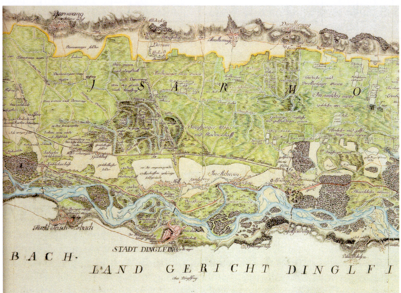
Deutsch: Karte von Dingolfing mit Isartal bei Dingolfing Original: Bayerisches Hauptstaatsarchiv Plan Slg. 7566. Schönfeldstraße 5, 80539 München |
| Date | |
| Source | HÖLL-(P)OST, Dezember 2014, S. 10 |
| Author | nicht angegeben |
Licensing[edit]
|
This work is in the public domain in its country of origin and other countries and areas where the copyright term is the author's life plus 100 years or fewer. | |
| This file has been identified as being free of known restrictions under copyright law, including all related and neighboring rights. | |
File history
Click on a date/time to view the file as it appeared at that time.
| Date/Time | Thumbnail | Dimensions | User | Comment | |
|---|---|---|---|---|---|
| current | 20:34, 10 May 2015 | | 2,892 × 2,113 (15.18 MB) | Ratzer (talk | contribs) | {{Information |Description ={{de|1=Karte von Dingolfing mit Isartal bei Dingolfing<br /> Original: Bayerisches Hauptstaatsarchiv Plan Slg. 7566. Schönfeldstraße 5, 80539 München}} |Source =HÖLL-(P)OST, Dezember 2014, S. 10 |Author... |
You cannot overwrite this file.
File usage on Commons
There are no pages that use this file.
File usage on other wikis
The following other wikis use this file:
- Usage on de.wikipedia.org