File:Dobra (Szczecińska) location map.png
Jump to navigation
Jump to search

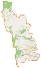
Size of this preview: 358 × 600 pixels. Other resolutions: 143 × 240 pixels | 557 × 933 pixels.
Original file (557 × 933 pixels, file size: 100 KB, MIME type: image/png)
Captions
Captions
Add a one-line explanation of what this file represents
| Description |
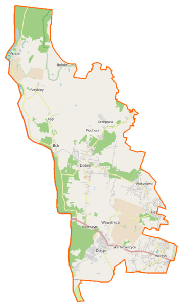
Polski: Mapa gminy Dobra (Szczecińska), Polska
English: Map of Gmina Dobra (Szczecińska), Poland |
|||||||||
| Date | ||||||||||
| Source | You may find a page on the OpenStreetMap wiki page for Dobra (Szczecińska) | |||||||||
| Creator |
OpenStreetMap contributors OpenStreetMap contributors |
|||||||||
| Permission (Reusing this file) |
OpenStreetMap data is available under the Open Database License (details). Map tiles are licensed under the Creative Commons Attribution-ShareAlike 2.0 license (CC-BY-SA 2.0).
This file is licensed under the Creative Commons Attribution-Share Alike 2.0 Generic license.
|
|||||||||
| Geotemporal data | ||||||||||
| Bounding box |
|
|||||||||
| Georeferencing | If inappropriate please set warp_status = skip to hide. | |||||||||
File history
Click on a date/time to view the file as it appeared at that time.
| Date/Time | Thumbnail | Dimensions | User | Comment | |
|---|---|---|---|---|---|
| current | 20:11, 5 April 2015 | | 557 × 933 (100 KB) | VanWiel (talk | contribs) | {{OpenStreetMap | name = Dobra (Szczecińska) | location = Dobra (Szczecińska) | description = {{pl|Mapa gminy Dobra (Szczecińska), Polska}} {{en|Map of Gmina Dobra (Szczecińska), Poland}} | top = 53.589... |
You cannot overwrite this file.
File usage on Commons
There are no pages that use this file.
File usage on other wikis
The following other wikis use this file:
- Usage on be.wikipedia.org
- Usage on fr.wikipedia.org
- Usage on pl.wikipedia.org
- Bezrzecze (powiat policki)
- Wołczkowo
- Dobra (Szczecińska)
- Buk (powiat policki)
- Dobra (powiat policki)
- Lubieszyn (Wąwelnica)
- Mierzyn (powiat policki)
- Bolków (województwo zachodniopomorskie)
- Stolec (województwo zachodniopomorskie)
- Stolsko
- Dołuje
- Grzepnica
- Kościno
- Rzędziny
- Redlica (osada)
- Skarbimierzyce
- Wąwelnica
- Łęgi (powiat policki)
- Przejście graniczne Buk-Blankensee
- Przejście graniczne Lubieszyn-Linken
- Płochocin (województwo zachodniopomorskie)
- Sławoszewo (województwo zachodniopomorskie)
- Mała Gunica
- Dołuje (stacja kolejowa)
- Wąwelnica Szczecińska
- Redlica (przystanek kolejowy)
- Dobra Szczecińska (stacja kolejowa)
- Buk Szczeciński
- Rzędziny (stacja kolejowa)
- Stolec (stacja kolejowa)
- Parafia Najświętszej Maryi Panny Matki Kościoła w Bezrzeczu
- Jutroszewo
- Huta Gunicka
- Kanał Wołczkowski
- Rybocin
View more global usage of this file.
_location_map.png)
_location_map.png&oldid=519961560)