File:Doerenther Klippen im Osning.png
Jump to navigation
Jump to search
Size of this preview: 800 × 533 pixels. Other resolutions: 320 × 213 pixels | 640 × 426 pixels | 974 × 649 pixels.
Original file (974 × 649 pixels, file size: 719 KB, MIME type: image/png)
Captions
Captions
Add a one-line explanation of what this file represents
| Description |
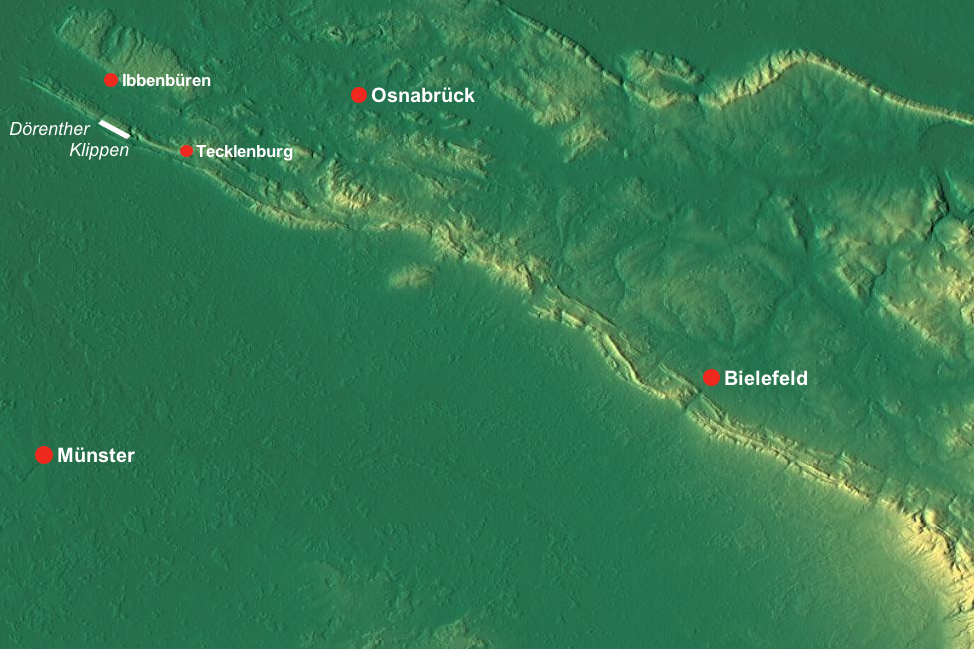
Deutsch: Lage der Dörenther Klippen bei Ibbenbüren und Tecklenburg im Osning (Teutoburger Wald), Deutschland – Die Reliefkarte ist genordet; zur Orientierung sind die drei größeren Städte Osnabrück, Münster und Bielefeld eingezeichnet. |
| Date | |
| Source |
English: Relief map from maps-for-free.com – slightly reworked (some locations added manually) |
| Author | SRTM-Daten/Maps for Free (reworked by bdk) |
| Permission (Reusing this file) |
GFDL – [1] |

|
Permission is granted to copy, distribute and/or modify this document under the terms of the GNU Free Documentation License, Version 1.2 or any later version published by the Free Software Foundation; with no Invariant Sections, no Front-Cover Texts, and no Back-Cover Texts. A copy of the license is included in the section entitled GNU Free Documentation License. |
File history
Click on a date/time to view the file as it appeared at that time.
| Date/Time | Thumbnail | Dimensions | User | Comment | |
|---|---|---|---|---|---|
| current | 15:32, 8 April 2009 | | 974 × 649 (719 KB) | Mahahahaneapneap (talk | contribs) | Compressed |
| 03:28, 23 December 2008 |  | 974 × 649 (1 MB) | Bdk (talk | contribs) | {{Information |Description={{de|Lage der de:Dörenther Klippen bei Ibbenbüren und Tecklenburg im Osning (Teutoburger Wald), Deutschland – Die Reliefkarte ist genordet; zur Orientierung sind die drei größeren Städte Osnabrück, Münster und Bie |
You cannot overwrite this file.
File usage on Commons
The following page uses this file:
File usage on other wikis
The following other wikis use this file:
- Usage on de.wikipedia.org
- Usage on nds-nl.wikipedia.org