File:Donetsk obl roads.png
Jump to navigation
Jump to search
Size of this preview: 414 × 599 pixels. Other resolutions: 166 × 240 pixels | 500 × 724 pixels.
Original file (500 × 724 pixels, file size: 211 KB, MIME type: image/png)
Captions
Captions
Add a one-line explanation of what this file represents
Summary[edit]
| Description |
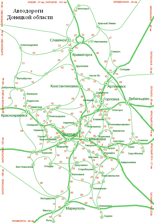
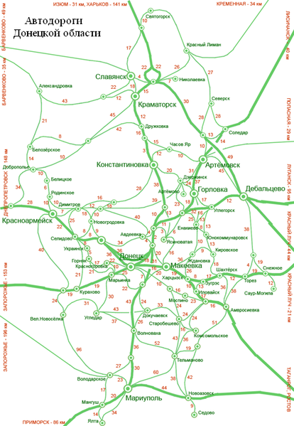
Donetsk_obl_roads map На карте не отмечено расстояние между городами:
|
| Date | |
| Source | Olegzima |
| Author |
Licensing[edit]
| I, the copyright holder of this work, release this work into the public domain. This applies worldwide. In some countries this may not be legally possible; if so: I grant anyone the right to use this work for any purpose, without any conditions, unless such conditions are required by law. |
File history
Click on a date/time to view the file as it appeared at that time.
| Date/Time | Thumbnail | Dimensions | User | Comment | |
|---|---|---|---|---|---|
| current | 19:06, 1 March 2007 | | 500 × 724 (211 KB) | Olegzima (talk | contribs) | {{Image |Name= Donetsk_obl_roads |Description= map |Author= Olegzima |Source= Olegzima |Date= Mar 2007 |Licensing= {{PD}} }} Category:Raions_of_Donetsk_Oblast |
You cannot overwrite this file.
File usage on Commons
There are no pages that use this file.
File usage on other wikis
The following other wikis use this file:
- Usage on ru.wikipedia.org
- Usage on ru.wikinews.org
- Usage on uk.wikipedia.org