File:Doruchów (gmina) location map.png
Doruchów_(gmina)_location_map.png (713 × 472 pixels, file size: 62 KB, MIME type: image/png)
Captions
Captions
| Description |
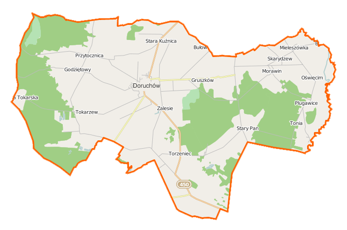
Polski: Mapa gminy Doruchów, Polska
English: Map of Gmina Doruchów, Poland |
|||||||||
| Date | ||||||||||
| Source | You may find a page on the OpenStreetMap wiki page for Doruchów (gmina) | |||||||||
| Creator |
OpenStreetMap contributors OpenStreetMap contributors |
|||||||||
| Permission (Reusing this file) |
OpenStreetMap data is available under the Open Database License (details). Map tiles are licensed under the Creative Commons Attribution-ShareAlike 2.0 license (CC-BY-SA 2.0).
This file is licensed under the Creative Commons Attribution-Share Alike 2.0 Generic license.
|
|||||||||
| Geotemporal data | ||||||||||
| Bounding box |
|
|||||||||
| Georeferencing | If inappropriate please set warp_status = skip to hide. | |||||||||
File history
Click on a date/time to view the file as it appeared at that time.
| Date/Time | Thumbnail | Dimensions | User | Comment | |
|---|---|---|---|---|---|
| current | 19:55, 18 December 2014 | | 713 × 472 (62 KB) | VanWiel (talk | contribs) | {{OpenStreetMap | name = Doruchów (gmina) | location = Doruchów (gmina) | description = {{pl|Mapa gminy Doruchów, Polska}} {{en|Map of Gmina Doruchów, Poland}} | top = 51.4540 | bottom = 51.3527... |
You cannot overwrite this file.
File usage on Commons
There are no pages that use this file.
File usage on other wikis
The following other wikis use this file:
- Usage on be.wikipedia.org
- Usage on de.wikipedia.org
- Usage on fr.wikipedia.org
- Doruchów (gmina)
- Doruchów
- Godziętowy
- Gruszków (Grande-Pologne)
- Mieleszówka
- Morawin (Ostrzeszów)
- Oświęcim (Grande-Pologne)
- Pieczyska (Ostrzeszów)
- Plugawice
- Przytocznica
- Rudniczysko
- Skarydzew
- Stara Kuźnica (Grande-Pologne)
- Tokarzew
- Tonia (Grande-Pologne)
- Torzeniec
- Wrzosy (Grande-Pologne)
- Wygoda Plugawska
- Wygoda Tokarska
- Zalesie (Ostrzeszów)
- Usage on pl.wikipedia.org
- Doruchów
- Doruchów (gmina)
- Godziętowy
- Plugawice
- Przytocznica
- Skarydzew
- Tokarzew (wieś w województwie wielkopolskim)
- Torzeniec
- Gruszków (województwo wielkopolskie)
- Zalesie (powiat ostrzeszowski)
- Morawin (powiat ostrzeszowski)
- Wygoda Plugawska
- Oświęcim (województwo wielkopolskie)
- Mieleszówka
- Tonia (województwo wielkopolskie)
- Rudniczysko
- Stara Kuźnica (województwo wielkopolskie)
- Wrzosy (województwo wielkopolskie)
- Pieczyska (powiat ostrzeszowski)
- Wygoda Tokarska
- Rezerwat przyrody Jodły Ostrzeszowskie
- Rezerwat przyrody Pieczyska (województwo wielkopolskie)
- Parafia św. Stanisława Kostki w Doruchowie
- Godziętowy (przystanek kolejowy)
- Tokarzew (osada leśna w województwie wielkopolskim)
- Moduł:Mapa/dane/Doruchów (gmina)
- Babiniec (Torzeniec)
- Huby (Torzeniec)
View more global usage of this file.
_location_map.png)
_location_map.png&oldid=519961922)