File:EDWB airfield 2012-05-28 Fotoflug Cuxhaven Wilhelmshaven DSC 3839 (crop).JPG
Jump to navigation
Jump to search
Size of this preview: 800 × 536 pixels. Other resolutions: 320 × 214 pixels | 640 × 428 pixels | 1,083 × 725 pixels.
Original file (1,083 × 725 pixels, file size: 891 KB, MIME type: image/jpeg)
Captions
Captions
Add a one-line explanation of what this file represents
Summary[edit]
| Description |
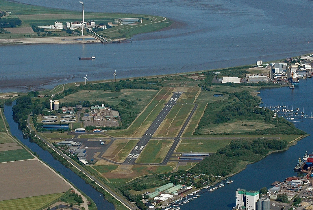
Deutsch: Flughafen Bremerhaven (EDWB) / Fotoflug vom Flugplatz Nordholz-Spieka über Cuxhaven und Wilhelmshaven |
| Date | 11:06:23 |
| Source | Own work |
| Author | Martina Nolte |
| Other versions | crop from File:2012-05-28 Fotoflug Cuxhaven Wilhelmshaven DSC 3839.jpg |
| Attribution (required by the license) | Foto: Martina Nolte / |
| Camera location | | View this and other nearby images on: OpenStreetMap |
|---|
Licensing[edit]

.JPG&action=edit§ion=1)
.JPG¶ms=053.523798_N_0008.551578_E_globe:Earth_type:camera__&language=en)
.JPG&action=edit§ion=2)
.JPG)
In printed material: "Photo: Martina Nolte, Lizenz: https://creativecommons.org/licenses/by-sa/3.0/de/legalcode"
1. Provide my name as given above: Martina Nolte,
2. a copy of, or the URI for, the applicable license: https://creativecommons.org/licenses/by-sa/3.0/de/legalcode,
3. in the case of an adaptation, a credit identifying the modification.
This license and the rights granted hereunder will terminate automatically upon any breach by you of the terms of this license. Any of the above conditions can be waived if you get permission from the copyright holder. If you have questions or wish any different conditions or a higher resolution, please contact me through
kontakt martina-nolte.de
 or my discussion page
This file is licensed under the Creative Commons Attribution-Share Alike 3.0 Germany license.
Attribution: Foto: Martina Nolte, Lizenz: Creative Commons by-sa-3.0 de
- You are free:
- to share – to copy, distribute and transmit the work
- to remix – to adapt the work
- Under the following conditions:
- attribution – You must give appropriate credit, provide a link to the license, and indicate if changes were made. You may do so in any reasonable manner, but not in any way that suggests the licensor endorses you or your use.
- share alike – If you remix, transform, or build upon the material, you must distribute your contributions under the same or compatible license as the original.

| Dieses Foto entstand aufgrund eines Projektes, das von Wikimedia Deutschland e. V. gefördert wurde.
Im Rahmen des „Community-Projektbudgets“ sollen Luftbilder u.a. von Inseln, Halligen, Sanden und Küstenstädten der deutschen Nordseeküste angefertigt werden. Das Projekt „Fotoflüge“ wurde im September 2011 begonnen. |
| Annotations | This image is annotated: View the annotations at Commons |
.JPG)
File history
Click on a date/time to view the file as it appeared at that time.
| Date/Time | Thumbnail | Dimensions | User | Comment | |
|---|---|---|---|---|---|
| current | 16:53, 17 February 2014 | | 1,083 × 725 (891 KB) | Martina Nolte (talk | contribs) | == {{int:filedesc}} == {{Information |Description={{de|Flughafen Bremerhaven (EDWB) / Fotoflug vom Flugplatz Nordholz-Spieka über Cuxhaven und Wilhelmshaven}} |Source={{own}} |o... |
You cannot overwrite this file.
File usage on Commons
The following 2 pages use this file:
File usage on other wikis
The following other wikis use this file:
- Usage on ast.wikipedia.org
- Usage on de.wikipedia.org
- Usage on en.wikipedia.org
- Usage on tr.wikipedia.org
- Usage on www.wikidata.org
.JPG&oldid=609344897)