File:Earnest Will map.png
Jump to navigation
Jump to search
Size of this preview: 748 × 600 pixels. Other resolutions: 300 × 240 pixels | 599 × 480 pixels | 887 × 711 pixels.
Original file (887 × 711 pixels, file size: 81 KB, MIME type: image/png)
Captions
Captions
Add a one-line explanation of what this file represents
Summary[edit]
| Description |
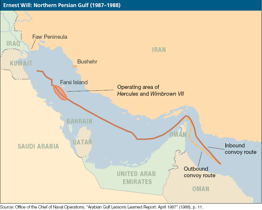
English: Map shows routes of in- and outbound convoys under protection of warships of the US Navy while the tanker war (dubbed Operation Earnest Will) |
| Date | |
| Source | Via https://apps.dtic.mil/sti/pdfs/ADA403506.pdf, where it is cited to Office of Chief of Naval Operations, "Arabian Gulf Lessons Learned Report: April 1987 (1988), p. 11. |
| Author | Office of Chief of Naval Operations |
Licensing[edit]
This work is in the public domain in the United States because it is a work prepared by an officer or employee of the United States Government as part of that person’s official duties under the terms of Title 17, Chapter 1, Section 105 of the US Code.
Note: This only applies to original works of the Federal Government and not to the work of any individual U.S. state, territory, commonwealth, county, municipality, or any other subdivision. This template also does not apply to postage stamp designs published by the United States Postal Service since 1978. (See § 313.6(C)(1) of Compendium of U.S. Copyright Office Practices). It also does not apply to certain US coins; see The US Mint Terms of Use.
|
 | |
| This file has been identified as being free of known restrictions under copyright law, including all related and neighboring rights. | ||
File history
Click on a date/time to view the file as it appeared at that time.
| Date/Time | Thumbnail | Dimensions | User | Comment | |
|---|---|---|---|---|---|
| current | 12:34, 1 May 2006 | | 887 × 711 (81 KB) | Schlendrian (talk | contribs) | Source: http://www.dtic.mil/doctrine/jel/jfq_pubs/0629.pdf There contributed to ''Office of Chief of Naval Operations, "Arabian Gulf lessons learend Report: April 1987 (1988), p. 11.'' map shows routes of in- and outbound convoys under protection of wars |
You cannot overwrite this file.
File usage on Commons
The following 2 pages use this file:
File usage on other wikis
The following other wikis use this file:
- Usage on ar.wikipedia.org
- Usage on ast.wikipedia.org
- Usage on azb.wikipedia.org
- Usage on az.wikipedia.org
- Usage on ca.wikipedia.org
- Usage on ckb.wikipedia.org
- Usage on cs.wikipedia.org
- Usage on de.wikipedia.org
- Usage on en.wikipedia.org
- Usage on es.wikipedia.org
- Usage on fa.wikipedia.org
- Usage on fi.wikipedia.org
- Usage on fr.wikipedia.org
- Usage on id.wikipedia.org
- Usage on it.wikipedia.org
- Usage on ja.wikipedia.org
- Usage on mzn.wikipedia.org
- Usage on ru.wikipedia.org
- Usage on tg.wikipedia.org
- Usage on uk.wikipedia.org
- Usage on www.wikidata.org