File:Ederplan.JPG
Jump to navigation
Jump to search
Size of this preview: 798 × 600 pixels. Other resolutions: 320 × 240 pixels | 639 × 480 pixels | 1,022 × 768 pixels | 1,280 × 962 pixels | 2,560 × 1,924 pixels | 2,832 × 2,128 pixels.
Original file (2,832 × 2,128 pixels, file size: 1.09 MB, MIME type: image/jpeg)
Captions
Captions
Add a one-line explanation of what this file represents
Summary[edit]
| Description |
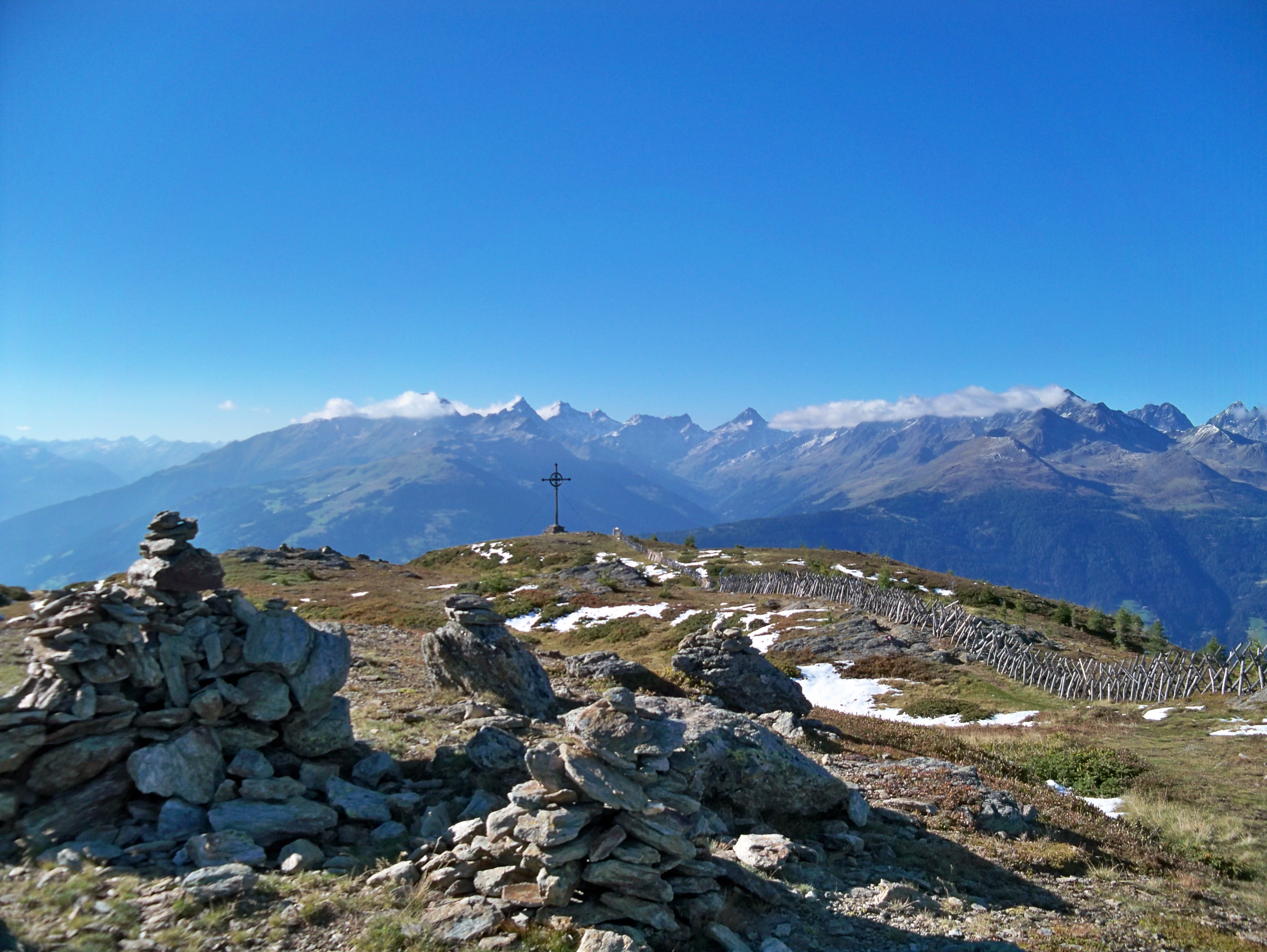
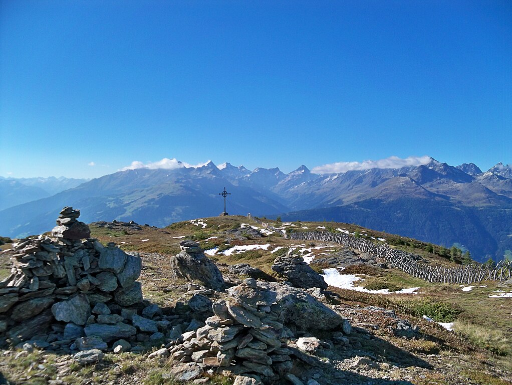
English: Top of the Ederplan, 2062m. View is towards north-west. The Ederplan is the westernmost mountain top within the Kreuzeck group ( part of the Hohe Tauern). Note the large cross on the top. It was erected by Veterans of both world wars, as a sign of gratitude for returning home safe. Deutsch: Der Gipfel des Ederplans, 2062m. Blickrichtung Nordwesten. Der Ederplan ist der westlichste Gipfel der Kreuzeckgruppe. Auf dem Gipfel befindet sich ein Heimkehrerkreuz. |
| Date | |
| Source | Own work |
| Author | Halgens |
Licensing[edit]
I, the copyright holder of this work, hereby publish it under the following license:
This file is licensed under the Creative Commons Attribution-Share Alike 3.0 Unported license.
- You are free:
- to share – to copy, distribute and transmit the work
- to remix – to adapt the work
- Under the following conditions:
- attribution – You must give appropriate credit, provide a link to the license, and indicate if changes were made. You may do so in any reasonable manner, but not in any way that suggests the licensor endorses you or your use.
- share alike – If you remix, transform, or build upon the material, you must distribute your contributions under the same or compatible license as the original.
| Annotations | This image is annotated: View the annotations at Commons |
File history
Click on a date/time to view the file as it appeared at that time.
| Date/Time | Thumbnail | Dimensions | User | Comment | |
|---|---|---|---|---|---|
| current | 22:17, 19 December 2012 | | 2,832 × 2,128 (1.09 MB) | Halgens (talk | contribs) | User created page with UploadWizard |
You cannot overwrite this file.
File usage on Commons
There are no pages that use this file.