File:Emanuel Stenghri - Magyarország kéziratos térképe 1664.jpg
Jump to navigation
Jump to search

Size of this preview: 800 × 567 pixels. Other resolutions: 320 × 227 pixels | 640 × 454 pixels | 1,024 × 726 pixels | 1,280 × 907 pixels | 1,600 × 1,134 pixels.
Original file (1,600 × 1,134 pixels, file size: 746 KB, MIME type: image/jpeg)
Captions
Captions
Add a one-line explanation of what this file represents
Summary[edit]
| Description |
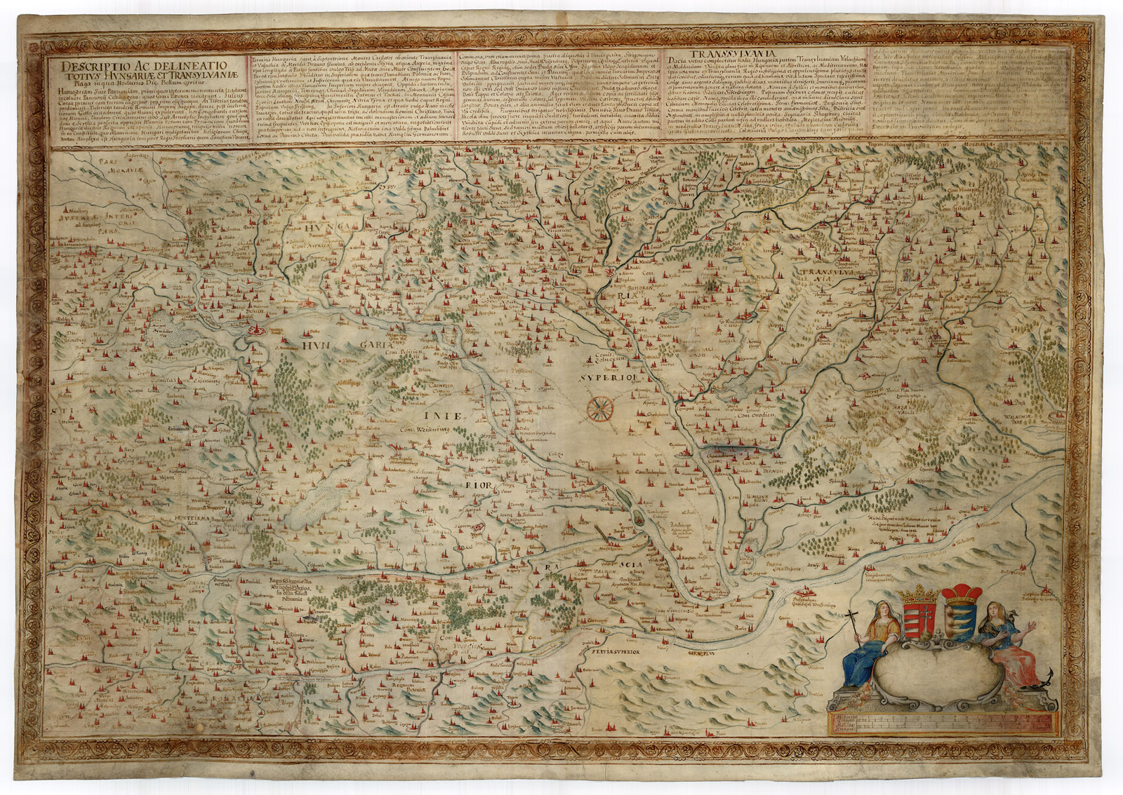
Magyar: Emanuel Stenghri: Descriptio ac delineatio totius Hungariae et Transyvalniae plaga in qua hodierno die bellum geritur (1664) Az egykori könyvtáralapító, Széchényi Ferenc gyűjteményéből származó, pergamenre rajzolt és finoman kidolgozott kéziratos térkép |
| Date | |
| Source | http://tortenet.oszk.hu/html/magyar/04kincseink/terkeptar/tk_1872_b.jpg |
| Author | Emanuel Stenghri |
Licensing[edit]
|
This work is in the public domain in its country of origin and other countries and areas where the copyright term is the author's life plus 100 years or fewer. | |
| This file has been identified as being free of known restrictions under copyright law, including all related and neighboring rights. | |
File history
Click on a date/time to view the file as it appeared at that time.
| Date/Time | Thumbnail | Dimensions | User | Comment | |
|---|---|---|---|---|---|
| current | 14:39, 22 August 2011 | | 1,600 × 1,134 (746 KB) | Zojatomi (talk | contribs) | {{Information |Description ={{hu|1=Emanuel Stenghri: Descriptio ac delineatio totius Hungariae et Transyvalniae plaga in qua hodierno die bellum geritur (1664) Az egykori könyvtáralapító, Széchényi Ferenc gyűjteményéből származó, pergamenre |
You cannot overwrite this file.
File usage on Commons
There are no pages that use this file.