File:Enklawa Kietrzańska.png
Jump to navigation
Jump to search
Size of this preview: 800 × 577 pixels. Other resolutions: 320 × 231 pixels | 640 × 461 pixels | 1,024 × 738 pixels | 1,280 × 923 pixels | 2,435 × 1,755 pixels.
Original file (2,435 × 1,755 pixels, file size: 9.05 MB, MIME type: image/png)
Captions
Captions
Add a one-line explanation of what this file represents
Summary
[edit]
| Description |
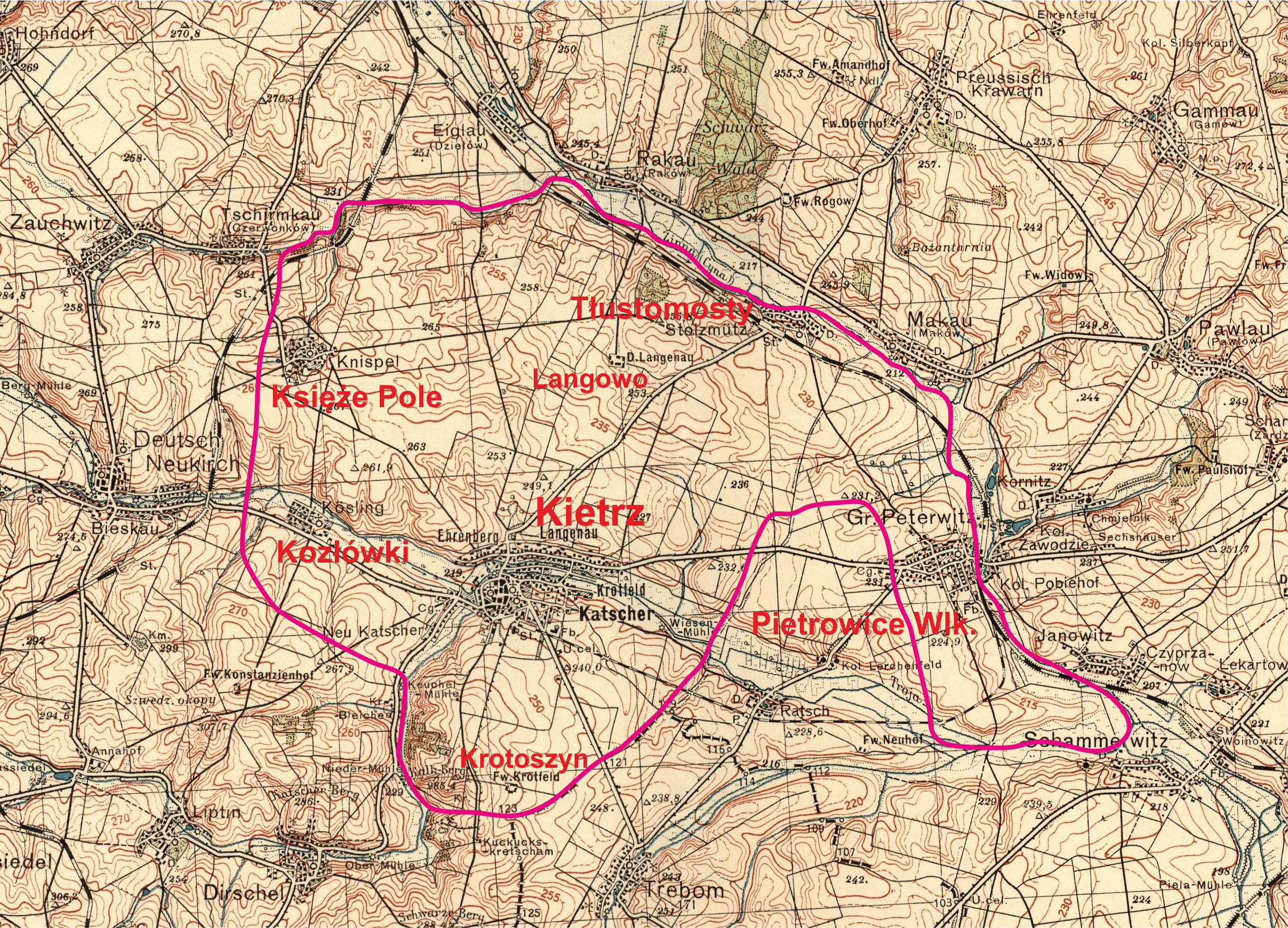
Polski: Przybliżony zasięg enklawy kietrzańskiej – dawnej enklawy Moraw na Śląsku istniejącej do 1742 roku. Zasięg enklawy na podstawie mapy Górnego Śląska z Atlas Silesiae Id Est Ducatus Silesiae Generaliter Quatuor Mappis Nec Non Specialiter XVI Mappis Tot Principatus Repraesentantibus Geographice Exhibitus (File:Superiorem Silesiam AD1746.jpg). Podkład: mapa topograficzna Wojskowego Instytutu Geograficznego 1:100 000 ark.: Pas 48-Słup 26 Racibórz (Ratibor) z 1933 r. |
||||
| Date | Before World War II/2015-02-04 | ||||
| Source | Wojskowy Instytut Geograficzny + Own work | ||||
| Author | Wojskowy Instytut Geograficzny (topographic map)/Aotearoa | ||||
| Permission (Reusing this file) |
topographic map:
modern content: I, the copyright holder of this work, hereby publish it under the following license: This file is licensed under the Creative Commons Attribution 3.0 Unported license.
|
||||
File history
Click on a date/time to view the file as it appeared at that time.
| Date/Time | Thumbnail | Dimensions | User | Comment | |
|---|---|---|---|---|---|
| current | 11:21, 4 February 2015 | | 2,435 × 1,755 (9.05 MB) | Aotearoa (talk | contribs) | == {{int:filedesc}} == {{Information |Description={{pl|1=Przybliżony zasięg enklawy kietrzańskiej – dawnej enklawy Moraw na Śląsku istniejącej do 1742 roku. Zasięg enklawy na podstawie mapy Górnego Śląska z ''Atlas Silesiae Id Est Ducatus S... |
You cannot overwrite this file.
File usage on Commons
There are no pages that use this file.
File usage on other wikis
The following other wikis use this file:
- Usage on pl.wikipedia.org