File:Eurasian Plate map-fr.png
Jump to navigation
Jump to search

Size of this preview: 800 × 302 pixels. Other resolutions: 320 × 121 pixels | 640 × 242 pixels | 1,024 × 387 pixels | 1,280 × 483 pixels | 3,325 × 1,255 pixels.
Original file (3,325 × 1,255 pixels, file size: 209 KB, MIME type: image/png)
Captions
Captions
Add a one-line explanation of what this file represents
| Description |
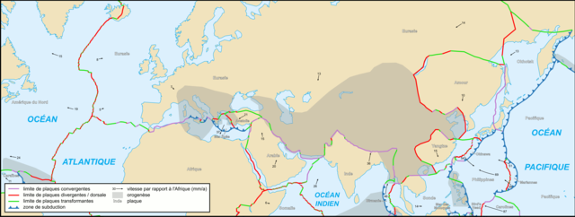
Français : Carte de la plaque eurasienne English: Map of the Eurasian Plate 中文:欧亚大陆板块地图 |
| Date | |
| Source | Cropped version by myself of Image:Tectonic_plates_boundaries_detailed-fr.svg created by Sting under CC-BY-SA |
| Author | Sting and Rémih |
| Permission (Reusing this file) |
This file is licensed under the Creative Commons Attribution-Share Alike 2.5 Generic license.
|
| Other versions |
File:Eurasian Plate map-sr.png; Scaled version of  |
File history
Click on a date/time to view the file as it appeared at that time.
| Date/Time | Thumbnail | Dimensions | User | Comment | |
|---|---|---|---|---|---|
| current | 13:19, 20 November 2006 | 3,325 × 1,255 (209 KB) | Sting (talk | contribs) | Still bug | |
| 13:12, 20 November 2006 | 3,325 × 1,255 (314 KB) | Sting (talk | contribs) | Display bug ? | ||
| 12:58, 20 November 2006 | 3,325 × 1,255 (314 KB) | Sting (talk | contribs) | smaller key; reduced weight of file | ||
| 22:58, 18 November 2006 | 3,310 × 1,233 (1.87 MB) | Rémih (talk | contribs) | {{Information |Description={{fr|Carte de la plaque eurasienne}}{{en|Map of the Eurasian Plate}} |Source=Cropped version by myself of Image:Tectonic_plates_boundaries_detailed-fr.svg created by Sting under CC-BY-SA |Date=18/11/2006 |Aut |
You cannot overwrite this file.
File usage on Commons
There are no pages that use this file.
File usage on other wikis
The following other wikis use this file:
- Usage on ca.wikipedia.org
- Usage on en.wikipedia.org
- Usage on fr.wikipedia.org
- Usage on pl.wikipedia.org
- Usage on uk.wikipedia.org
- Usage on www.wikidata.org
- Usage on zh.wikipedia.org