File:F54 Hôtel-de-ville-de-Nancy.jpg
Original file (960 × 1,280 pixels, file size: 1.29 MB, MIME type: image/jpeg)
Captions
Summary
[edit]DescriptionF54 Hôtel-de-ville-de-Nancy.jpg |
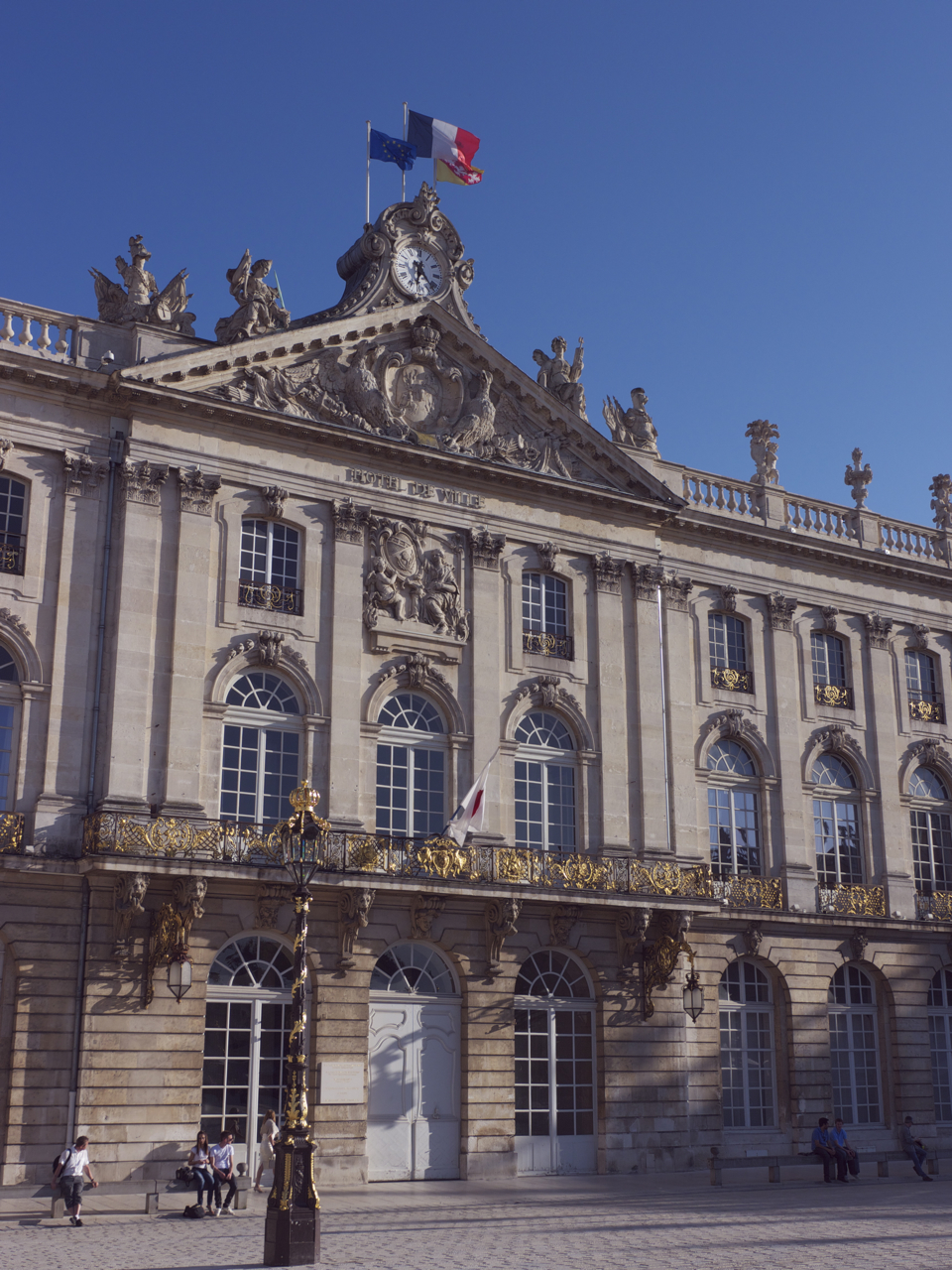
Français : Avant-corps central de l'Hôtel de ville de Nancy, bâtiment principal de la Place Stanislas (98m de façade), édifié par Émmanuel Héré de 1552 à 1755 et agrément d'un majestueux balcon du ferronnier Jean Lamour |
Date | |
Source | Own work |
Author | François BERNARDIN |
Object location | 48° 41′ 35.21″ N, 6° 11′ 00.79″ E | View this and other nearby images on: OpenStreetMap | 48.693113; 6.183554 |
---|
Licensing
[edit]- You are free:
- to share – to copy, distribute and transmit the work
- to remix – to adapt the work
- Under the following conditions:
- attribution – You must give appropriate credit, provide a link to the license, and indicate if changes were made. You may do so in any reasonable manner, but not in any way that suggests the licensor endorses you or your use.
- share alike – If you remix, transform, or build upon the material, you must distribute your contributions under the same or compatible license as the original.
This image was uploaded as part of Wiki Loves Monuments 2011.
Afrikaans ∙ Alemannisch ∙ العربية ∙ جازايرية ∙ azərbaycanca ∙ Bikol Central ∙ беларуская ∙ беларуская (тарашкевіца) ∙ български ∙ বাংলা ∙ brezhoneg ∙ bosanski ∙ català ∙ čeština ∙ Cymraeg ∙ dansk ∙ Deutsch ∙ Zazaki ∙ Ελληνικά ∙ English ∙ Esperanto ∙ español ∙ eesti ∙ euskara ∙ فارسی ∙ suomi ∙ français ∙ Frysk ∙ Gaeilge ∙ galego ∙ עברית ∙ हिन्दी ∙ hrvatski ∙ magyar ∙ հայերեն ∙ Bahasa Indonesia ∙ Ido ∙ italiano ∙ 日本語 ∙ ქართული ∙ 한국어 ∙ кыргызча ∙ Lëtzebuergesch ∙ latviešu ∙ Malagasy ∙ македонски ∙ മലയാളം ∙ Bahasa Melayu ∙ Malti ∙ norsk bokmål ∙ नेपाली ∙ Nederlands ∙ norsk nynorsk ∙ norsk ∙ polski ∙ português ∙ português do Brasil ∙ română ∙ русский ∙ sicilianu ∙ davvisámegiella ∙ slovenčina ∙ slovenščina ∙ shqip ∙ српски / srpski ∙ svenska ∙ ไทย ∙ Tagalog ∙ Türkçe ∙ українська ∙ اردو ∙ oʻzbekcha / ўзбекча ∙ Yorùbá ∙ 中文 ∙ 中文(中国大陆) ∙ 中文(简体) ∙ 中文(繁體) ∙ 中文(香港) ∙ 中文(臺灣) ∙ +/− |
This building is classé au titre des monuments historiques de la France. It is indexed in the base Mérimée, a database of architectural heritage maintained by the French Ministry of Culture, under the reference PA00106124 .
brezhoneg ∙ català ∙ Deutsch ∙ English ∙ español ∙ Esperanto ∙ euskara ∙ français ∙ italiano ∙ magyar ∙ Nederlands ∙ português do Brasil ∙ português ∙ română ∙ sicilianu ∙ slovenščina ∙ suomi ∙ svenska ∙ Ελληνικά ∙ беларуская (тарашкевіца) ∙ македонски ∙ русский ∙ українська ∙ বাংলা ∙ +/− |
File history
Click on a date/time to view the file as it appeared at that time.
Date/Time | Thumbnail | Dimensions | User | Comment | |
---|---|---|---|---|---|
current | 21:06, 3 September 2011 | 960 × 1,280 (1.29 MB) | Freb (talk | contribs) |
You cannot overwrite this file.
File usage on Commons
The following 5 pages use this file:
File usage on other wikis
The following other wikis use this file:
- Usage on es.wikipedia.org
- Usage on fr.wikipedia.org
- Usage on www.wikidata.org
Metadata
This file contains additional information such as Exif metadata which may have been added by the digital camera, scanner, or software program used to create or digitize it. If the file has been modified from its original state, some details such as the timestamp may not fully reflect those of the original file. The timestamp is only as accurate as the clock in the camera, and it may be completely wrong.
Camera manufacturer | Panasonic |
---|---|
Camera model | DMC-GH2 |
Exposure time | 1/400 sec (0.0025) |
F-number | f/8 |
ISO speed rating | 160 |
Date and time of data generation | 17:25, 8 April 2011 |
Lens focal length | 22 mm |
Orientation | Normal |
Horizontal resolution | 72 dpi |
Vertical resolution | 72 dpi |
Software used | QuickTime 7.6.6 |
File change date and time | 10:03, 10 April 2011 |
Exposure Program | Landscape mode (for landscape photos with the background in focus) |
Exif version | 2.2 |
Date and time of digitizing | 17:25, 8 April 2011 |
APEX exposure bias | 0 |
Maximum land aperture | 4.33984375 APEX (f/4.5) |
Metering mode | Pattern |
Light source | Unknown |
Flash | Flash did not fire, compulsory flash suppression |
Sensing method | One-chip color area sensor |
Structured data
Items portrayed in this file
depicts
8 April 2011
48°41'35.207"N, 6°11'0.794"E
160
0.0025 second
22 millimetre
image/jpeg
- CC-BY-SA-3.0
- Self-published work
- Images from Wiki Loves Monuments 2011
- Images from Wiki Loves Monuments 2011 in France
- Images from Wiki Loves Monuments missing SDC creator
- Base Mérimée
- Monuments historiques classés
- Mérimée with PA parameter
- Cultural heritage monuments in France with known IDs
- France photographs taken on 2011-04-08