File:FH Kiel Campus Kiel Dietrichsdorf Schwentine.png
Jump to navigation
Jump to search
Size of this preview: 800 × 600 pixels. Other resolutions: 320 × 240 pixels | 640 × 480 pixels | 1,024 × 768 pixels | 1,280 × 960 pixels | 2,560 × 1,920 pixels | 4,000 × 3,000 pixels.
Original file (4,000 × 3,000 pixels, file size: 18.18 MB, MIME type: image/png)
Captions
Captions
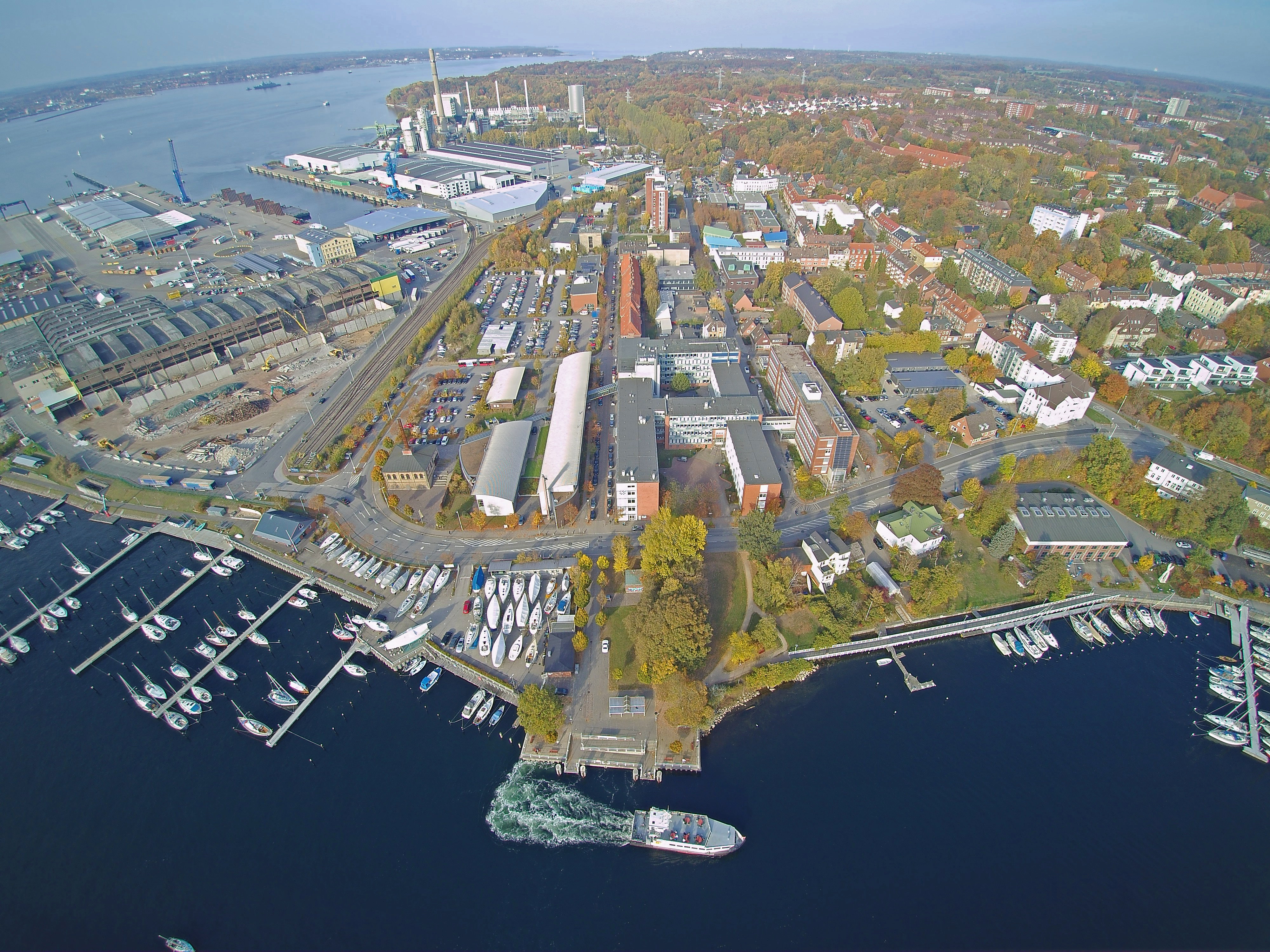
The campus of the Kiel University of Applied Sciences
Summary[edit]
| Description |
English: In this photo taken by an air drone the campus of the Kiel University of Applied Sciences can be seen in the center. The camera points towards the north. Adjacent to it the port of Kiel, one of the local power plants and neighbouring houses of the district Dietrichsdorf can be seen. At the bottom the river mouth of the Schwentine into the Fjord of Kiel can be seen with a commuting ferry connecting the Kiel University of Applied Sciences and GEOMAR Helmholtz Centre for Ocean Research Kiel with the other side of the bay.
Deutsch: Diese Drohnenaufnahme zeigt den Campus der Fachhochschule Kiel von Süden in Richtung Norden blickend. Neben dem Campus sind der Port of Kiel, eines der lokalen Kraftwerke, die Schwentinemündung in die Kieler Förde und die anliegende dietrichsdorfer Nachbarschaft sichtbar. Die Pendlerfähre am unteren Bildrand verbindet die Fachhochschule Kiel und das Geomar Helmholtz Zentrum für Ozeanografie mit dem Westufer der Stadt. |
| Date | |
| Source | not published in any book, website or other publication |
| Author | Lasse Hänert |
| Camera location | | View this and other nearby images on: OpenStreetMap |
|---|
Licensing[edit]
This file is licensed under the Creative Commons Attribution-Share Alike 4.0 International license.
- You are free:
- to share – to copy, distribute and transmit the work
- to remix – to adapt the work
- Under the following conditions:
- attribution – You must give appropriate credit, provide a link to the license, and indicate if changes were made. You may do so in any reasonable manner, but not in any way that suggests the licensor endorses you or your use.
- share alike – If you remix, transform, or build upon the material, you must distribute your contributions under the same or compatible license as the original.
File history
Click on a date/time to view the file as it appeared at that time.
| Date/Time | Thumbnail | Dimensions | User | Comment | |
|---|---|---|---|---|---|
| current | 17:00, 9 January 2020 | | 4,000 × 3,000 (18.18 MB) | Yan Mayen (talk | contribs) | User created page with UploadWizard |
You cannot overwrite this file.
File usage on Commons
The following page uses this file:
File usage on other wikis
The following other wikis use this file:
- Usage on de.wikipedia.org
- Usage on en.wikipedia.org
- Usage on www.wikidata.org