File:Fairy Ring in Moorat's Park - geograph.org.uk - 1308877.jpg
Jump to navigation
Jump to search
No higher resolution available.
Fairy_Ring_in_Moorat's_Park_-_geograph.org.uk_-_1308877.jpg (640 × 478 pixels, file size: 197 KB, MIME type: image/jpeg)
Captions
Captions
Add a one-line explanation of what this file represents
Summary[edit]
| Description |
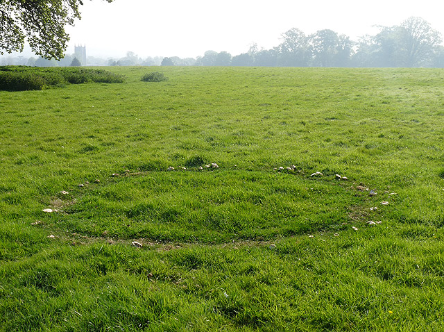
English: Fairy Ring in Moorat's Park. Close to 1054413, which can be seen to the left, this view includes St Mary's, Dedham in the background and a large expanse of open grassland. This piece of National Trust land is hidden away off the Dedham - Stratford road and served by a small lay-by on the north side of the road. The approach is up a narrow track through woodland, with plenty of these 1308878, before opening out into a grassy hill, with a few trees and commanding views over Dedham and its Vale. |
||
| Date | |||
| Source | geograph.org.uk | ||
| Author | Zorba the Geek | ||
| Permission (Reusing this file) |
This file is licensed under the Creative Commons Attribution-Share Alike 2.0 Generic license. Attribution: Zorba the Geek
|
||
| Attribution (required by the license) | Zorba the Geek / Fairy Ring in Moorat's Park / | ||

| Camera location | | View this and other nearby images on: OpenStreetMap |
|---|
_heading:67.00&language=en)
| Object location | | View this and other nearby images on: OpenStreetMap |
|---|
_heading:67.00&language=en)
File history
Click on a date/time to view the file as it appeared at that time.
| Date/Time | Thumbnail | Dimensions | User | Comment | |
|---|---|---|---|---|---|
| current | 13:06, 27 February 2011 | | 640 × 478 (197 KB) | GeographBot (talk | contribs) | == {{int:filedesc}} == {{Information |description={{en|1=Fairy Ring in Moorat's Park Close to 1054413, which can be seen to the left, this view includes St Mary's, Dedham in the background and a large expanse of open grassland. This piece of National |
You cannot overwrite this file.
File usage on Commons
There are no pages that use this file.