File:Finnish-Russian border, Paljakka-2.jpg
From Wikimedia Commons, the free media repository
Jump to navigation
Jump to search
Size of this preview: 518 × 599 pixels. Other resolutions: 207 × 240 pixels | 415 × 480 pixels | 664 × 768 pixels | 885 × 1,024 pixels | 1,771 × 2,048 pixels | 3,486 × 4,032 pixels.
Original file (3,486 × 4,032 pixels, file size: 13.66 MB, MIME type: image/jpeg)
File information
Structured data
Captions
Summary
[edit]DescriptionFinnish-Russian border, Paljakka-2.jpg |
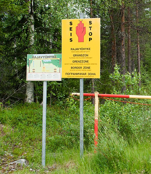
English: Finnish-Russian border in Paljakka, Kuusamo, Finland. |
||
Date | July 2010 (12 July 2010, according to Exif data) | ||
Source | Own work | ||
Author | Fanny Schertzer | ||
Permission (Reusing this file) |
I, the copyright holder of this work, hereby publish it under the following licenses:
This file is licensed under the Creative Commons Attribution-Share Alike 3.0 Unported, 2.5 Generic, 2.0 Generic and 1.0 Generic license.
You may select the license of your choice. |
Camera location | 66° 09′ 48.91″ N, 29° 33′ 47.26″ E | View this and other nearby images on: OpenStreetMap | 66.163586; 29.563128 |
---|
The making of this document was supported by Wikimédia France. (Submit your project!)
العربية ∙ বাংলা ∙ brezhoneg ∙ čeština ∙ Deutsch ∙ English ∙ Esperanto ∙ español ∙ فارسی ∙ suomi ∙ français ∙ italiano ∙ македонски ∙ Nederlands ∙ polski ∙ português ∙ português do Brasil ∙ русский ∙ sicilianu ∙ svenska ∙ தமிழ் ∙ Türkçe ∙ українська ∙ +/− |
File history
Click on a date/time to view the file as it appeared at that time.
Date/Time | Thumbnail | Dimensions | User | Comment | |
---|---|---|---|---|---|
current | 19:26, 11 August 2010 | 3,486 × 4,032 (13.66 MB) | Inisheer (talk | contribs) | {{Information |Description=Finnish-Russian border in Paljakka, Finland. |Source={{own}} |Date=2010-07 |Author= Fanny Schertzer |Permission= |other_versions= }} Category:International borders of Finland [[Category:International borde |
You cannot overwrite this file.
File usage on Commons
The following 3 pages use this file:
File usage on other wikis
The following other wikis use this file:
- Usage on ca.wikipedia.org
- Usage on en.wikipedia.org
- Usage on en.wikivoyage.org
- Usage on es.wikipedia.org
- Usage on fi.wikipedia.org
- Usage on no.wikipedia.org
- Usage on sv.wikipedia.org
- Usage on th.wikipedia.org
- Usage on tr.wikipedia.org
- Usage on www.wikidata.org
Metadata
This file contains additional information such as Exif metadata which may have been added by the digital camera, scanner, or software program used to create or digitize it. If the file has been modified from its original state, some details such as the timestamp may not fully reflect those of the original file. The timestamp is only as accurate as the clock in the camera, and it may be completely wrong.
Image title | SONY DSC |
---|---|
Camera manufacturer | SONY |
Camera model | DSLR-A900 |
Copyright holder | Fanny Schertzer |
Exposure time | 1/125 sec (0.008) |
F-number | f/9 |
ISO speed rating | 800 |
Date and time of data generation | 15:32, 12 July 2010 |
Lens focal length | 50 mm |
Altitude | 293.278 meters above sea level |
Horizontal resolution | 240 dpi |
Vertical resolution | 240 dpi |
Software used | DSLR-A900 v1.00 |
File change date and time | 20:45, 11 August 2010 |
Exposure Program | Aperture priority |
Exif version | 2.21 |
Date and time of digitizing | 15:32, 12 July 2010 |
APEX shutter speed | 6.965784 |
APEX aperture | 6.33985 |
APEX brightness | 6.12 |
APEX exposure bias | 0.7 |
Maximum land aperture | 4 APEX (f/4) |
Metering mode | Pattern |
Light source | Unknown |
Flash | Flash did not fire, compulsory flash suppression |
Custom image processing | Normal process |
Exposure mode | Auto exposure |
White balance | Auto white balance |
Focal length in 35 mm film | 50 mm |
Scene capture type | Standard |
Contrast | Normal |
Saturation | Normal |
Sharpness | Normal |
North or south latitude | North latitude |
East or west longitude | East longitude |
Geodetic survey data used | WGS-84 |
GPS date | 2010-07-12 |
Structured data
Items portrayed in this file
depicts
some value
July 2010
66°9'48.910"N, 29°33'47.261"E
14,325,132 byte
4,032 pixel
3,486 pixel
image/jpeg
36b08d928f53f01b98eb5a35875ab77d55648e78
0.008 second
800
50 millimetre
Hidden categories: