File:Flemmings Karte für das türkische Interessen-Gebiet, die Türkei und die Grenzgebiete mit Rußland, Balkanstaaten, Großbritanien, Italien, Persien.jpg
Jump to navigation
Jump to search

Size of this preview: 748 × 600 pixels. Other resolutions: 300 × 240 pixels | 599 × 480 pixels | 958 × 768 pixels | 1,278 × 1,024 pixels | 2,555 × 2,048 pixels | 20,919 × 16,766 pixels.
Original file (20,919 × 16,766 pixels, file size: 75.27 MB, MIME type: image/jpeg)
Captions
Captions
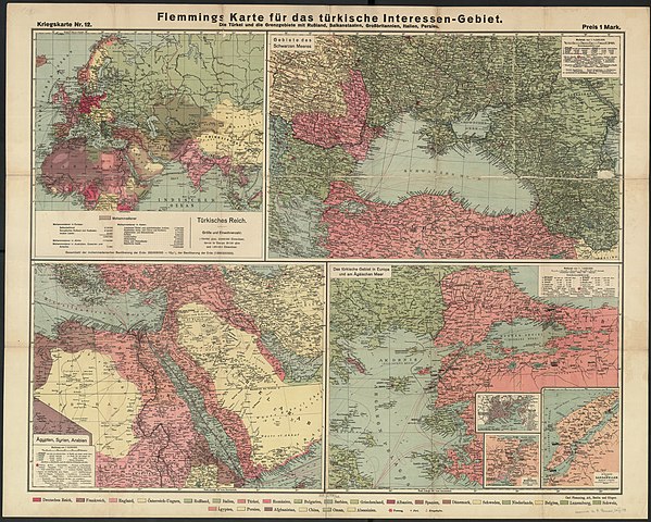
Flemmings Karte für das türkische Interessen-Gebiet, die Türkei und die Grenzgebiete mit Rußland, Balkanstaaten, Großbritanien, Italien, Persien
Summary
[edit]| Warning | The original file is very high-resolution. It might not load properly or could cause your browser to freeze when opened at full size. |
|---|
| Description |
English: Flemmings Karte für das türkische Interessen-Gebiet, die Türkei und die Grenzgebiete mit Rußland, Balkanstaaten, Großbritanien, Italien, Persien |
| Date | circa 1914 |
| Source | http://polona.pl/item/25119841/ |
| Author | Flemming, Carl (1806-1878)</contributorCorp> |
| Other versions |
.jpg)
.jpg)
.jpg)
.jpg)
.jpg)
.jpg)
Licensing
[edit]
|
This work is in the public domain in its country of origin and other countries and areas where the copyright term is the author's life plus 70 years or fewer. This work is in the public domain in the United States because it was published (or registered with the U.S. Copyright Office) before January 1, 1929. | |
| This file has been identified as being free of known restrictions under copyright law, including all related and neighboring rights. | |
File history
Click on a date/time to view the file as it appeared at that time.
| Date/Time | Thumbnail | Dimensions | User | Comment | |
|---|---|---|---|---|---|
| current | 18:03, 26 June 2020 | | 20,919 × 16,766 (75.27 MB) | Balkanique (talk | contribs) | Uploaded a work by Flemming, Carl (1806-1878)</contributorCorp> from http://polona.pl/item/25119841/ with UploadWizard |
You cannot overwrite this file.
File usage on Commons
The following 8 pages use this file:
- User:Magog the Ogre/Maps of conflicts/2020 June
- File:Black Sea Area - Flemmings Karte für das türkische Interessen-Gebiet, die Türkei und die Grenzgebiete mit Rußland, Balkanstaaten, Großbritanien, Italien, Persien (cropped).jpg
- File:Dardanelles - Flemmings Karte für das türkische Interessen-Gebiet, die Türkei und die Grenzgebiete mit Rußland, Balkanstaaten, Großbritanien, Italien, Persien (cropped).jpg
- File:Das türkische Gebiet in Europa und Ägäischen Meer - Flemmings Karte für das türkische Interessen-Gebiet, die Türkei und die Grenzgebiete mit Rußland, Balkanstaaten, Großbritanien, Italien, Persien (cropped).jpg
- File:Der Bosporus - Flemmings Karte für das türkische Interessen-Gebiet, die Türkei und die Grenzgebiete mit Rußland, Balkanstaaten, Großbritanien, Italien, Persien (cropped).jpg
- File:Egypt, Syria, Arabia - Flemmings Karte für das türkische Interessen-Gebiet, die Türkei und die Grenzgebiete mit Rußland, Balkanstaaten, Großbritanien, Italien, Persien (cropped).jpg
- File:Istanbul - Das türkische Gebiet in Europa und Ägäischen Meer - Flemmings Karte für das türkische Interessen-Gebiet, die Türkei und die Grenzgebiete mit Rußland, Balkanstaaten, Großbritanien, Italien, Persien (cropped) (cropped).jpg
- File:Türkisches Reich - Flemmings Karte für das türkische Interessen-Gebiet, die Türkei und die Grenzgebiete mit Rußland, Balkanstaaten, Großbritanien, Italien, Persien (cropped).jpg
_(cropped).jpg)