File:Floating island of garbage in the Drina River, Bosnia and Herzegovina.jpg

Original file (3,380 × 2,540 pixels, file size: 1.41 MB, MIME type: image/jpeg)
Captions
Captions
Summary[edit]
| Description |
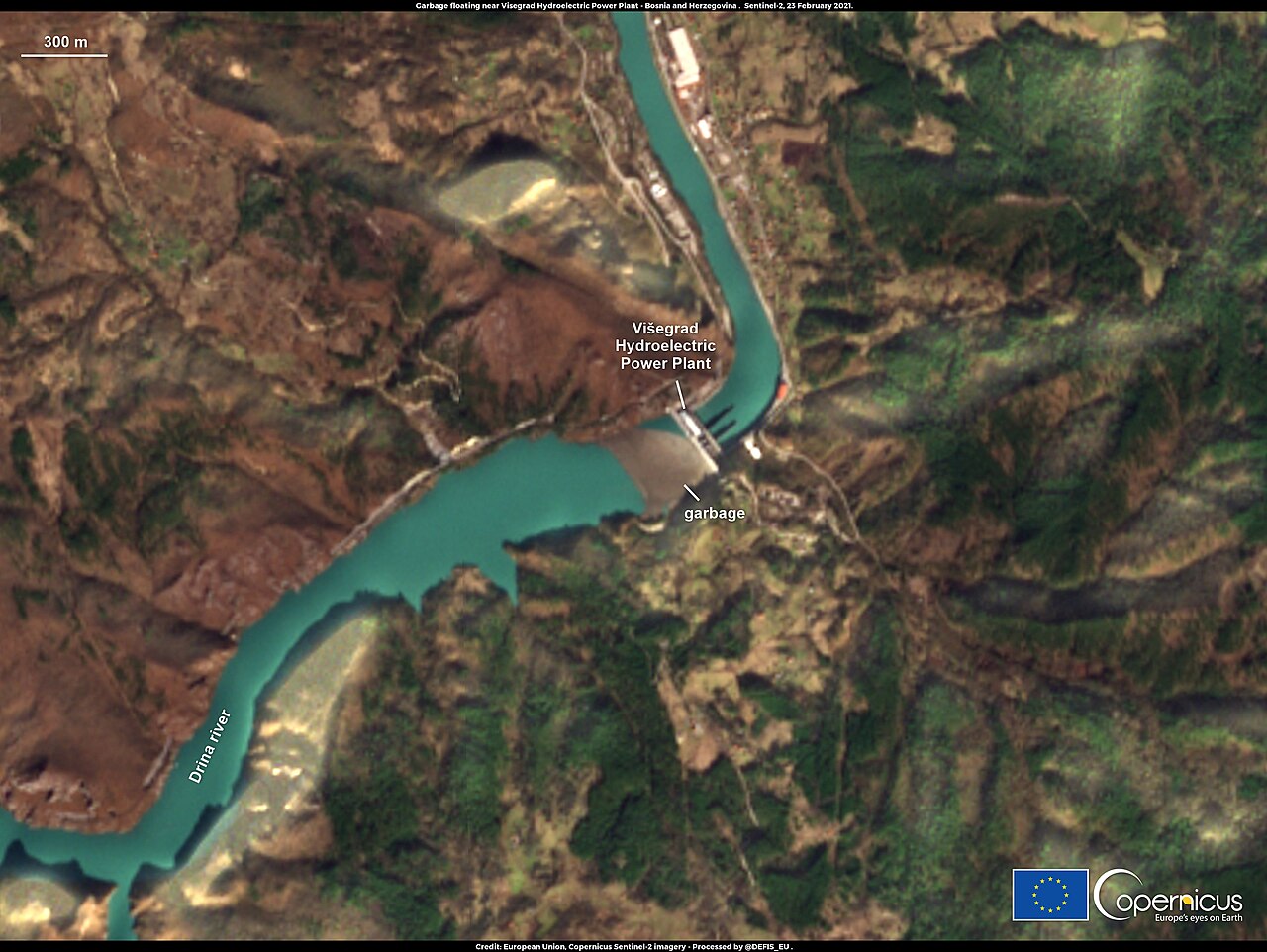
English: This image, acquired by one of the Copernicus Sentinel-2 satellites on 23 February 2020, shows a floating island of trash blocked by a barrier just before the dam of the Višegrad Hydroelectric Power Plant in Bosnia and Herzegovina. Due to the severe weather that affected this region of Europe in the past months, the Drina River had swept up tens of thousands of cubic metres of waste from illegal landfill sites that skirt it and its tributaries in Serbia and Montenegro, including plastic bottles, rusty barrels, used tyres, old furniture and other rubbish. Despite the ongoing efforts of the authorities to curtail the environmental damage and the possible negative effect to the operation of the power plant, this floating island has already broken through two protective barriers constructed to detain it. According to Darko Frganja, Head of the Environmental Protection Department of the Višegrad Hydroelectric Power Plant, a new working unit has been formed to manage the clean-up operations. Local environmental activists warn that the entire local ecosystem is in danger due to the microplastics and toxins that end up in the food chain once they are released from the waste. The open data provided by the Copernicus Sentinel missions offer important information that can be used to determine the status of river ecosystems. |
| Date | Taken on 23 February 2020 |
| Source | Floating island of garbage in the Drina River, Bosnia and Herzegovina |
| Author | European Union, Copernicus Sentinel-2 imagery |
Licensing[edit]

|
This image contains data from a satellite in the Copernicus Programme, such as Sentinel-1, Sentinel-2 or Sentinel-3. Attribution is required when using this image.
Attribution: Contains modified Copernicus Sentinel data 2020
The use of Copernicus Sentinel Data is regulated under EU law (Commission Delegated Regulation (EU) No 1159/2013 and Regulation (EU) No 377/2014). Relevant excerpts:
Free access shall be given to GMES dedicated data [...] made available through GMES dissemination platforms [...].
Access to GMES dedicated data [...] shall be given for the purpose of the following use in so far as it is lawful:
GMES dedicated data [...] may be used worldwide without limitations in time.
GMES dedicated data and GMES service information are provided to users without any express or implied warranty, including as regards quality and suitability for any purpose. |
File history
Click on a date/time to view the file as it appeared at that time.
| Date/Time | Thumbnail | Dimensions | User | Comment | |
|---|---|---|---|---|---|
| current | 08:27, 27 August 2023 | | 3,380 × 2,540 (1.41 MB) | OptimusPrimeBot (talk | contribs) | #Spacemedia - Upload of https://www.copernicus.eu/system/files/2021-03/image_day/IslandsOfWaste.jpg via Commons:Spacemedia |
You cannot overwrite this file.
File usage on Commons
There are no pages that use this file.