File:Floods in Vietnam.jpg

Original file (3,535 × 2,567 pixels, file size: 5.28 MB, MIME type: image/jpeg)
Captions
Captions
Summary[edit]
| Description |
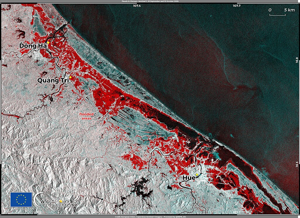
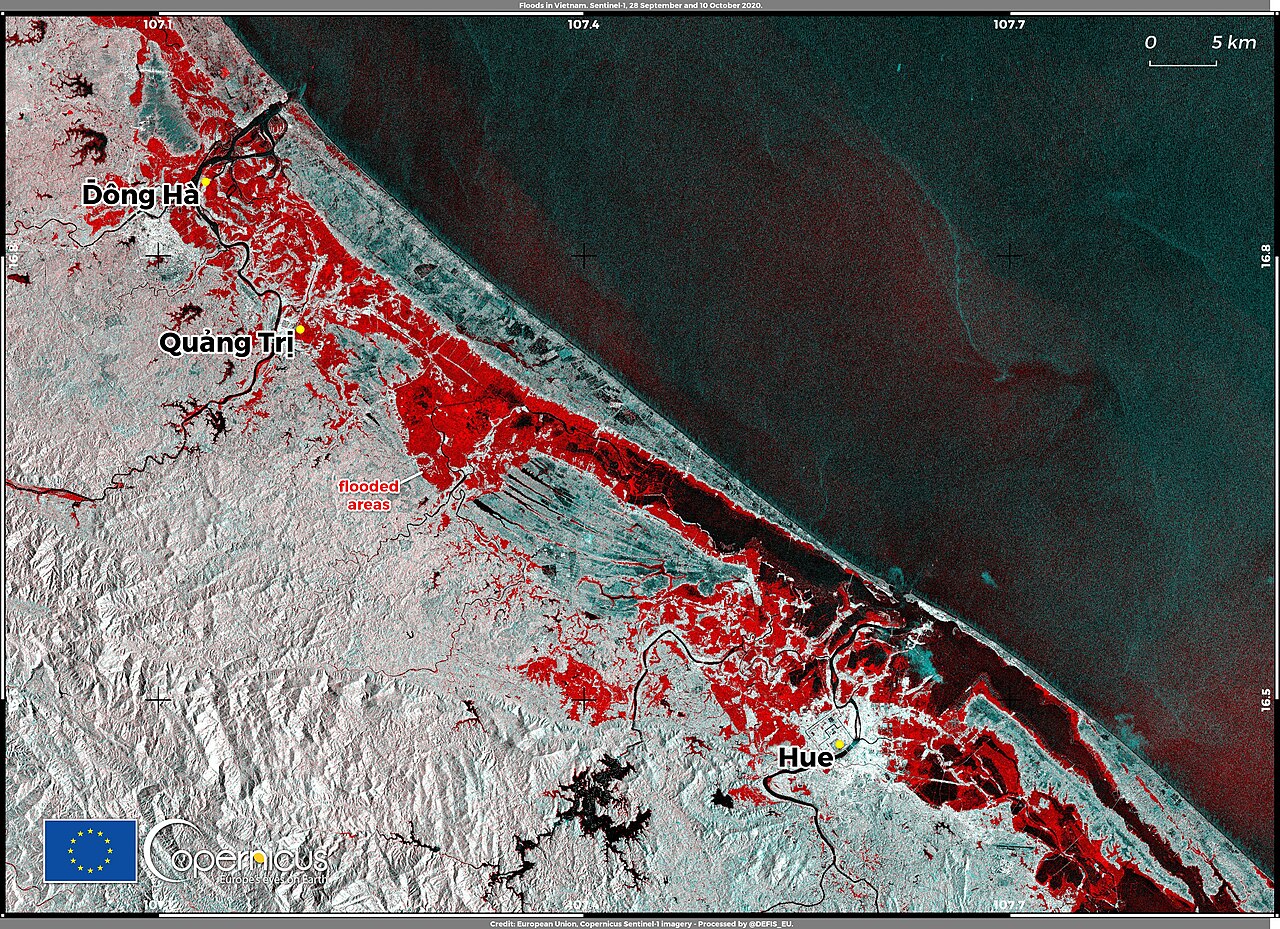
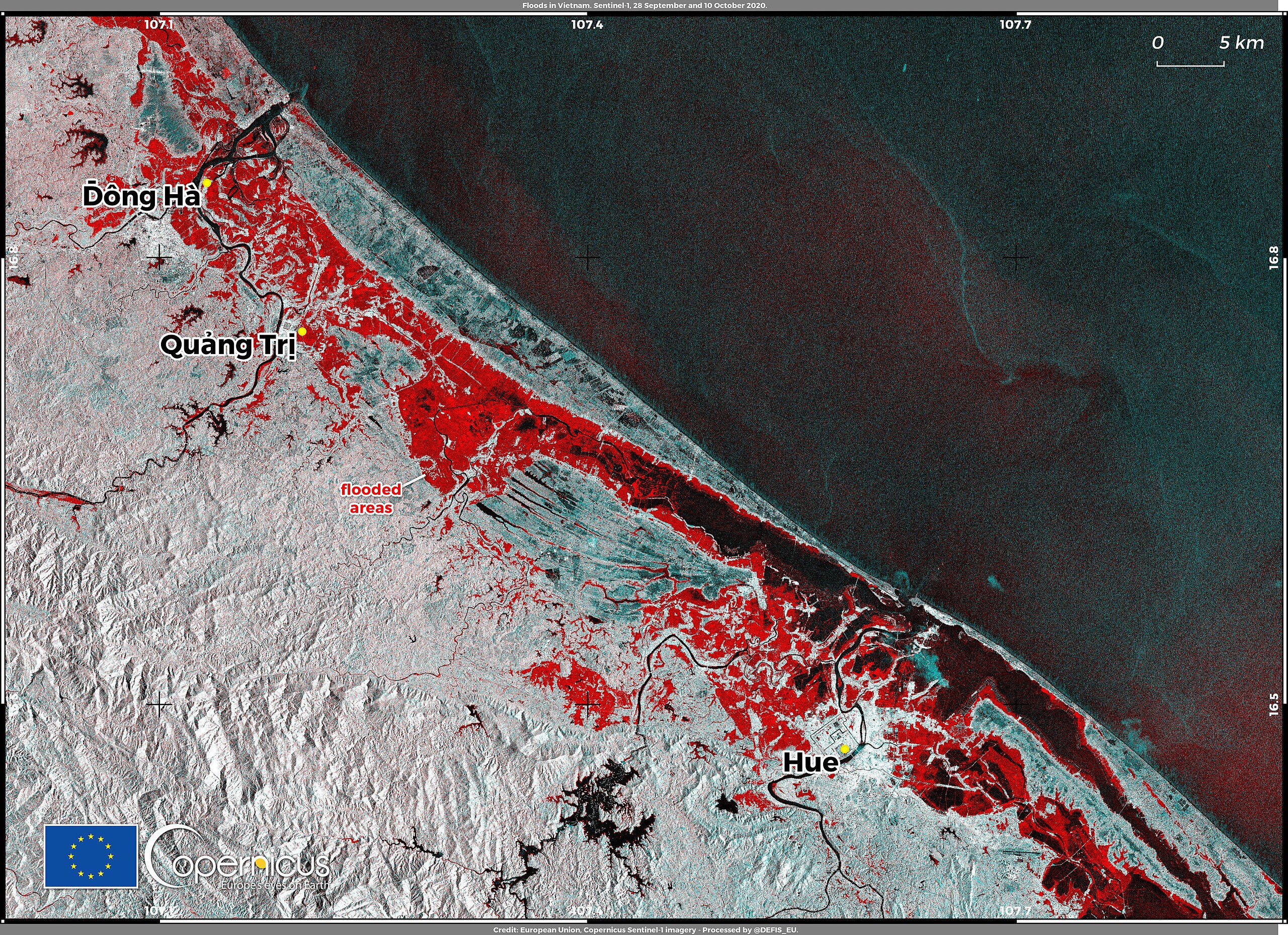
English: October 2020 brought torrential rains to central Vietnam that have triggered floods and landslides. Many areas of the provinces of Quang Binh, Quang Tri, Thua Thien-Hue, and Da Nang were submerged as a result of these floods. According to media reports, local authorities have had to evacuate more than 46,000 residents from affected areas and at least 18 people have died as a consequence of the floods. The Copernicus Emergency Management Service Rapid Mapping component was activated on 7 October (EMSR469) to monitor the floods in 11 Area of Interest with delineation maps derived from Very High Resolution satellite data. This image, obtained by combining Copernicus Sentinel-1 radar satellite images that were acquired on 28 September and on 10 October 2020, shows the flooded zones around the city of Hue in red. Data obtained by the radar on board Copernicus Sentinel-1 satellites allow us to monitor flooded zones when data acquired by optical satellites are not available due to cloud coverage. |
| Date | 13 October 2020 (upload date) |
| Source | Floods in Vietnam |
| Author | European Union , Copernicus Sentinel-1 imagery |
Licensing[edit]

|
This image contains data from a satellite in the Copernicus Programme, such as Sentinel-1, Sentinel-2 or Sentinel-3. Attribution is required when using this image.
Attribution: Contains modified Copernicus Sentinel data 2020
The use of Copernicus Sentinel Data is regulated under EU law (Commission Delegated Regulation (EU) No 1159/2013 and Regulation (EU) No 377/2014). Relevant excerpts:
Free access shall be given to GMES dedicated data [...] made available through GMES dissemination platforms [...].
Access to GMES dedicated data [...] shall be given for the purpose of the following use in so far as it is lawful:
GMES dedicated data [...] may be used worldwide without limitations in time.
GMES dedicated data and GMES service information are provided to users without any express or implied warranty, including as regards quality and suitability for any purpose. |
File history
Click on a date/time to view the file as it appeared at that time.
| Date/Time | Thumbnail | Dimensions | User | Comment | |
|---|---|---|---|---|---|
| current | 11:42, 8 August 2023 | | 3,535 × 2,567 (5.28 MB) | OptimusPrimeBot (talk | contribs) | #Spacemedia - Upload of https://www.copernicus.eu/system/files/2020-10/image_day/Vietnam_credit_row_logo.jpg via Commons:Spacemedia |
You cannot overwrite this file.
File usage on Commons
There are no pages that use this file.