File:Francafrique map.png
Jump to navigation
Jump to search

Size of this preview: 800 × 579 pixels. Other resolutions: 320 × 231 pixels | 640 × 463 pixels | 1,024 × 741 pixels | 1,280 × 926 pixels | 2,560 × 1,852 pixels | 4,463 × 3,228 pixels.
Original file (4,463 × 3,228 pixels, file size: 5.3 MB, MIME type: image/png)
Captions
Captions
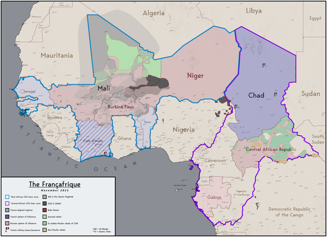
Map of the Francafrique
Summary[edit]
| Description |
English: Map of the French and Russian spheres of influence in west Africa |
| Date | |
| Source | Own work |
| Author | Abdurrahman AbdulMoneim |
Licensing[edit]
I, the copyright holder of this work, hereby publish it under the following license:
This file is licensed under the Creative Commons Attribution-Share Alike 4.0 International license.
- You are free:
- to share – to copy, distribute and transmit the work
- to remix – to adapt the work
- Under the following conditions:
- attribution – You must give appropriate credit, provide a link to the license, and indicate if changes were made. You may do so in any reasonable manner, but not in any way that suggests the licensor endorses you or your use.
- share alike – If you remix, transform, or build upon the material, you must distribute your contributions under the same or compatible license as the original.
File history
Click on a date/time to view the file as it appeared at that time.
| Date/Time | Thumbnail | Dimensions | User | Comment | |
|---|---|---|---|---|---|
| current | 20:30, 15 November 2023 | | 4,463 × 3,228 (5.3 MB) | Userd898 (talk | contribs) | correct version for november |
| 20:16, 15 November 2023 |  | 4,463 × 3,228 (5.33 MB) | Userd898 (talk | contribs) | updated for november of 2023 | |
| 14:04, 22 June 2023 |  | 4,463 × 3,228 (5.32 MB) | Userd898 (talk | contribs) | Uploaded own work with UploadWizard |
You cannot overwrite this file.
File usage on Commons
The following page uses this file:
File usage on other wikis
The following other wikis use this file:
- Usage on en.wikipedia.org
- Usage on pl.wikipedia.org
Metadata
Categories:
- CFA franc
- Maps of West Africa
- Relations of Africa and France
- Russian imperialism
- Islamic State of Iraq and the Levant
- Central African Republic Civil War (2012–present)
- Maps of Northern Mali conflict (2012-)
- Current civil wars maps
- Maps of the Central African Republic Civil War (2012–present)
- Maps of ongoing armed conflicts in Africa