File:France location map-Regions-2015 (numbered).svg
Jump to navigation
Jump to search

Size of this PNG preview of this SVG file: 512 × 492 pixels. Other resolutions: 250 × 240 pixels | 500 × 480 pixels | 799 × 768 pixels | 1,066 × 1,024 pixels | 2,131 × 2,048 pixels.
Original file (SVG file, nominally 512 × 492 pixels, file size: 457 KB)
Captions
Captions
Add a one-line explanation of what this file represents
Summary[edit]
| Description |
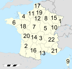
English: Administrative map of France with numbered regions. |
||||
| Date | & 2020-10 | ||||
| Source | Own work based on: France location map-Regions-2015.svg by Sting | ||||
| Author | Eric Gaba (Sting - Sting), derivative work by GeMet | ||||
| Permission (Reusing this file) |
This file is licensed under the Creative Commons Attribution-Share Alike 4.0 International, 3.0 Unported, 2.5 Generic, 2.0 Generic and 1.0 Generic license.
You may select the license of your choice. |
||||
| Other versions |
|
||||
| SVG development |


.svg&action=edit§ion=1)
File history
Click on a date/time to view the file as it appeared at that time.
| Date/Time | Thumbnail | Dimensions | User | Comment | |
|---|---|---|---|---|---|
| current | 02:54, 8 October 2020 | | 512 × 492 (457 KB) | GeMet (talk | contribs) | border fix |
| 02:43, 8 October 2020 |  | 512 × 492 (457 KB) | GeMet (talk | contribs) | == {{int:filedesc}} == {{Information |Description={{en|Administrative map of France with numbered regions.}} |Source={{Own based|France location map-Regions-2015.svg|by=Sting}} |Date=2008-07 & 2020-10 |Author=Eric Gaba ({{U|Sting}} - {{U|Sting||fr}}), derivative work by {{u|GeMet}} |Permission= {{User:Sting/Credits|type=map}} {{self|author=Eric Gaba ({{U|Sting}} - {{U|Sting||fr}}) & {{u|GeMet}}|GFDL|cc-by-sa-all}} |Other versions= <gallery> France location map-Regions-2015.svg... |
You cannot overwrite this file.
File usage on Commons
The following 2 pages use this file:
File usage on other wikis
The following other wikis use this file:
- Usage on sv.wikipedia.org
- Usage on tr.wikipedia.org
- Usage on www.wikidata.org
.svg&oldid=483978761)