File:Frankfurt, J & C Blaeu c 1640.jpg
Jump to navigation
Jump to search

Size of this preview: 720 × 600 pixels. Other resolutions: 288 × 240 pixels | 577 × 480 pixels | 922 × 768 pixels | 1,230 × 1,024 pixels | 2,460 × 2,048 pixels | 5,976 × 4,976 pixels.
Original file (5,976 × 4,976 pixels, file size: 10.42 MB, MIME type: image/jpeg)
Captions
Captions
Add a one-line explanation of what this file represents
Summary[edit]
| Description |
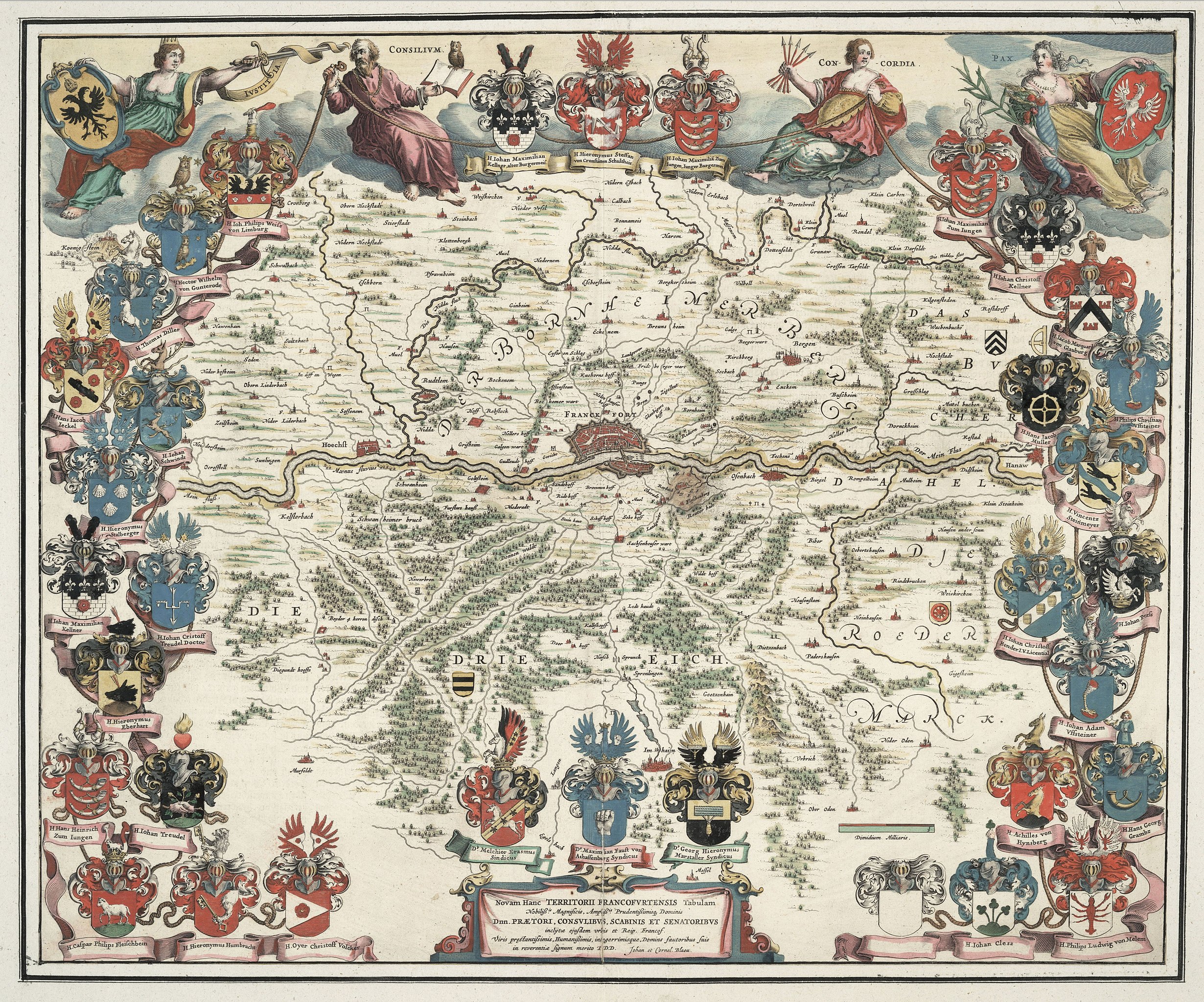
English: Map of the territory of the Free Imperial City of Frankfurt and surrounding area in the mid 17th century. The map also shows the coat of arms of the city's ruling magistrates: burgermeisters, consuls, aldermen and senators. The map titled Territorii Francofvrtensis, etc. was published by Joan and Cornelius Blaeu c. 1640. |
| Date | circa 1640 |
| Source | https://langen.ykom.de/serverlocal/diys_static/hessen_slub.html |
| Author | Joan and Cornelius Blaeu |
Licensing[edit]
|
This work is in the public domain in its country of origin and other countries and areas where the copyright term is the author's life plus 100 years or fewer. | |
| This file has been identified as being free of known restrictions under copyright law, including all related and neighboring rights. | |
File history
Click on a date/time to view the file as it appeared at that time.
| Date/Time | Thumbnail | Dimensions | User | Comment | |
|---|---|---|---|---|---|
| current | 12:13, 20 August 2018 | | 5,976 × 4,976 (10.42 MB) | Lubiesque (talk | contribs) | User created page with UploadWizard |
You cannot overwrite this file.
File usage on Commons
There are no pages that use this file.