File:Geopark Stamberk.jpeg
Jump to navigation
Jump to search

Size of this preview: 600 × 600 pixels. Other resolutions: 240 × 240 pixels | 480 × 480 pixels | 768 × 768 pixels | 1,024 × 1,024 pixels | 2,048 × 2,048 pixels | 2,800 × 2,800 pixels.
Original file (2,800 × 2,800 pixels, file size: 2.1 MB, MIME type: image/jpeg)
Captions
Captions
Add a one-line explanation of what this file represents
Summary[edit]
| Description |
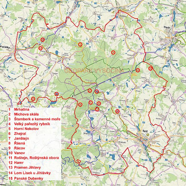
English: Map of Geopark Štamberk, located in the South-west Highlands near Telč
Čeština: Mapa Geoparku Štamberk na jihozápadní Vysočině u Telče |
| Date | |
| Source | Geopark Štamberk |
| Author | Geopark Štamberk |
Licensing[edit]
I, the copyright holder of this work, hereby publish it under the following license:
| This file is made available under the Creative Commons CC0 1.0 Universal Public Domain Dedication. | |
| The person who associated a work with this deed has dedicated the work to the public domain by waiving all of their rights to the work worldwide under copyright law, including all related and neighboring rights, to the extent allowed by law. You can copy, modify, distribute and perform the work, even for commercial purposes, all without asking permission.
|
File history
Click on a date/time to view the file as it appeared at that time.
| Date/Time | Thumbnail | Dimensions | User | Comment | |
|---|---|---|---|---|---|
| current | 11:49, 20 February 2017 | | 2,800 × 2,800 (2.1 MB) | Osidor (talk | contribs) | Better version |
| 18:22, 14 February 2017 |  | 1,680 × 1,680 (1.06 MB) | Osidor (talk | contribs) | {{Information |Description ={{en|1=Map of Geopark Stamberk}} {{cs|1=Mapa Geoparku Štamberk}} |Source =Geopark Štamberk |Author =Geopark Štamberk |Date =28.1.2017 |Permission = |other_versions = }} |
You cannot overwrite this file.
File usage on Commons
The following page uses this file:
File usage on other wikis
The following other wikis use this file:
- Usage on cs.wikipedia.org
- Usage on www.wikidata.org