File:German East Africa.png
Jump to navigation
Jump to search
No higher resolution available.
German_East_Africa.png (303 × 341 pixels, file size: 7 KB, MIME type: image/png)
Captions
Captions
Add a one-line explanation of what this file represents
Summary
[edit]
| Description |
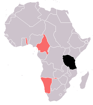
English: German East Africa (black), with other German colonies in red
Based on :Image:BlankMap-World-WWI.PNG |
| Date | 7 December 2006 (original upload date) |
| Source | Transferred from en.wikipedia to Commons by Shizhao using CommonsHelper. |
| Author | The original uploader was 52 Pickup at English Wikipedia. |
Licensing
[edit]
| This map is ineligible for copyright and therefore in the public domain, because it consists entirely of information that is common property and contains no original authorship. For more information, see Commons:Threshold of originality § Maps.
|
File history
Click on a date/time to view the file as it appeared at that time.
| Date/Time | Thumbnail | Dimensions | User | Comment | |
|---|---|---|---|---|---|
| current | 21:33, 15 July 2023 | | 303 × 341 (7 KB) | Randomastwritter (talk | contribs) | added dervish state |
| 03:18, 5 May 2009 |  | 303 × 341 (5 KB) | File Upload Bot (Magnus Manske) (talk | contribs) | {{BotMoveToCommons|en.wikipedia|year={{subst:CURRENTYEAR}}|month={{subst:CURRENTMONTHNAME}}|day={{subst:CURRENTDAY}}}} {{Information |Description={{en|en:German East Africa (black), with other German colonies in red Based on [[:en::Image:BlankMap- |
You cannot overwrite this file.
File usage on Commons
The following page uses this file: