File:Godley River (aerial photo).jpg
Jump to navigation
Jump to search

Size of this preview: 800 × 500 pixels. Other resolutions: 320 × 200 pixels | 640 × 400 pixels | 1,024 × 640 pixels | 1,280 × 800 pixels | 2,560 × 1,600 pixels | 4,096 × 2,560 pixels.
Original file (4,096 × 2,560 pixels, file size: 2.49 MB, MIME type: image/jpeg)
Captions
Captions
Add a one-line explanation of what this file represents
Summary[edit]
.jpg&action=edit§ion=1)
| Description |
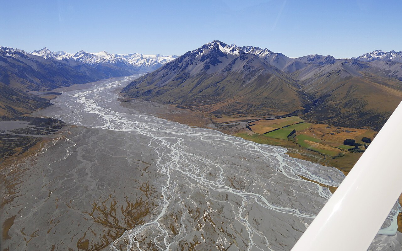
English: Godley River, Mackenzie District, Canterbury Region, South Island, New Zealand (aerial photo, view from Lake Tekapo to north; Mount Errebus 2311 m, Sibbald Range in the middle of the photo) |
| Date | |
| Source | Own work |
| Author | Ulrich Lange, Bochum, Germany |
| Annotations | This image is annotated: View the annotations at Commons |
.jpg)
| Camera location | | View this and other nearby images on: OpenStreetMap |
|---|
.jpg¶ms=-43.722081_N_0170.534647_E_globe:Earth_type:camera_region:NZ-CAN_&language=en)
Licensing[edit]
.jpg&action=edit§ion=2)
I, the copyright holder of this work, hereby publish it under the following license:
This file is licensed under the Creative Commons Attribution-Share Alike 4.0 International license.
- You are free:
- to share – to copy, distribute and transmit the work
- to remix – to adapt the work
- Under the following conditions:
- attribution – You must give appropriate credit, provide a link to the license, and indicate if changes were made. You may do so in any reasonable manner, but not in any way that suggests the licensor endorses you or your use.
- share alike – If you remix, transform, or build upon the material, you must distribute your contributions under the same or compatible license as the original.
File history
Click on a date/time to view the file as it appeared at that time.
| Date/Time | Thumbnail | Dimensions | User | Comment | |
|---|---|---|---|---|---|
| current | 13:52, 29 January 2020 | | 4,096 × 2,560 (2.49 MB) | Ulanwp (talk | contribs) | Bigger size |
| 04:40, 19 February 2017 |  | 2,048 × 1,229 (380 KB) | Ulanwp (talk | contribs) | {{Information |Description ={{en|1=Godley River, Mackenzie District, Canterbury Region, South Island, New Zealand (aerial photo, view from Lake Tekapo to north; Mount Errebus 2311 m, Sibbald Range in the middle of the photo)}} |Source ={{own... |
You cannot overwrite this file.
File usage on Commons
The following 3 pages use this file:
File usage on other wikis
The following other wikis use this file:
- Usage on arz.wikipedia.org
- Usage on ceb.wikipedia.org
- Usage on de.wikipedia.org
- Usage on en.wikipedia.org
- Usage on fr.wikipedia.org
- Usage on www.wikidata.org
- Usage on zh.wikipedia.org
.jpg&oldid=667168466)