File:Golan Heights Wind Farm.jpg
Jump to navigation
Jump to search
Size of this preview: 800 × 594 pixels. Other resolutions: 320 × 238 pixels | 640 × 475 pixels | 1,024 × 760 pixels | 1,280 × 950 pixels | 2,560 × 1,901 pixels | 3,587 × 2,663 pixels.
Original file (3,587 × 2,663 pixels, file size: 6.38 MB, MIME type: image/jpeg)
Captions
Captions
Add a one-line explanation of what this file represents
Summary[edit]
| Description |
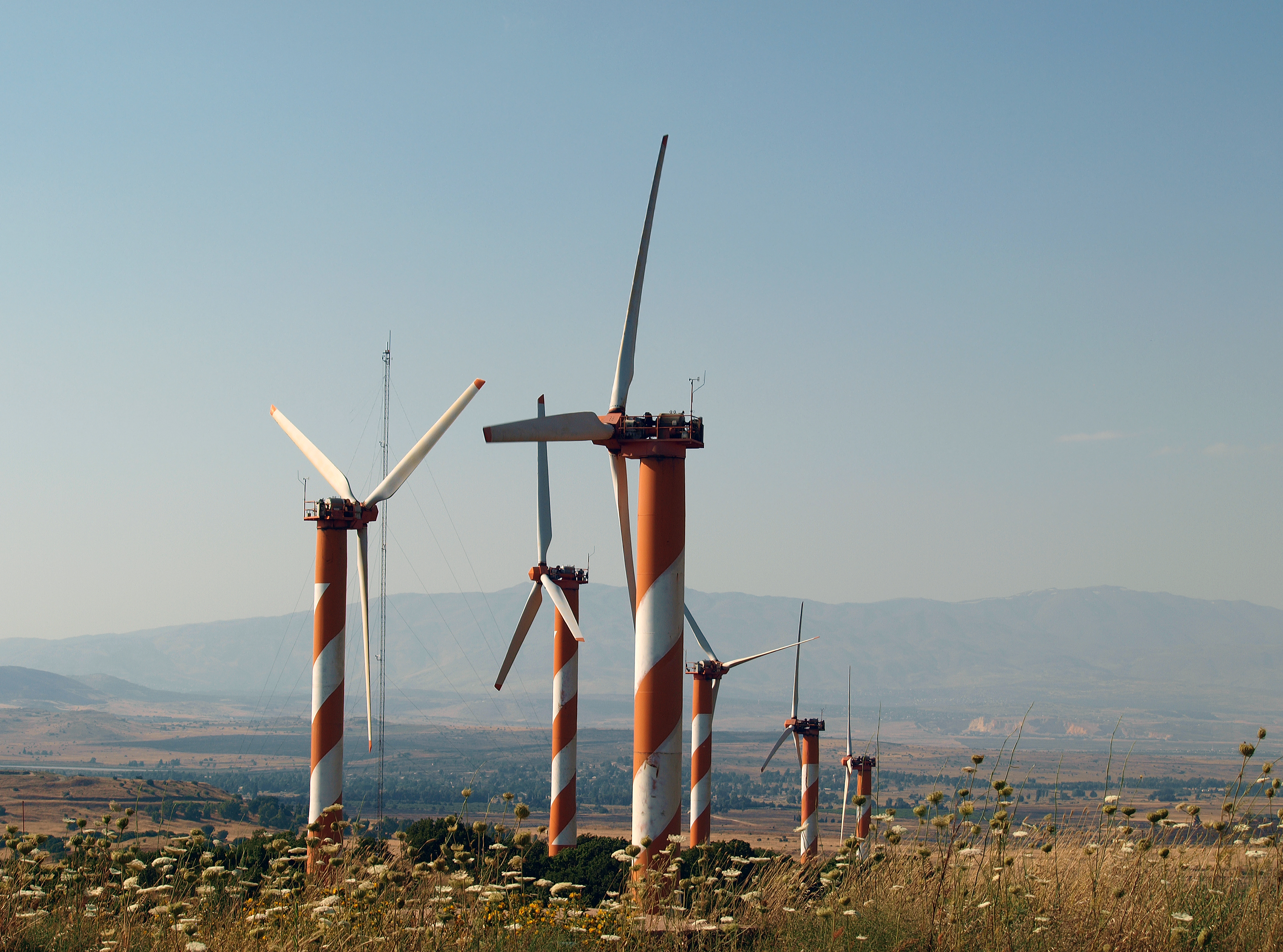
English: Bnei Rasan (wind farm) Čeština: Bnej Rasan (větrná farma) Русский: Бней-Расан (Ветряная электростанция) עברית: חוות הרוח בהר בני רסן Français : Bney Rasan (parc éolien) Deutsch: Bney Rasan (Windpark) Español: Bney Rasan (parques eólicos) |
| Date | |
| Source | Own work |
| Author | Staselnik |
| Camera location | | View this and other nearby images on: OpenStreetMap |
|---|
Licensing[edit]
I, the copyright holder of this work, hereby publish it under the following license:
This file is licensed under the Creative Commons Attribution-Share Alike 3.0 Unported license.
- You are free:
- to share – to copy, distribute and transmit the work
- to remix – to adapt the work
- Under the following conditions:
- attribution – You must give appropriate credit, provide a link to the license, and indicate if changes were made. You may do so in any reasonable manner, but not in any way that suggests the licensor endorses you or your use.
- share alike – If you remix, transform, or build upon the material, you must distribute your contributions under the same or compatible license as the original.
This image has been assessed using the Quality image guidelines and is considered a Quality image.
|

|
This image has been assessed under the valued image criteria and is considered the most valued image on Commons within the scope: Golan Heights Wind Farm. View from the mountain Har Bnei Rasan.. You can see its nomination here. |
File history
Click on a date/time to view the file as it appeared at that time.
| Date/Time | Thumbnail | Dimensions | User | Comment | |
|---|---|---|---|---|---|
| current | 21:39, 13 August 2013 | | 3,587 × 2,663 (6.38 MB) | Staselnik (talk | contribs) | User created page with UploadWizard |
You cannot overwrite this file.
File usage on Commons
The following 8 pages use this file:
- User talk:Staselnik
- Commons:Quality images/Subject/Architecture/Towers and Masts/Archive
- Commons:Quality images candidates/Archives December 14 2013
- Commons:Valued image candidates/Golan Heights Wind Farm.jpg
- Commons:Valued images by topic/Objects/Industrial
- File:Har Bnei Rasan 07.jpg
- Category:Golan Heights Wind Farm
- Category:Views from Golan Heights Wind Farm
File usage on other wikis
The following other wikis use this file:
- Usage on fr.wikipedia.org
- Usage on ru.wikipedia.org
- Usage on www.wikidata.org