File:Granborough Rd - geograph-4404135-by-Robin-Webster.jpg
Jump to navigation
Jump to search
No higher resolution available.
Granborough_Rd_-_geograph-4404135-by-Robin-Webster.jpg (640 × 480 pixels, file size: 126 KB, MIME type: image/jpeg)
Captions
Captions
Add a one-line explanation of what this file represents
Summary[edit]
| Description |
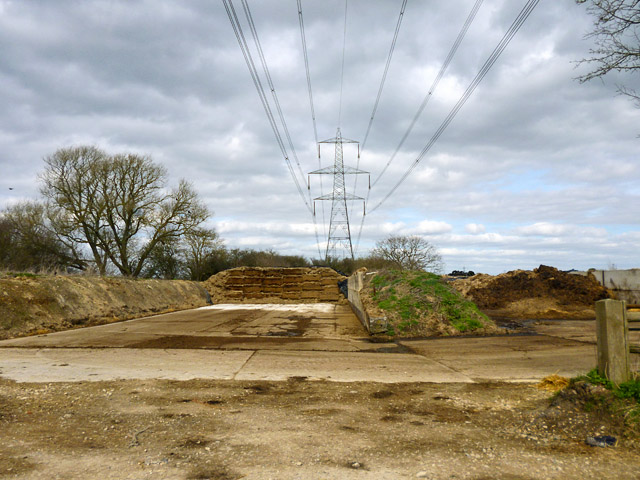
English: Site of Granborough Road station Both the agricultural area and the pylon are built exactly on the course of the line from Quainton Road to Verney Junction. This was taken over by the Metropolitan Railway in 1891 and closed for passengers in 1936 when London Transport came into being. |
| Date | |
| Source | From geograph.org.uk |
| Author | Robin Webster |
| Permission (Reusing this file) |
Creative Commons Attribution Share-alike license 2.0 |
| Attribution (required by the license) | Robin Webster / Site of Granborough Road station / |
| Camera location | | View this and other nearby images on: OpenStreetMap |
|---|
_heading:22.00&language=en)
| Object location | | View this and other nearby images on: OpenStreetMap |
|---|
_heading:22.00&language=en)
Licensing[edit]

|
This image was taken from the Geograph project collection. See this photograph's page on the Geograph website for the photographer's contact details. The copyright on this image is owned by Robin Webster and is licensed for reuse under the Creative Commons Attribution-ShareAlike 2.0 license.
|
This file is licensed under the Creative Commons Attribution-Share Alike 2.0 Generic license.
Attribution: Robin Webster
- You are free:
- to share – to copy, distribute and transmit the work
- to remix – to adapt the work
- Under the following conditions:
- attribution – You must give appropriate credit, provide a link to the license, and indicate if changes were made. You may do so in any reasonable manner, but not in any way that suggests the licensor endorses you or your use.
- share alike – If you remix, transform, or build upon the material, you must distribute your contributions under the same or compatible license as the original.
File history
Click on a date/time to view the file as it appeared at that time.
| Date/Time | Thumbnail | Dimensions | User | Comment | |
|---|---|---|---|---|---|
| current | 19:56, 1 December 2020 | | 640 × 480 (126 KB) | Lamberhurst (talk | contribs) | == {{int:filedesc}} == {{Information |Description={{en|1=<b>Site of Granborough Road station</b><br>Both the agricultural area and the pylon are built exactly on the course of the line from Quainton Road to Verney Junction. This was taken over by the Metropolitan Railway in 1891 and closed for passengers in 1936 when London Transport came into being.}} |Source=From [https://www.geograph.org.uk/photo/4404135 geograph.org.uk] |Date=2015-03-27 |Author=[https://www.geograph.org.uk/profile/9905 Ro... |
You cannot overwrite this file.
File usage on Commons
The following page uses this file:
File usage on other wikis
The following other wikis use this file:
- Usage on en.wikipedia.org