File:Gravelly Hill Interchange OpenStreetMap.png
Jump to navigation
Jump to search
Size of this preview: 800 × 537 pixels. Other resolutions: 320 × 215 pixels | 640 × 429 pixels | 1,024 × 687 pixels | 1,280 × 859 pixels | 1,619 × 1,086 pixels.
Original file (1,619 × 1,086 pixels, file size: 986 KB, MIME type: image/png)
Captions
Captions
Add a one-line explanation of what this file represents
| Description |
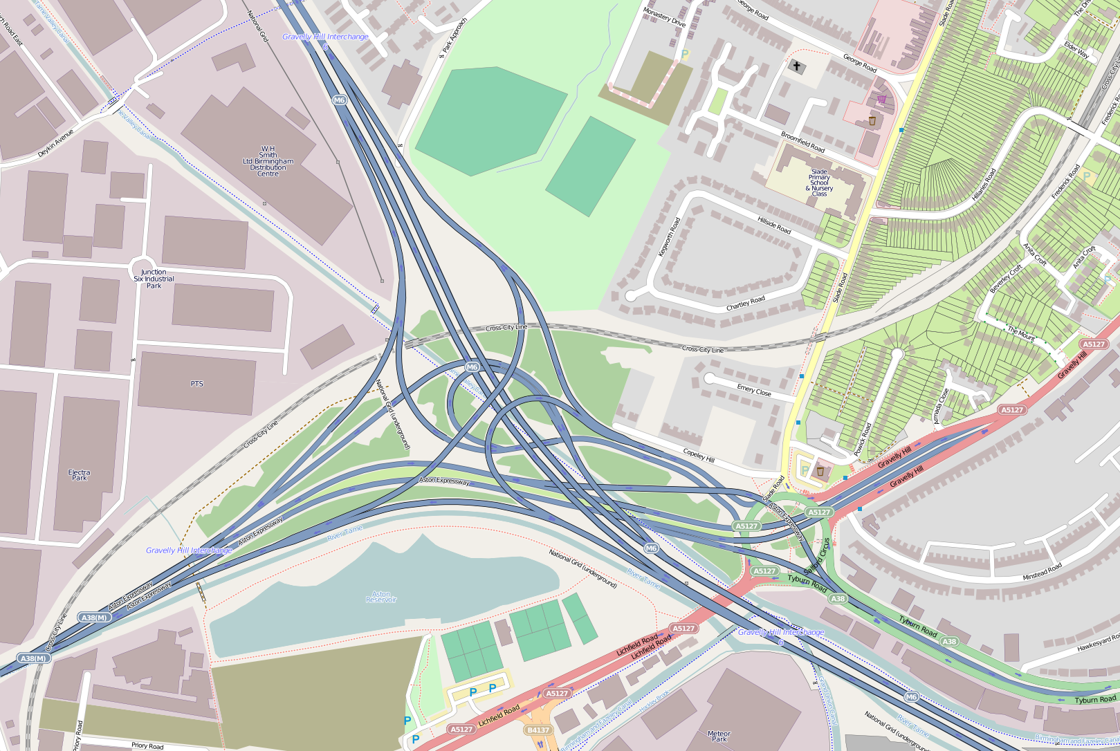
Map of Gravelly Hill Interchange in Birmingham, Great Britain This map of Birmingham was created from OpenStreetMap project data, collected by the community. This map may be incomplete, and may contain errors. Don't rely solely on it for navigation. |
|||||||||
| Date | ||||||||||
| Source | You may find a page on the OpenStreetMap wiki page for Gravelly Hill Interchange | |||||||||
| Creator |
OpenStreetMap contributors |
|||||||||
| Permission (Reusing this file) |
OpenStreetMap data is available under the Open Database License (details). Map tiles are licensed under the Creative Commons Attribution-ShareAlike 2.0 license (CC-BY-SA 2.0).
This file is licensed under the Creative Commons Attribution-Share Alike 2.0 Generic license.
|
|||||||||
| Geotemporal data | ||||||||||
| Bounding box |
|
|||||||||
| Georeferencing | If inappropriate please set warp_status = skip to hide. | |||||||||
| Other versions | OSM knooppunt Birmingham - spaghetti junction.png by User:Leo de Beo | |||||||||
File history
Click on a date/time to view the file as it appeared at that time.
| Date/Time | Thumbnail | Dimensions | User | Comment | |
|---|---|---|---|---|---|
| current | 02:40, 19 June 2013 | | 1,619 × 1,086 (986 KB) | Miko101 (talk | contribs) | {{OpenStreetMap | name = Gravelly Hill Interchange | location = Birmingham | description = Map of Gravelly Hill Interchange in Birmingham, Great Britain | top = 52.51575 | bottom = 52.50699 | left = -1.87... |
You cannot overwrite this file.
File usage on Commons
There are no pages that use this file.
File usage on other wikis
The following other wikis use this file:
- Usage on en.wikipedia.org