File:Hamburg Hafen Quantum of the Seas Dock 17 7248 Torsten Baetge.JPG
Jump to navigation
Jump to search

Size of this preview: 800 × 533 pixels. Other resolutions: 320 × 213 pixels | 640 × 427 pixels | 1,024 × 683 pixels | 1,280 × 853 pixels | 3,000 × 2,000 pixels.
Original file (3,000 × 2,000 pixels, file size: 1.35 MB, MIME type: image/jpeg)
Captions
Captions
Add a one-line explanation of what this file represents
Summary[edit]
| Description |
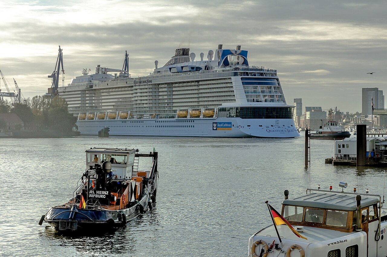
Deutsch: Die Quantum of the Seas (IMO 9549463) wird in Hamburg bei Blohm + Voss in das Trockendock Elbe 17 eingedockt. Die Quantum of the Seas ist ein Kreuzfahrtschiff der Reederei Royal Caribbean International und das Typschiff der Quantum-Klasse. Sie ist mit einer Länge von 348 m, Breite von 41,4 m, einem Tiefgang von bis zu 8,5 m und einer Vermessung von 167.800 BRZ das bislang größte in Deutschland gebaute Kreuzfahrtschiff. Es bietet Platz für 4180 Passagiere. Die Quantum of the Seas wurde von Januar 2013 bis September 2014 auf der Meyer Werft in Papenburg gebaut. Im Anschluss an Probefahrten in der Nordsee sollen in Hamburg Restarbeiten durchgeführt werden. English: The Quantum of the Seas (IMO 9549463) is docked in Hamburg near Blohm + Voss in the dry dock Elbe 17. The Quantum of the Seas is a cruise ship of the shipping company Royal Caribbean International and the type ship of the Quantum class. With a length of 348 m, a width of 41.4 m, a draught of up to 8.5 m and a survey of 167,800 BRZ, it is the largest cruise ship built in Germany to date. It can accommodate 4180 passengers. The Quantum of the Seas was built from January 2013 to September 2014 at Meyer Werft in Papenburg. Following test voyages in the North Sea, remaining work is to be carried out in Hamburg. |
| Date | |
| Source | Own work |
| Author | Torsten Bätge, Hamburg |
| Permission (Reusing this file) |
Deutsch: Die Nutzung außerhalb der Bedingungen der GNU-Lizenz für freie Dokumentation in der Originalfassung oder der deutschen Übersetzung von Hugo Giese jr. ist honorarpflichtig gemäß derzeit gültiger Broschüre Bildhonorare der Mittelstandsgemeinschaft Foto-Marketing (MFM-Liste). |
| Camera location | | View this and other nearby images on: OpenStreetMap |
|---|
Licensing[edit]

|
Permission is granted to copy, distribute and/or modify this document under the terms of the GNU Free Documentation License, Version 1.2 or any later version published by the Free Software Foundation; with no Invariant Sections, no Front-Cover Texts, and no Back-Cover Texts. A copy of the license is included in the section entitled GNU Free Documentation License. |
File history
Click on a date/time to view the file as it appeared at that time.
| Date/Time | Thumbnail | Dimensions | User | Comment | |
|---|---|---|---|---|---|
| current | 17:13, 23 August 2023 | | 3,000 × 2,000 (1.35 MB) | R8cocin8 (talk | contribs) | removed watermark and adjusted exposure |
| 23:29, 15 November 2014 |  | 3,000 × 2,000 (1.75 MB) | Torsten Bätge (talk | contribs) | Uploaded with LrMediaWiki 0.2.3 |
You cannot overwrite this file.
File usage on Commons
The following 2 pages use this file: