File:Hexenstühle ober Tiosels Kastelruth.jpg
Jump to navigation
Jump to search

Size of this preview: 800 × 534 pixels. Other resolutions: 320 × 214 pixels | 640 × 427 pixels | 1,024 × 683 pixels | 1,280 × 854 pixels | 2,560 × 1,709 pixels | 7,360 × 4,912 pixels.
Original file (7,360 × 4,912 pixels, file size: 28.26 MB, MIME type: image/jpeg)
Captions
Captions
Add a one-line explanation of what this file represents
Summary[edit]
| Description |
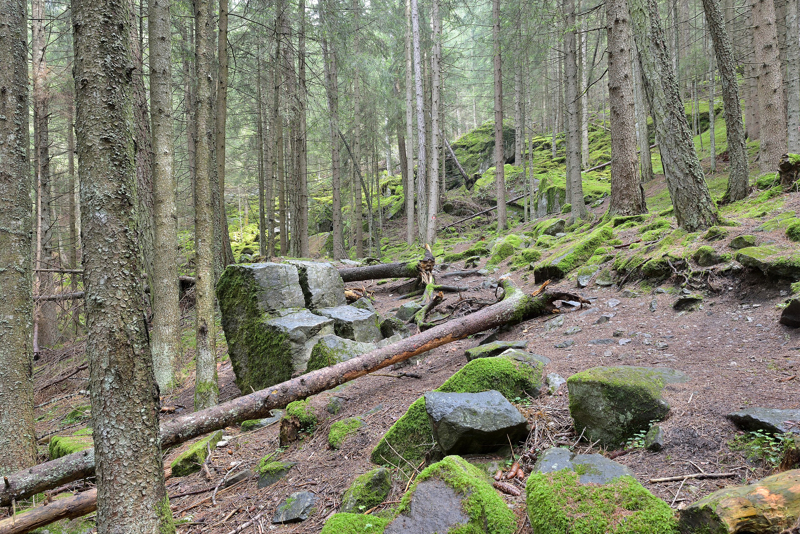
Deutsch: Hexenstühle ober Tiosels de:Kastelruth - Doppelsteinsitz mit Rückenlehnen (Augitporphyrsäulen).
Es handelt sich um einen auffällig gespaltenen Kalkstein in Sesselform. Der Doppelsteinsitz ist ca. 1 m hoch, weist schräge Sitzflächen auf und ist an Seiten- bzw. Rückenwand moosbewachsen. Diese höchst eigenartige Felsform gibt noch immer ungelöste Rätsel auf und bleibt einen Hinweis auf ihr Alter schuldig. Als sagenumwobene, früh- oder urgeschichliche Sehenswürdigkeit sind die Hexenstühle allgemein bekannt geworden.
English: Witches stools in Kastelruth.
Italiano: Hexenstühle sopra Tinoselles. Monumento naturale: geologico a Castelrotto. Doppio sedile con schienali (colonne di porfirite augitica).
Si tratta di una pietra calcarea notevolmente fessurata a forma di sedile. Il doppio sedile inclinato é alto ca. 1 m e le pareti laterali e dello schienale sono ricoperte di muschio. Questa singolare formazione costituisce ancora oggi un enigma irrisolto dall'etá incerta. Le "Hexenstühle" sono divenute ampiamente note citate in molte leggende e come antiche bellezze da ammirare
|
||||||
| Date | |||||||
| Source | Own work | ||||||
| Author |
|
||||||
| Permission (Reusing this file) |
Own work, attribution required (Multi-license with GFDL and Creative Commons CC-BY 2.5). Capture: Photo by Wolfgang Moroder |

| Object location | | View this and other nearby images on: OpenStreetMap |
|---|
Licensing[edit]
I, the copyright holder of this work, hereby publish it under the following license:
This file is licensed under the Creative Commons Attribution-Share Alike 3.0 Unported license.
- You are free:
- to share – to copy, distribute and transmit the work
- to remix – to adapt the work
- Under the following conditions:
- attribution – You must give appropriate credit, provide a link to the license, and indicate if changes were made. You may do so in any reasonable manner, but not in any way that suggests the licensor endorses you or your use.
- share alike – If you remix, transform, or build upon the material, you must distribute your contributions under the same or compatible license as the original.
This image has been assessed using the Quality image guidelines and is considered a Quality image.
|
File history
Click on a date/time to view the file as it appeared at that time.
| Date/Time | Thumbnail | Dimensions | User | Comment | |
|---|---|---|---|---|---|
| current | 22:08, 15 August 2015 | | 7,360 × 4,912 (28.26 MB) | Moroder (talk | contribs) | == {{int:filedesc}} == {{Information |Description= {{de|1=Eisloch beim Madrunglhof in St. Oswald de:Kastelruth}} {{en|1=Icehole in St. Oswald {{w|Kastelruth}}}} {{it|1=Buco di ghiaccio presso il maso Madrungl di S. Oswaldo Castelrotto}} {{Naturden... |
You cannot overwrite this file.
File usage on Commons
The following 5 pages use this file:
File usage on other wikis
The following other wikis use this file:
- Usage on de.wikipedia.org