File:Hibernia, Anglia vulgare Hirlandia vocatur - map of Ireland by John Goghe, 1567 (South-east detail).jpg
Jump to navigation
Jump to search

Size of this preview: 769 × 600 pixels. Other resolutions: 308 × 240 pixels | 615 × 480 pixels | 985 × 768 pixels | 1,280 × 999 pixels | 2,560 × 1,997 pixels | 3,625 × 2,828 pixels.
Original file (3,625 × 2,828 pixels, file size: 1.47 MB, MIME type: image/jpeg)
Captions
Captions
Add a one-line explanation of what this file represents
Summary[edit]
| Description |
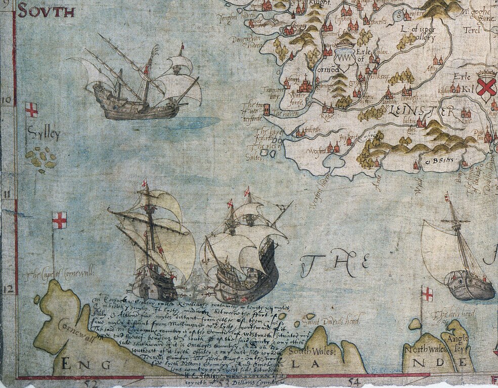
English: Map of Ireland from 1567. (National Archives: MPF 1/68. Formerly: State Papers (SP 64/1))
Ireland is shown as 'Hibernia' in this map by John Goghe with additions by Sir William Cecil. Showing place-names, hills in relief, ships, fish, and a sea monster. Scale: about 1 inch to 16 miles. The map was extracted from the State Papers (SP 64/1) to be preserved as a flat map. |
| Date | |
| Source | https://www.flickr.com/photos/nationalarchives/48429945321/ |
| Author | The National Archives UK |
| Other versions |

.jpg&action=edit§ion=1)
Licensing[edit]
.jpg&action=edit§ion=2)
This image was taken from Flickr's The Commons. The uploading organization may have various reasons for determining that no known copyright restrictions exist, such as:
More information can be found at https://flickr.com/commons/usage/. Please add additional copyright tags to this image if more specific information about copyright status can be determined. See Commons:Licensing for more information. |
File history
Click on a date/time to view the file as it appeared at that time.
| Date/Time | Thumbnail | Dimensions | User | Comment | |
|---|---|---|---|---|---|
| current | 06:40, 16 January 2022 | | 3,625 × 2,828 (1.47 MB) | GPinkerton (talk | contribs) | File:Hibernia, Anglia vulgare Hirlandia vocatur - map of Ireland by John Goghe, 1567.jpg cropped 51 % horizontally, 50 % vertically using CropTool with lossless mode. |
You cannot overwrite this file.
File usage on Commons
The following page uses this file:
.jpg&oldid=653336472)