File:Hinode 2008 CKU20081-C19-10.jpg
Jump to navigation
Jump to search

Size of this preview: 600 × 600 pixels. Other resolutions: 240 × 240 pixels | 480 × 480 pixels | 768 × 768 pixels | 1,024 × 1,024 pixels | 1,404 × 1,404 pixels.
Original file (1,404 × 1,404 pixels, file size: 1.64 MB, MIME type: image/jpeg)
Captions
Captions
Add a one-line explanation of what this file represents
Summary[edit]
| Description |
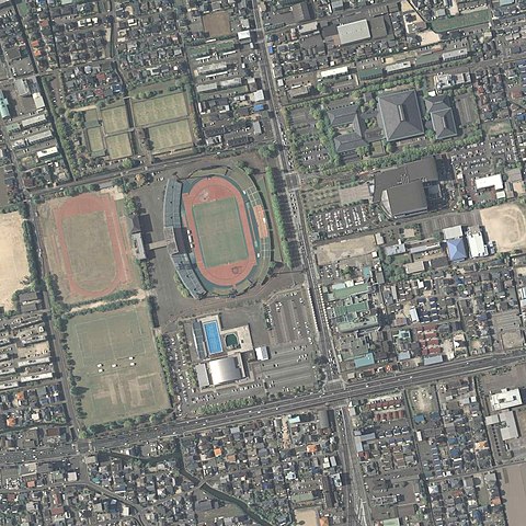
English: Aerial photo around Hinode, Saga, Saga, Japan. Rotated and cut image of an original. |
| Date | |
| Source | 国土地理院「地図・空中写真閲覧サービス」の空中写真 整理番号=CKU20081 コース番号=C19 写真番号=10 https://mapps.gsi.go.jp/maplibSearch.do?specificationId=608559 |
| Author |
日本語: 国土地理院 |
| Other versions |
|


| Camera location | | View this and other nearby images on: OpenStreetMap |
|---|
Licensing[edit]

|
This work is licensed under the Government of Japan Standard Terms of Use (Ver.2.0). The Terms of Use are compatible with the Creative Commons Attribution License 4.0 International. For the terms of use of this work, see this license page.
|
This file is licensed under the Creative Commons Attribution 4.0 International license.
Attribution: 国土地理院 (GSI)
- You are free:
- to share – to copy, distribute and transmit the work
- to remix – to adapt the work
- Under the following conditions:
- attribution – You must give appropriate credit, provide a link to the license, and indicate if changes were made. You may do so in any reasonable manner, but not in any way that suggests the licensor endorses you or your use.
File history
Click on a date/time to view the file as it appeared at that time.
| Date/Time | Thumbnail | Dimensions | User | Comment | |
|---|---|---|---|---|---|
| current | 15:11, 15 July 2022 | | 1,404 × 1,404 (1.64 MB) | Peka (talk | contribs) | Uploaded a work by {{en|{{W|Geospatial Information Authority of Japan}}}} {{ja|{{Wja|国土地理院}}}} from 国土地理院「地図・空中写真閲覧サービス」の空中写真 整理番号=CKU20081 コース番号=C19 写真番号=10 https://mapps.gsi.go.jp/maplibSearch.do?specificationId=608559 with UploadWizard |
You cannot overwrite this file.
File usage on Commons
The following 3 pages use this file:
File usage on other wikis
The following other wikis use this file:
- Usage on ja.wikipedia.org