File:Holme Pit - geograph.org.uk - 1334888.jpg
Jump to navigation
Jump to search
No higher resolution available.
Holme_Pit_-_geograph.org.uk_-_1334888.jpg (640 × 479 pixels, file size: 125 KB, MIME type: image/jpeg)
Captions
Captions
Add a one-line explanation of what this file represents
Summary[edit]
| Description |
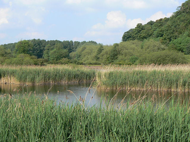
English: Holme Pit This pond, formerly a marl pit, lies at the foot of Clifton Woods. In 2008 a clean-up program saw 7000 cubic metres of silt removed, with a substantial benefit to conditions. The silt was used to improve soil quality on neighbouring farmland - just as had been done when the pit was first created! There were reed warblers singing in these reed beds. |
| Date | |
| Source | From geograph.org.uk |
| Author | Alan Murray-Rust |
| Attribution (required by the license) | Alan Murray-Rust / Holme Pit / |
| Camera location | | View this and other nearby images on: OpenStreetMap |
|---|
| Object location | | View this and other nearby images on: OpenStreetMap |
|---|
Licensing[edit]

|
This image was taken from the Geograph project collection. See this photograph's page on the Geograph website for the photographer's contact details. The copyright on this image is owned by Alan Murray-Rust and is licensed for reuse under the Creative Commons Attribution-ShareAlike 2.0 license.
|
This file is licensed under the Creative Commons Attribution-Share Alike 2.0 Generic license.
Attribution: Alan Murray-Rust
- You are free:
- to share – to copy, distribute and transmit the work
- to remix – to adapt the work
- Under the following conditions:
- attribution – You must give appropriate credit, provide a link to the license, and indicate if changes were made. You may do so in any reasonable manner, but not in any way that suggests the licensor endorses you or your use.
- share alike – If you remix, transform, or build upon the material, you must distribute your contributions under the same or compatible license as the original.

_heading:45.00&language=en)
_heading:45.00&language=en)
File history
Click on a date/time to view the file as it appeared at that time.
| Date/Time | Thumbnail | Dimensions | User | Comment | |
|---|---|---|---|---|---|
| current | 01:25, 28 February 2011 | | 640 × 479 (125 KB) | GeographBot (talk | contribs) | == {{int:filedesc}} == {{Information |description={{en|1=Holme Pit This pond, formerly a marl pit, lies at the foot of Clifton Woods. In 2008 a clean-up program saw 7000 cubic metres of silt removed, with a substantial benefit to conditions. The silt was |
You cannot overwrite this file.
File usage on Commons
There are no pages that use this file.