File:Hun Kal crater on Mercury.jpg
Jump to navigation
Jump to search
Size of this preview: 704 × 600 pixels. Other resolutions: 282 × 240 pixels | 564 × 480 pixels | 902 × 768 pixels | 1,202 × 1,024 pixels | 1,294 × 1,102 pixels.
Original file (1,294 × 1,102 pixels, file size: 310 KB, MIME type: image/jpeg)
Captions
Captions
Add a one-line explanation of what this file represents
Summary[edit]
| Description |
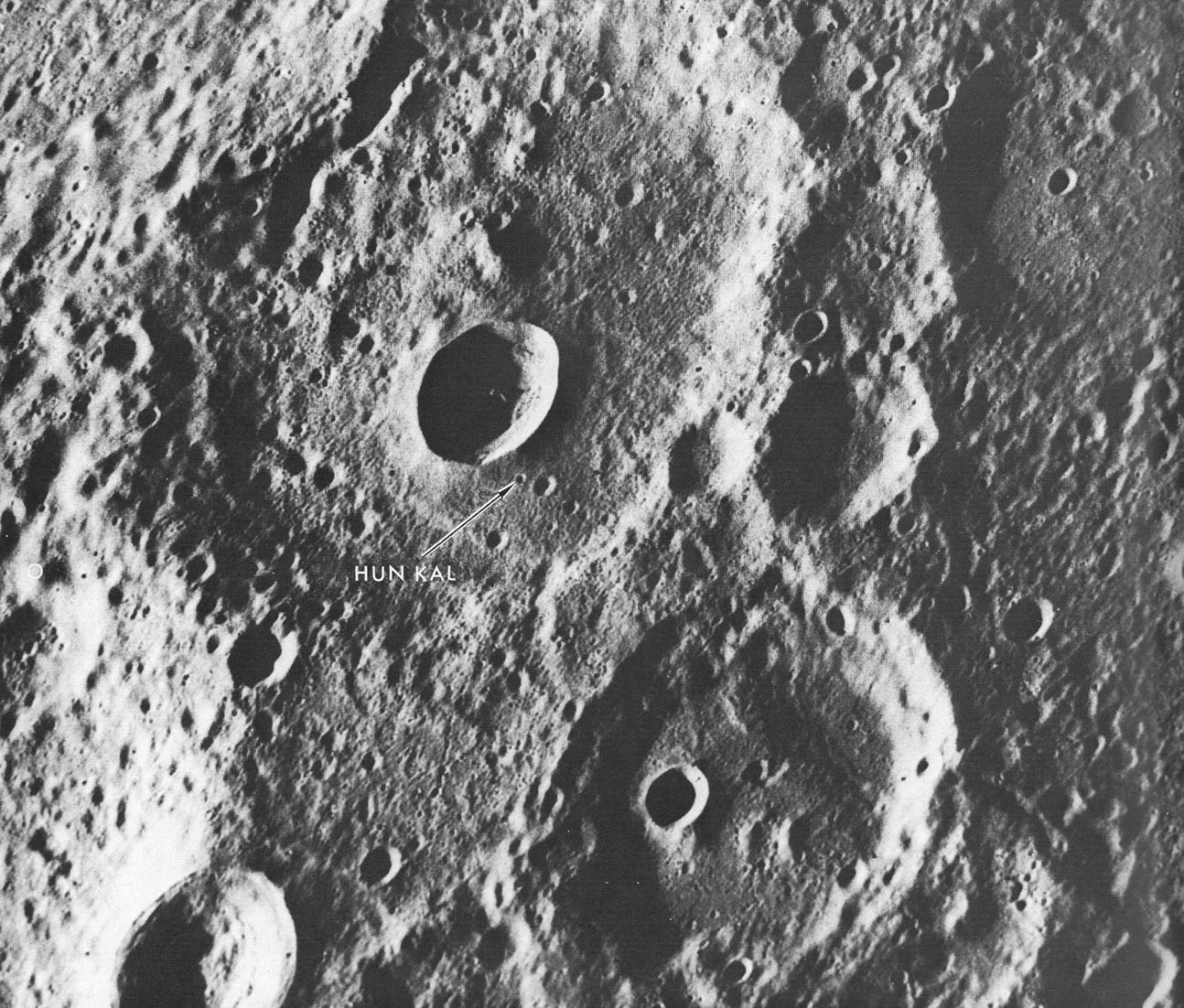
English: A fresh new crater in the center of an older crater basin provides a landmark for the tiny crater named Hun kal- the Mayan number 20 - which is the basis for positioning the longitudes on Mercury. By definition, the 20° meridian passes through the center of this small crater. Assuming that the spin axis of Mercury is perpendicular to its orbital plane, the latitude of Hun Kal is 0.23°S. This picture, which covers an area of 130 by 170 km ( 90 by 105 mi), was taken from a distance of about 20,700 km (12,860 mi), a half-hour before Mariner made its first close flyby of Mercury, March 1974. |
| Source | http://history.nasa.gov/SP-424/p112.htm |
| Author | Mariner 10 |
| Other versions | cropped to show Hun Kal more plainly |
Licensing[edit]
| This file is in the public domain in the United States because it was solely created by NASA. NASA copyright policy states that "NASA material is not protected by copyright unless noted". (See Template:PD-USGov, NASA copyright policy page or JPL Image Use Policy.) | ||
 |
Warnings:
|
File history
Click on a date/time to view the file as it appeared at that time.
| Date/Time | Thumbnail | Dimensions | User | Comment | |
|---|---|---|---|---|---|
| current | 21:06, 9 April 2008 | | 1,294 × 1,102 (310 KB) | Bryan Derksen (talk | contribs) | {{Information |Description={{en|A fresh new crater in the center of an older crater basin provides a landmark for the tiny crater named Hun kal- the Mayan number 20 - which is the basis for positioning the longitudes on Mercury. By definition, the 20° me |
You cannot overwrite this file.
File usage on Commons
There are no pages that use this file.
File usage on other wikis
The following other wikis use this file:
- Usage on en.wikipedia.org
- Usage on fr.wikipedia.org
- Usage on hy.wikipedia.org
- Usage on ja.wikipedia.org
- Usage on ml.wikipedia.org
- Usage on pl.wikibooks.org
- Usage on ru.wikipedia.org
- Usage on zh.wikipedia.org