File:Hunza River.jpg
Jump to navigation
Jump to search
Size of this preview: 800 × 600 pixels. Other resolutions: 320 × 240 pixels | 640 × 480 pixels | 1,024 × 768 pixels | 1,280 × 960 pixels | 2,592 × 1,944 pixels.
Original file (2,592 × 1,944 pixels, file size: 550 KB, MIME type: image/jpeg)
Captions
Captions
Add a one-line explanation of what this file represents
Summary[edit]
| Description |
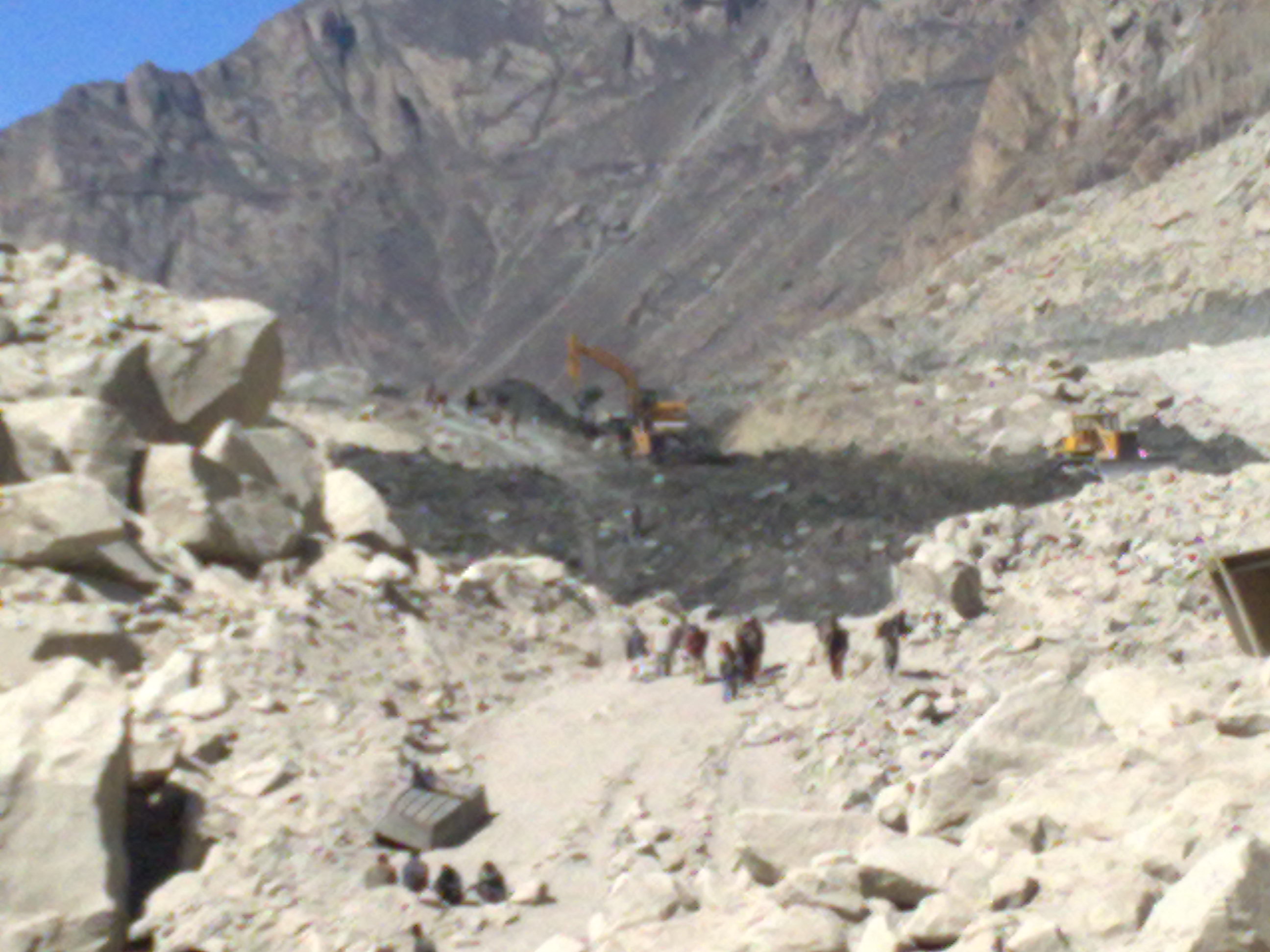
English: 40,000 people with residents from up to 34 villages which have already been evacuated to safer areas. water level in the lake is rising about one meter per day due to increase in water inflow which is overflowing through the spillway made by the FWO( Frontier Works Organization ). seven helicopters of Pakistan Army, Cabinet Division and Agha Khan Foundation would be ready to cater to any unforeseen event. Rebuilding of the affected portion of the Karakoram Highway would also depend on the future scenario. The National Highway Authority construct a road, worthy for travelling by jeep.wilhttp://en.wikipedia.org/wiki/Hunza_Riverl |
| Date | |
| Source | Own work (Original text: I (shakeelgilgity) created this work entirely by myself.) |
| Author | Shakeel Ahmad |
Licensing[edit]
Shakeelgilgity at English Wikipedia, the copyright holder of this work, hereby publishes it under the following license:
This file is licensed under the Creative Commons Attribution-Share Alike 3.0 Unported license.
Attribution: Shakeelgilgity at English Wikipedia
- You are free:
- to share – to copy, distribute and transmit the work
- to remix – to adapt the work
- Under the following conditions:
- attribution – You must give appropriate credit, provide a link to the license, and indicate if changes were made. You may do so in any reasonable manner, but not in any way that suggests the licensor endorses you or your use.
- share alike – If you remix, transform, or build upon the material, you must distribute your contributions under the same or compatible license as the original.
Original upload log[edit]
Transferred from en.wikipedia to Commons by Logan using CommonsHelper.
The original description page was here. All following user names refer to en.wikipedia.
- 2010-05-29 21:15 Shakeelgilgity 2592×1944× (563584 bytes) {{Information |Description = 40,000 people with residents from up to 34 villages which have already been evacuated to safer areas. water level in the lake is rising about one meter per day due to increase in water inflow which is overflowing through
File history
Click on a date/time to view the file as it appeared at that time.
| Date/Time | Thumbnail | Dimensions | User | Comment | |
|---|---|---|---|---|---|
| current | 23:00, 6 May 2011 | | 2,592 × 1,944 (550 KB) | File Upload Bot (Magnus Manske) (talk | contribs) | {{BotMoveToCommons|en.wikipedia|year={{subst:CURRENTYEAR}}|month={{subst:CURRENTMONTHNAME}}|day={{subst:CURRENTDAY}}}} {{Information |Description={{en|40,000 people with residents from up to 34 villages which have already been evacuated to safer areas. |
You cannot overwrite this file.
File usage on Commons
There are no pages that use this file.
File usage on other wikis
The following other wikis use this file:
- Usage on hu.wikipedia.org
- Usage on kn.wikipedia.org
- Usage on pnb.wikipedia.org
- Usage on tr.wikipedia.org
- Usage on ur.wikipedia.org